GOOS, Abraham.
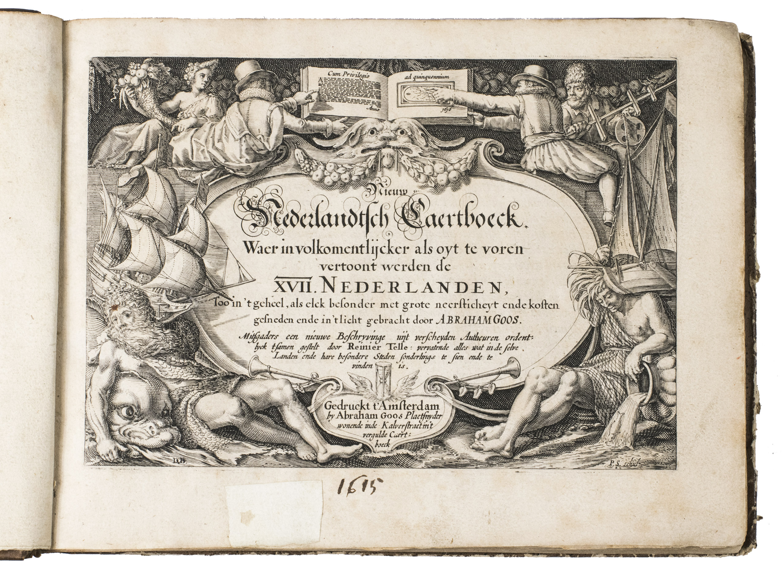
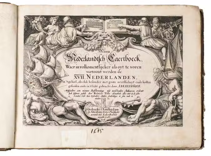
Nieuw Nederlandtsch caertboeck. Waer in volkomentlijcker als oyt te voren vertoont werden de XVII. Nederlanden, soo in t geheel, als elck besonder met grote neersticheyt ende kosten gesneden ende in t licht gebracht. Mitsgaders een nieuwe beschryvinge uijt verscheyden autheuren ordentlyck tsamen gestelt door Reinier Telle ... .
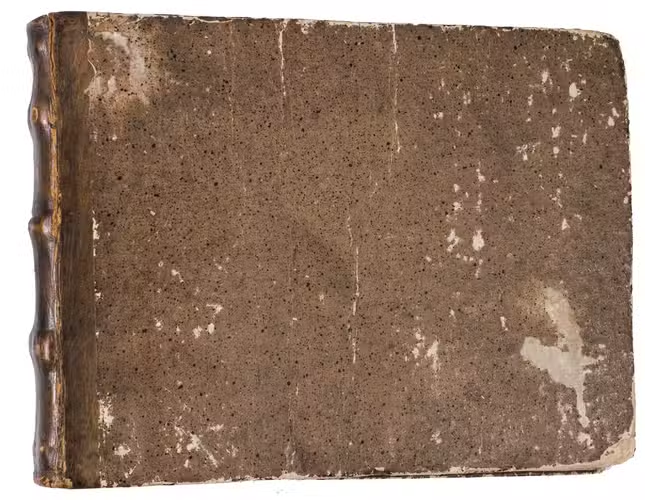
Amsterdam, Abraham Goos in de Kalverstraet, [1616]. Oblong 4to (ca. 16 x 21 cm). With an engraved title page (signed by P.S[erwouter] scul. (bottom right) after D.V[inck] B[oons] (bottom left)), 23 full page maps, several decorated woodcut initials and woodcut tailpieces. 19th-century quarter calf. [7], "305" [=294], [2], [1 blank] pp.
€ 4,500
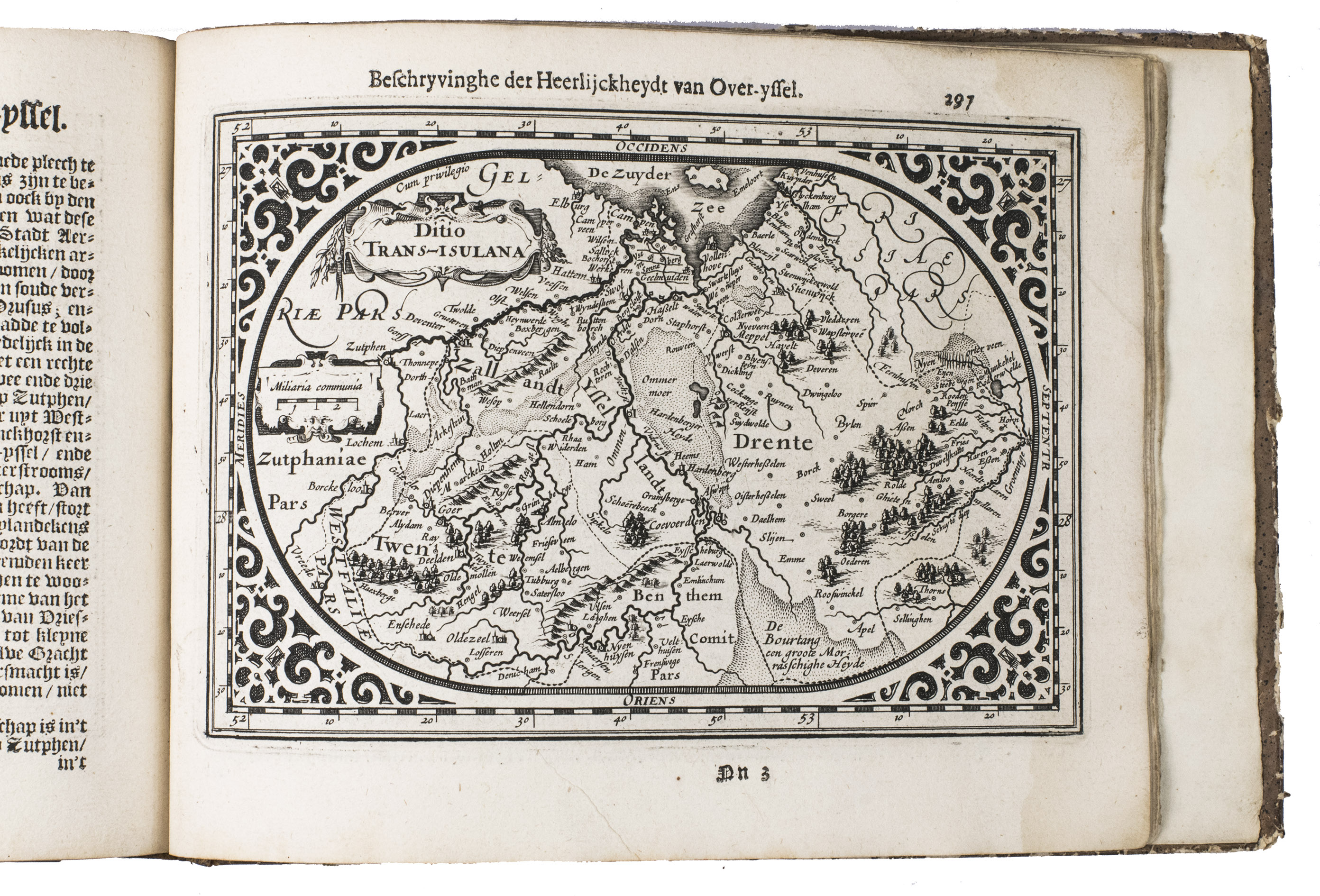
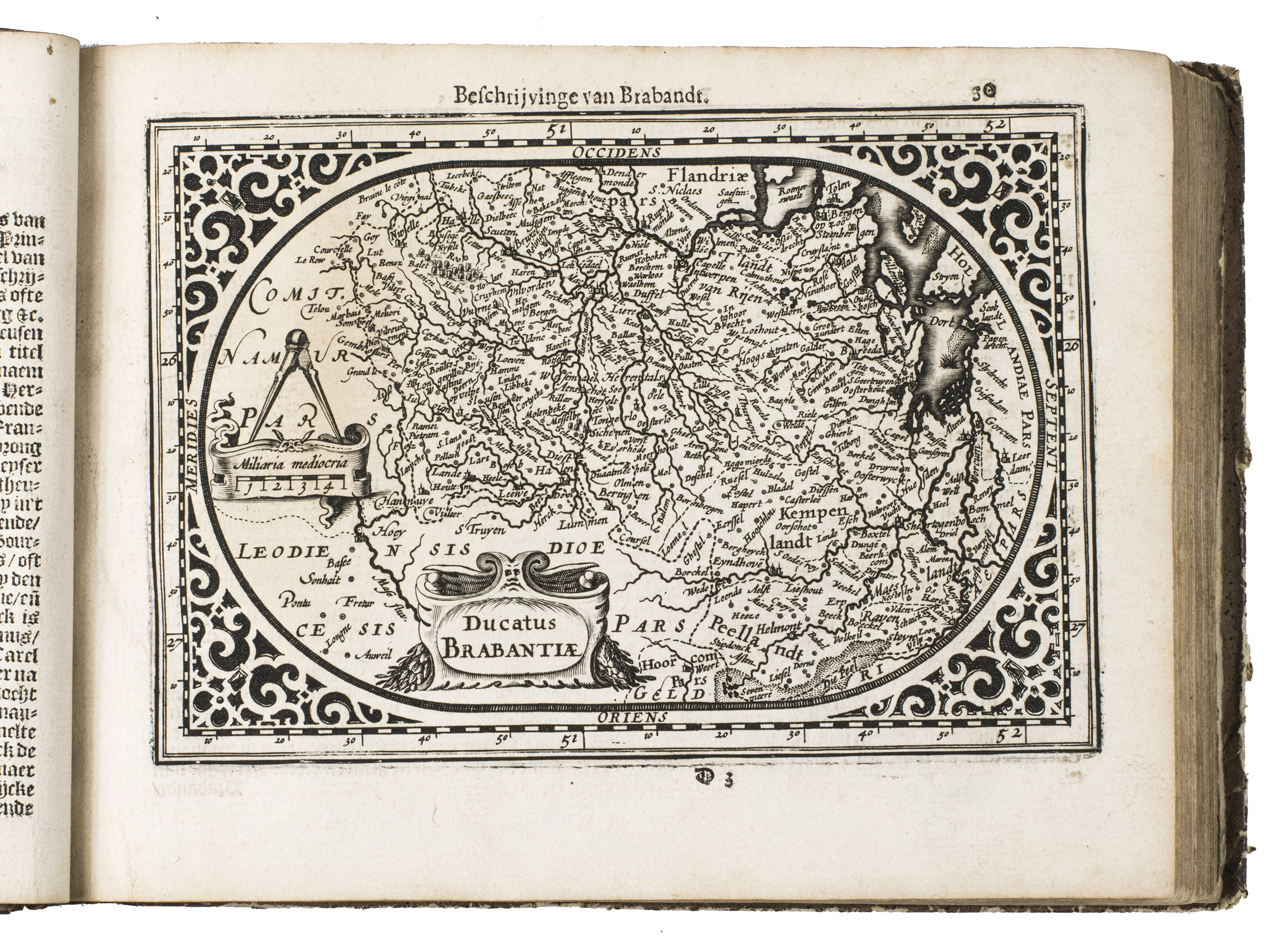
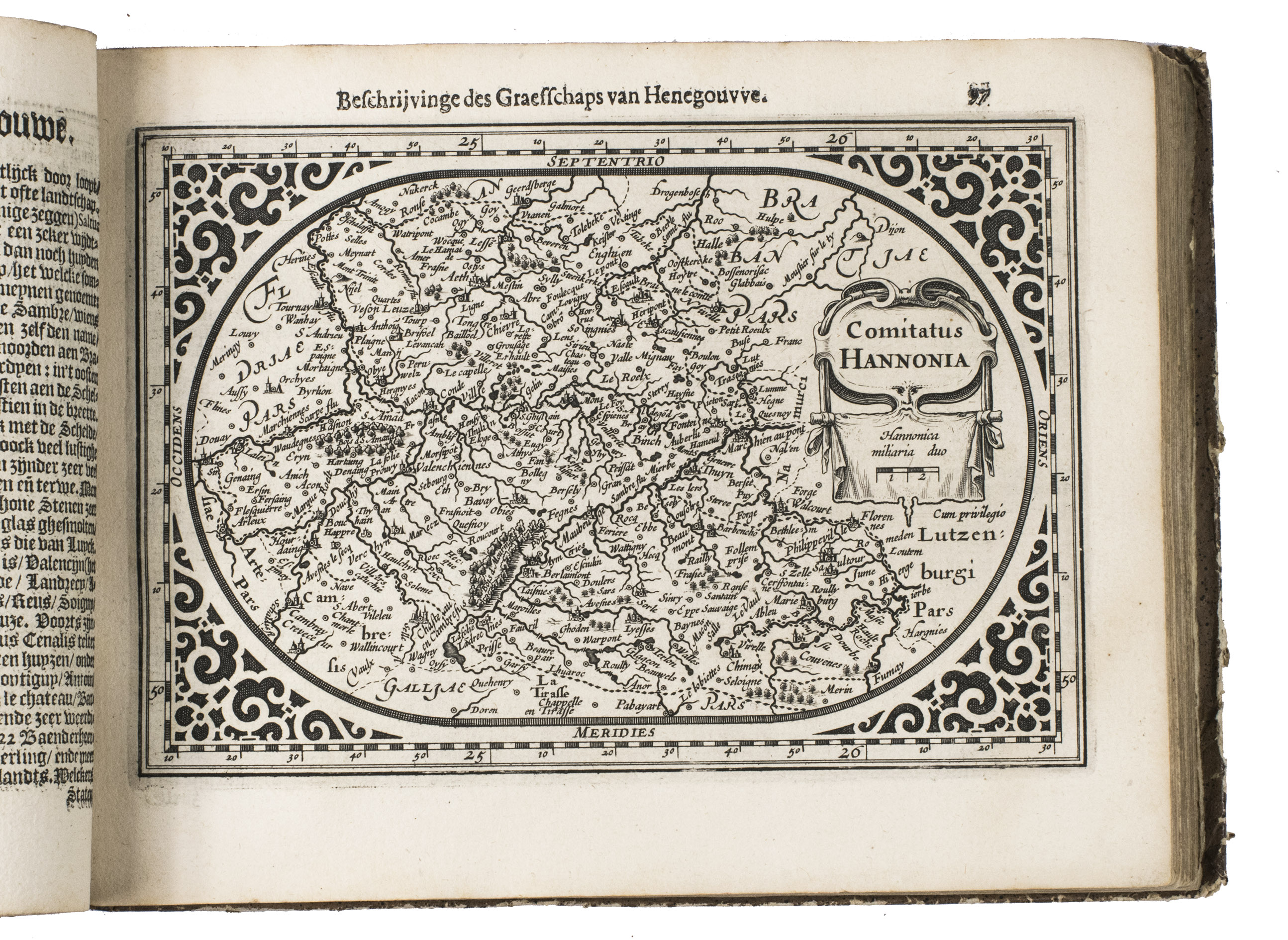
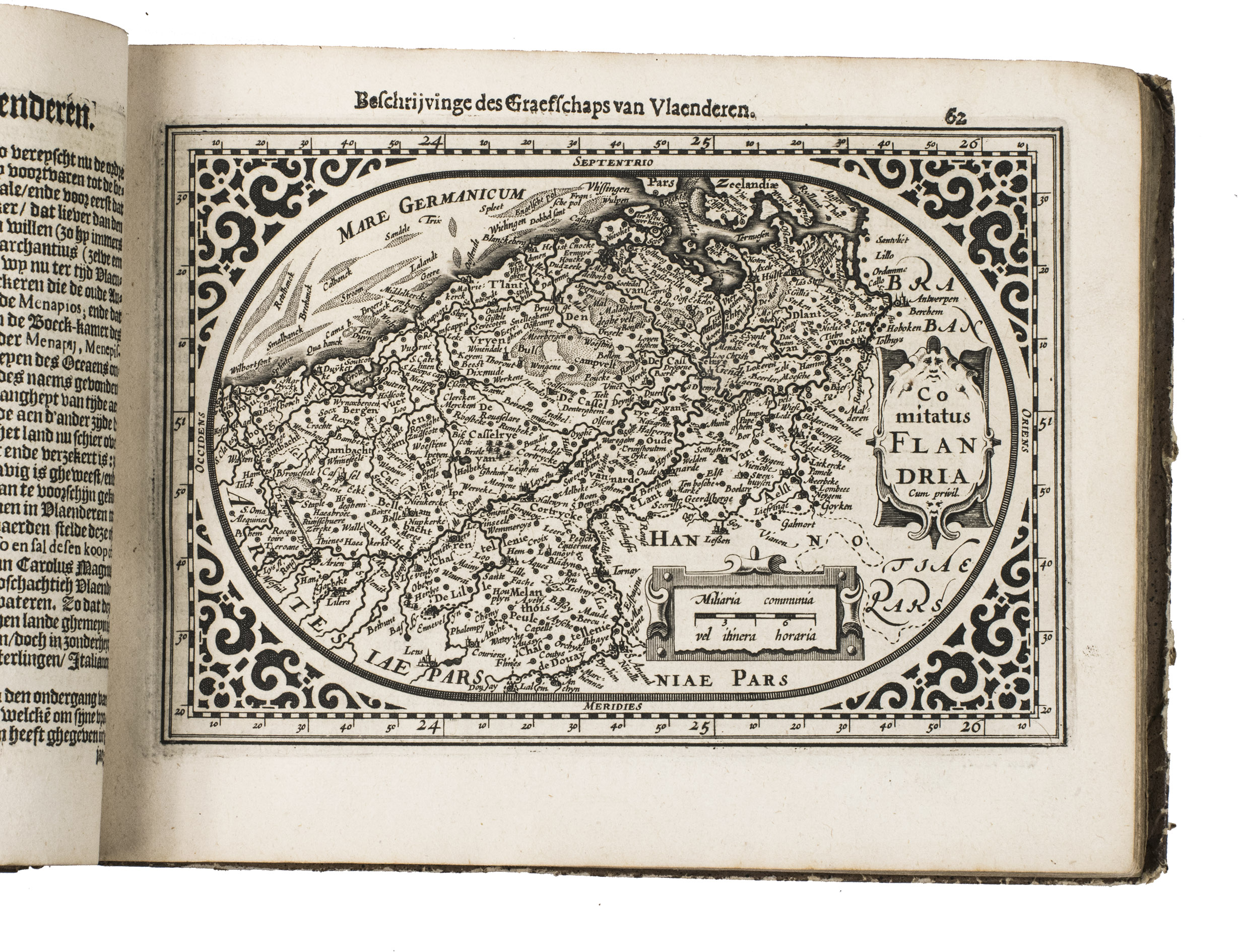
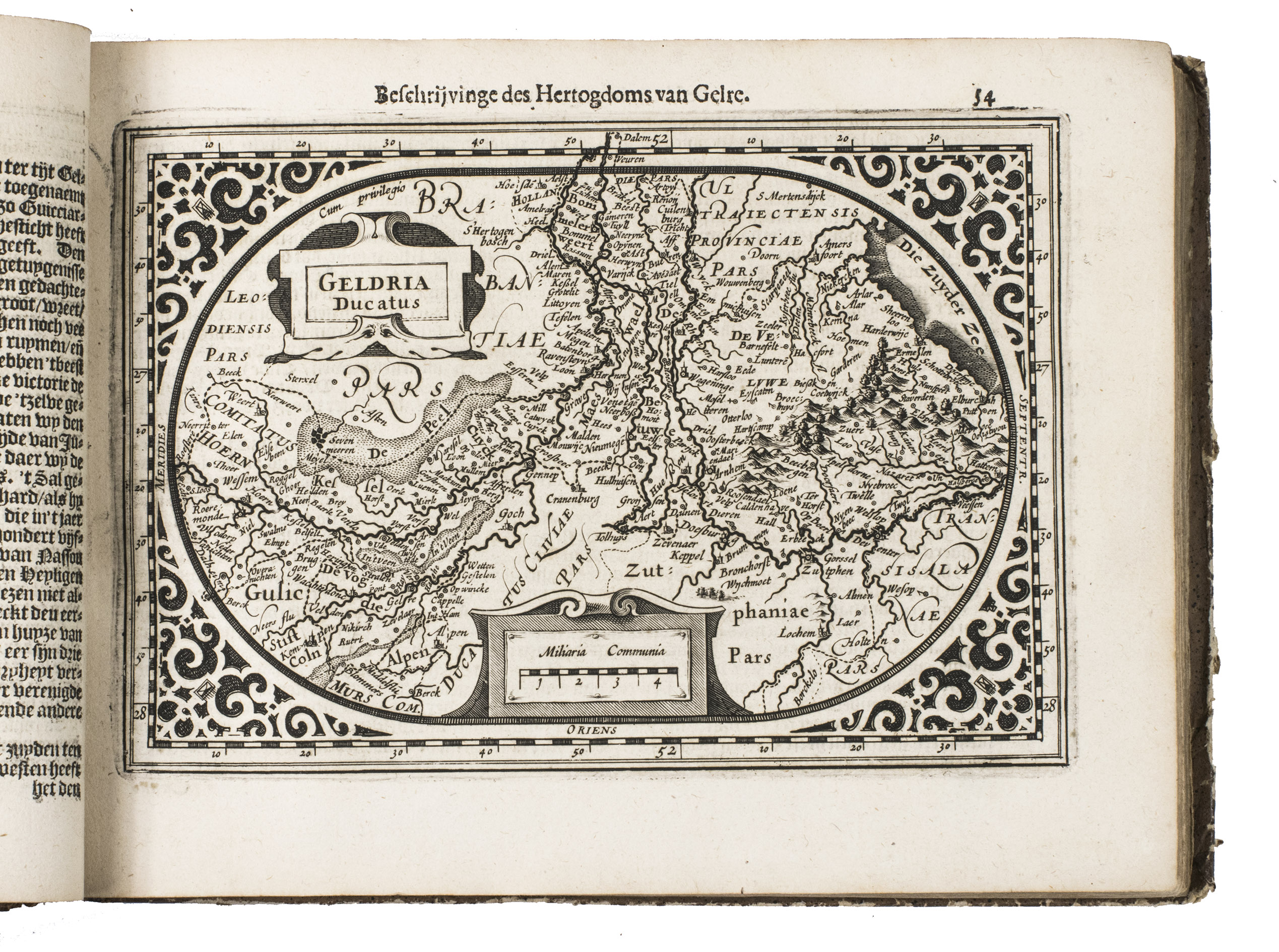
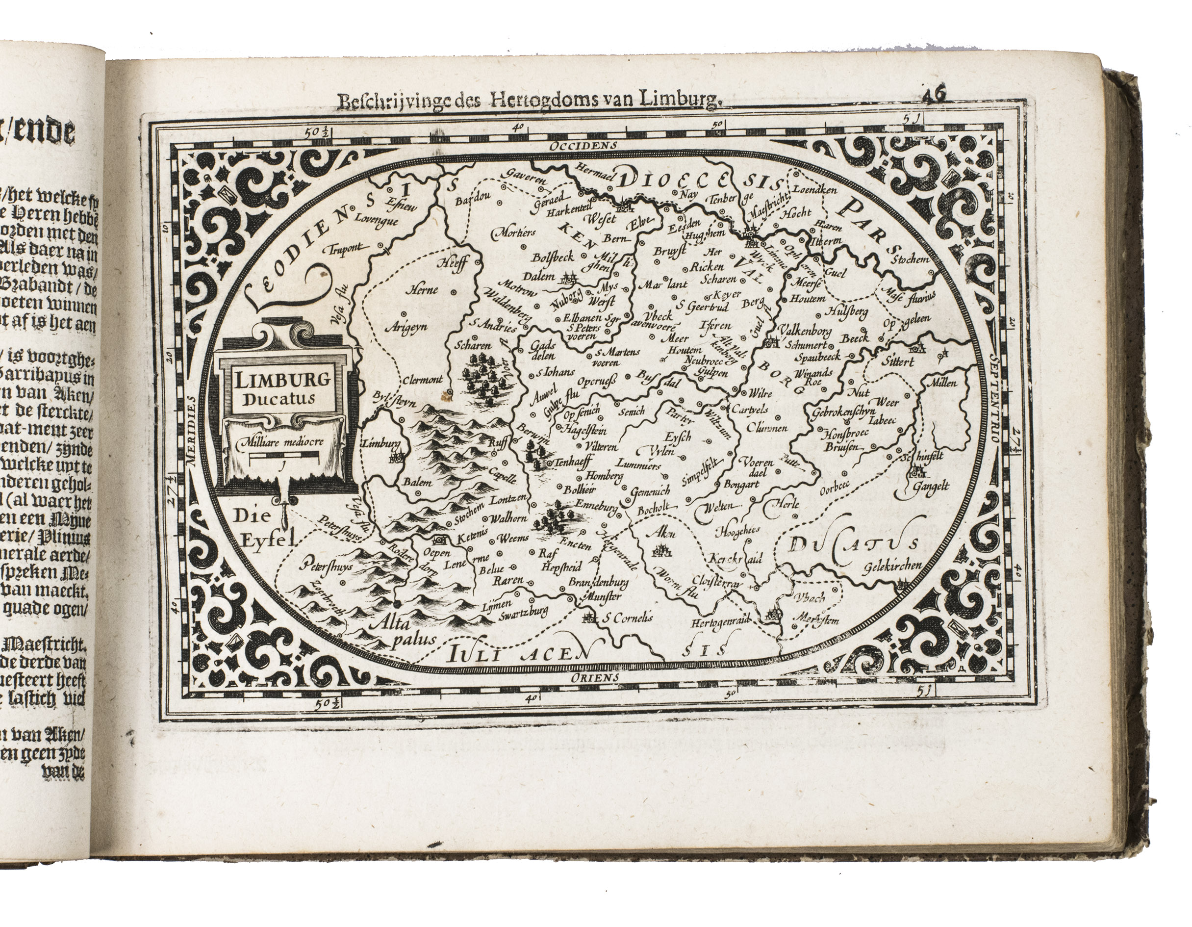
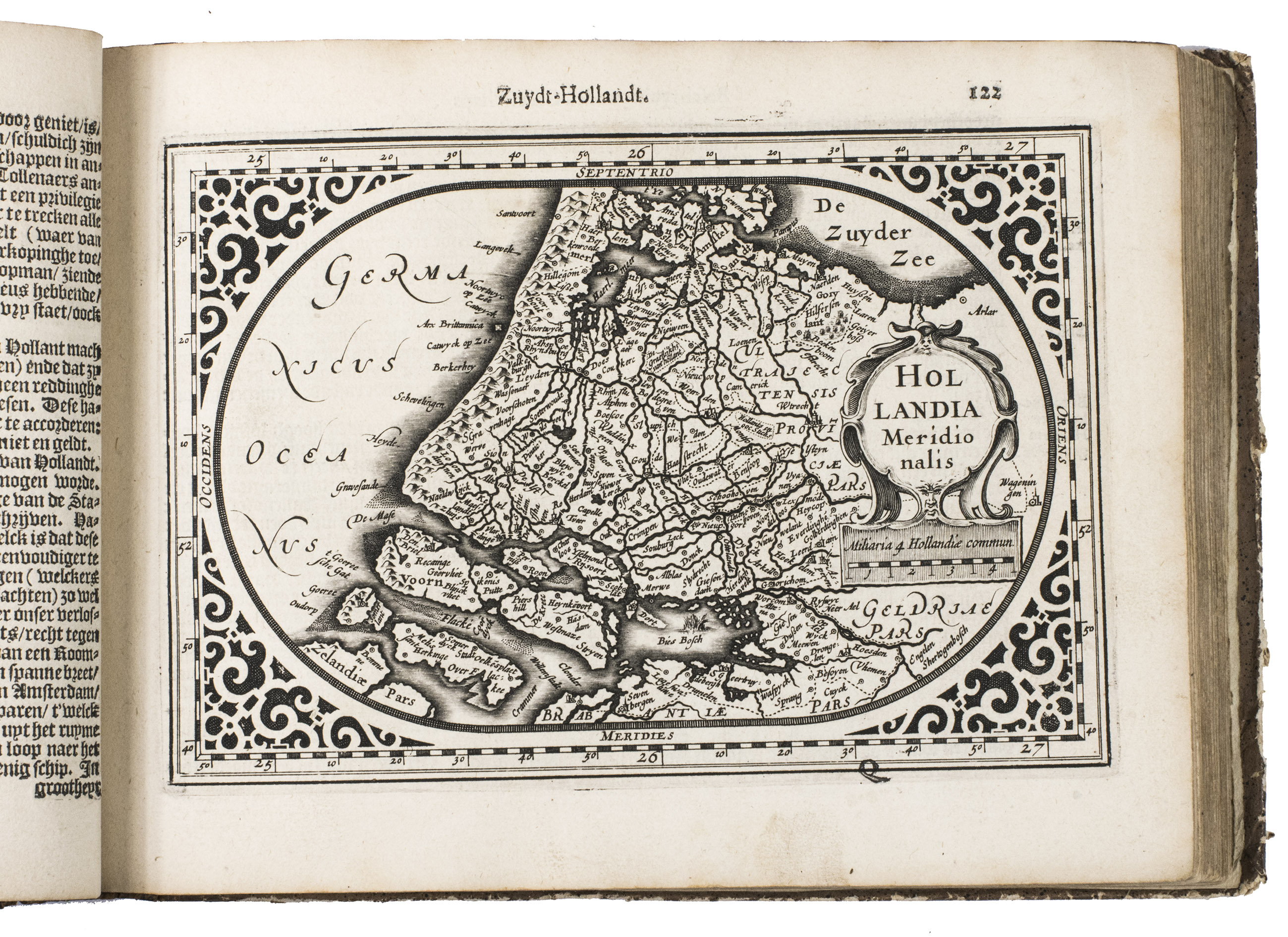
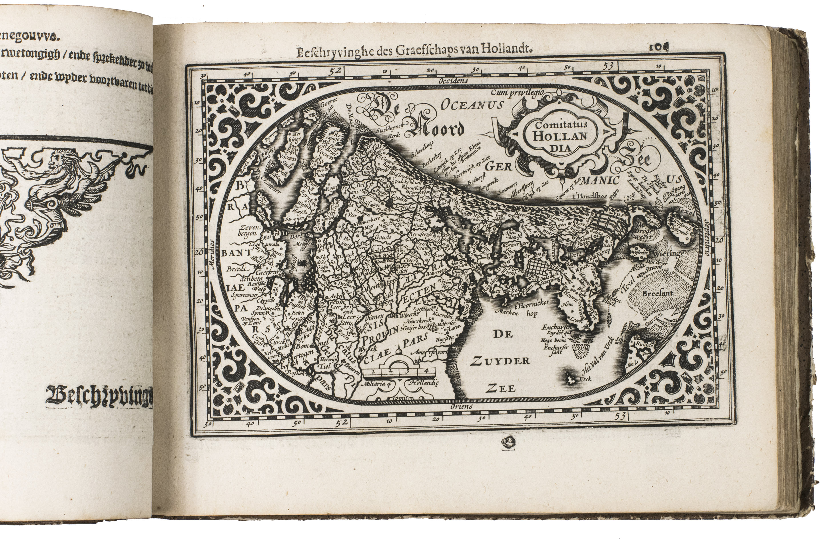
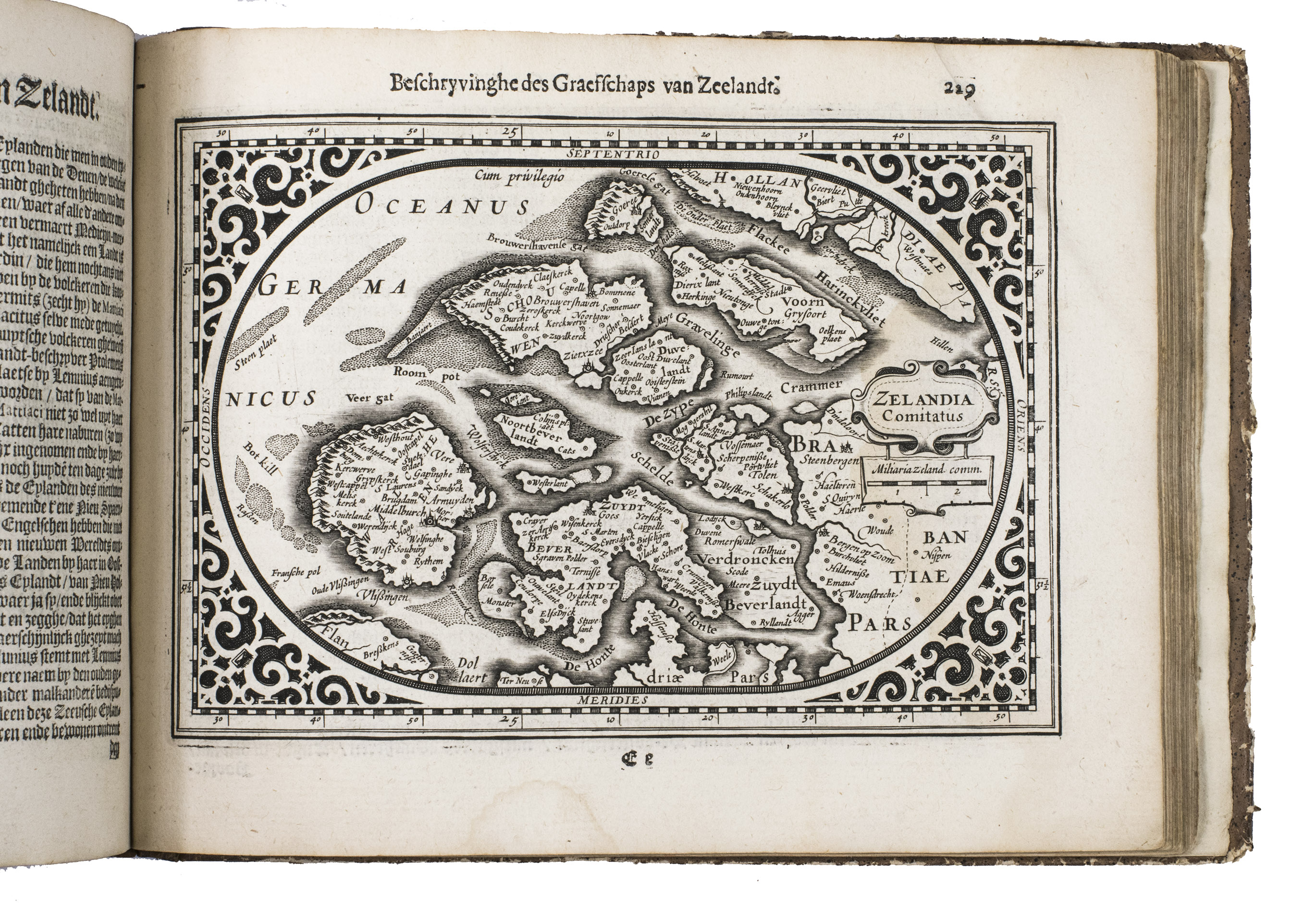
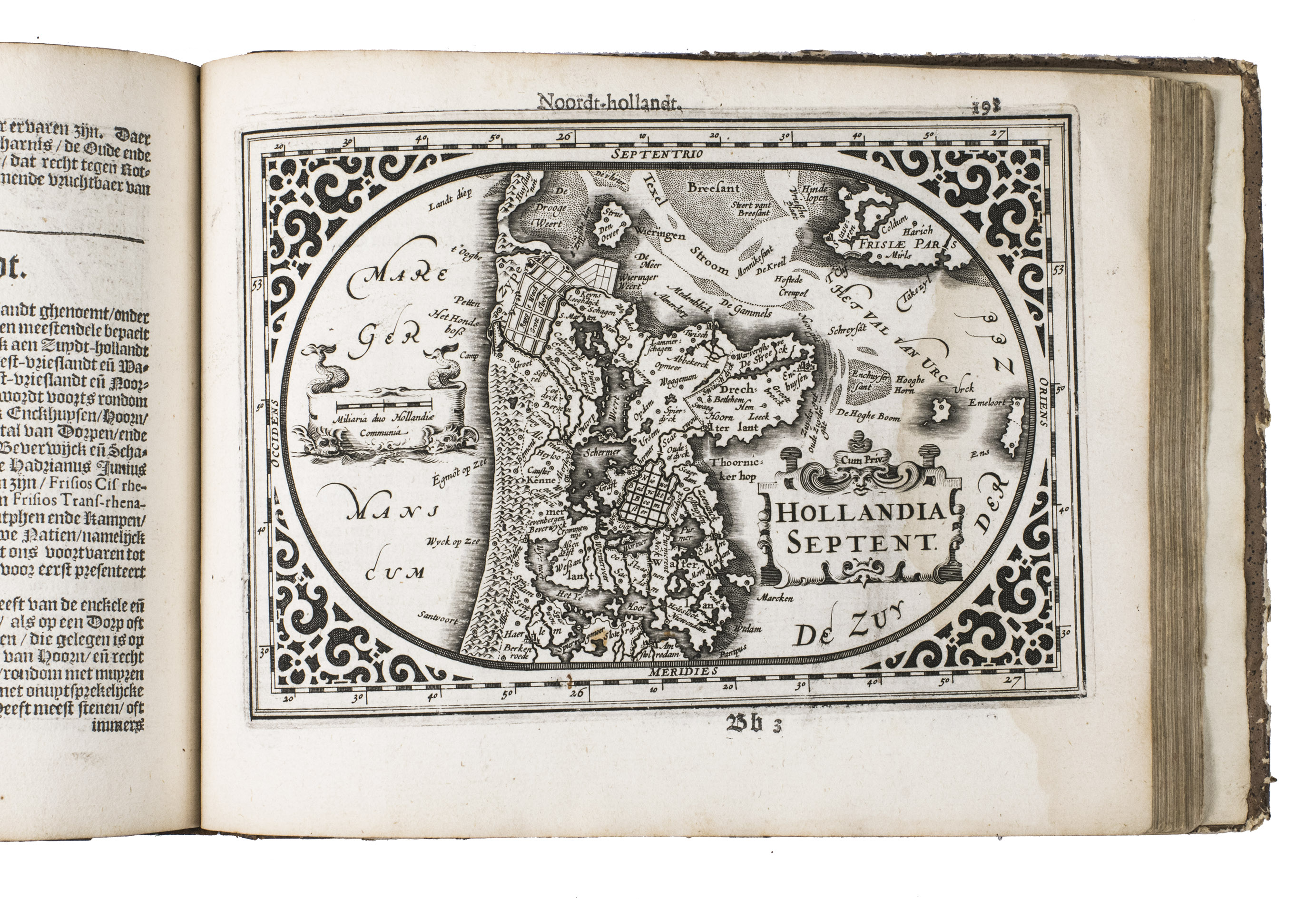
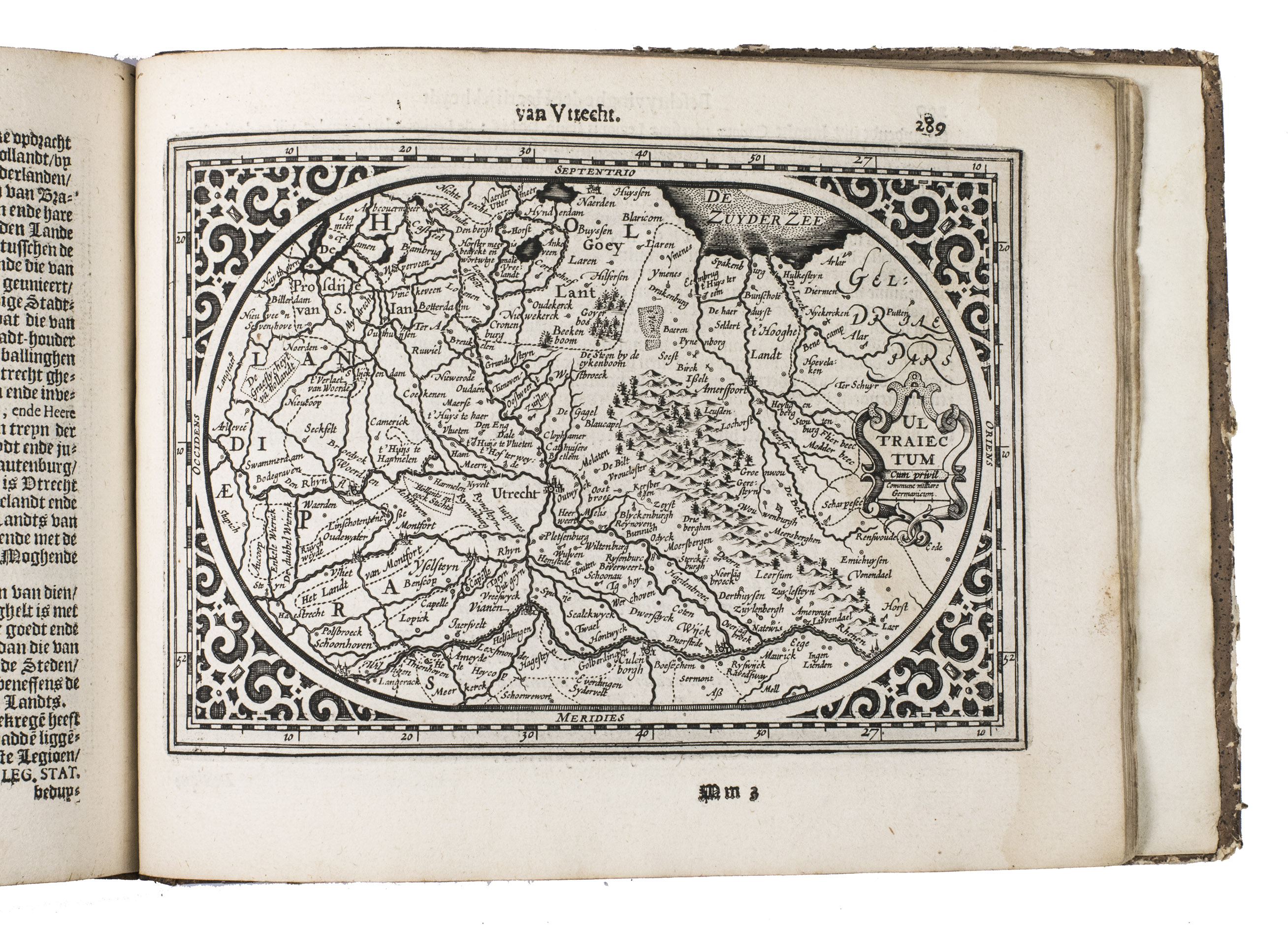
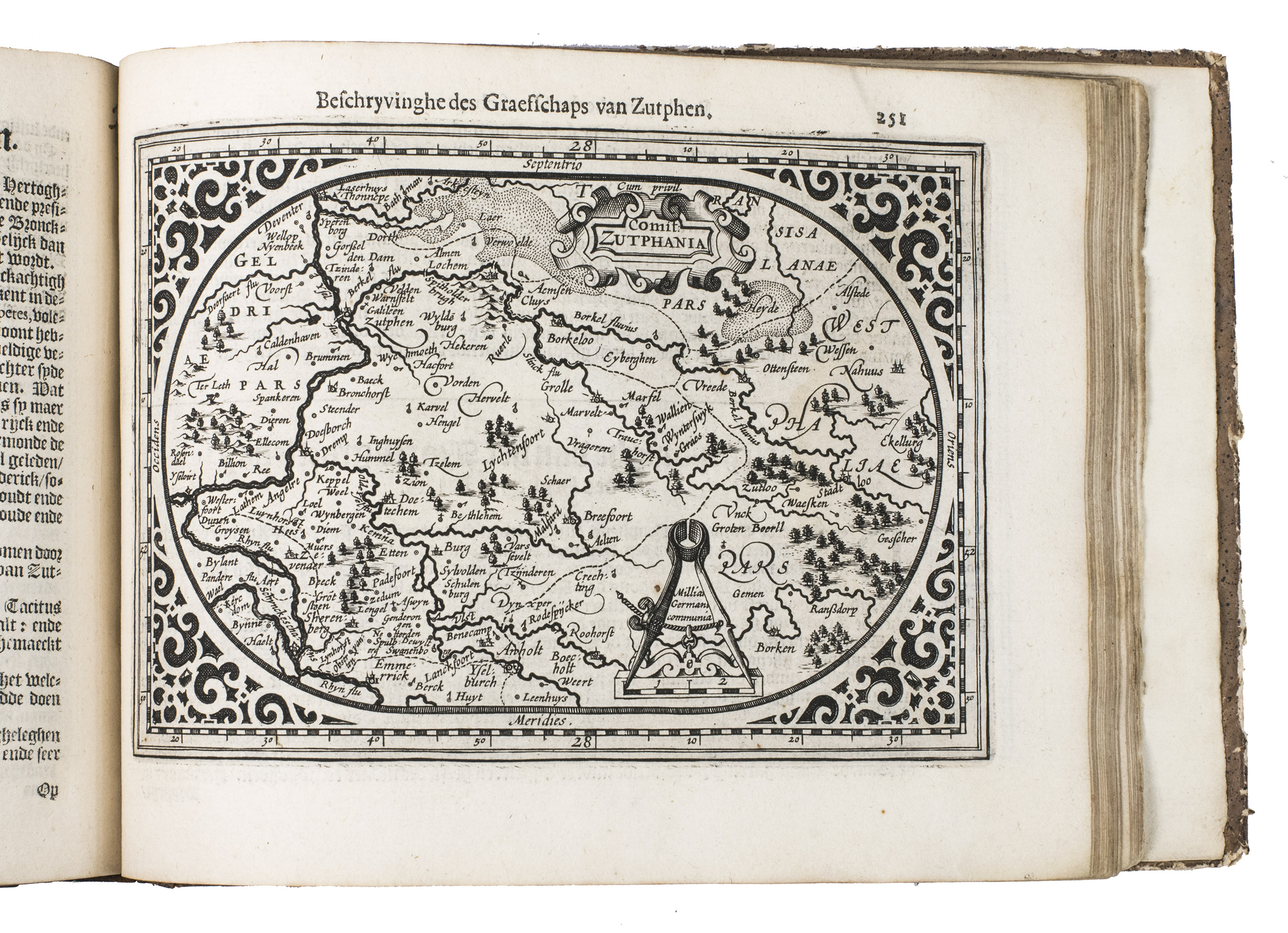
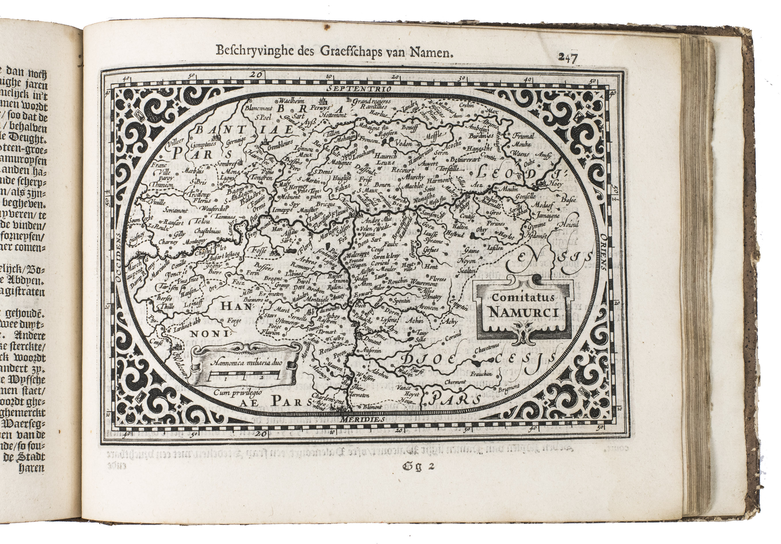
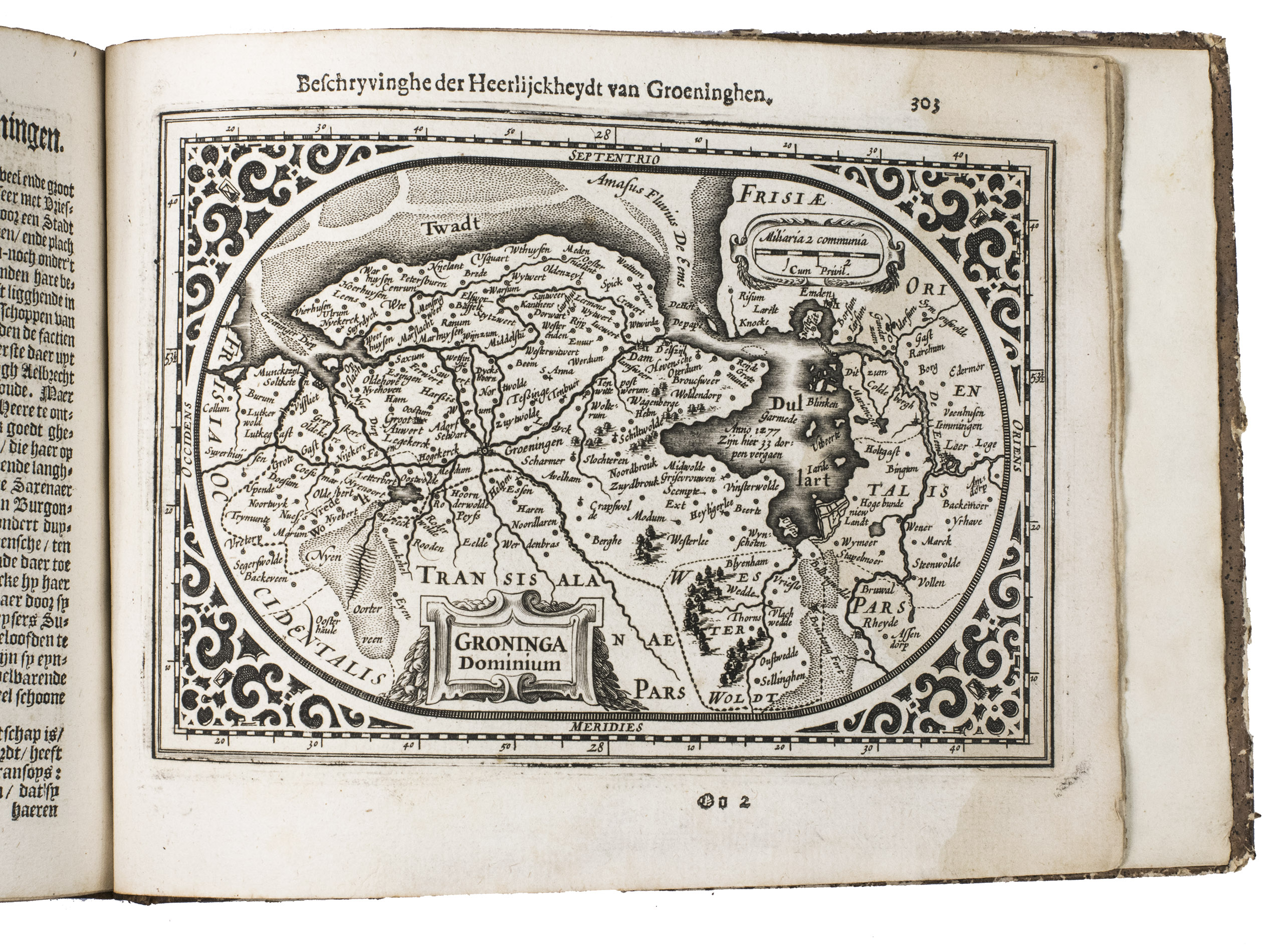
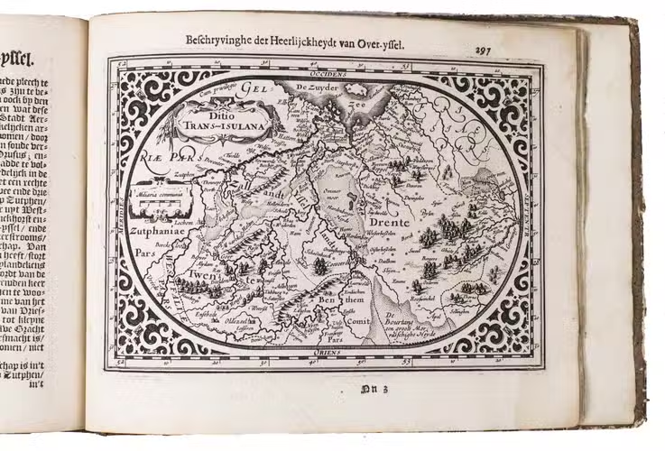
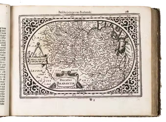
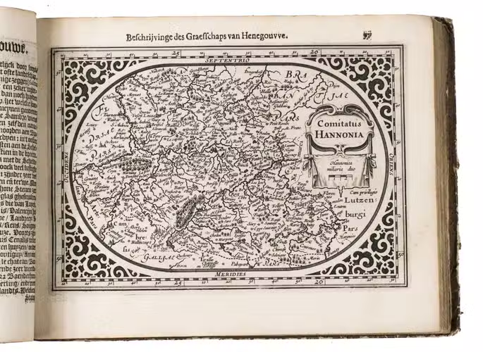
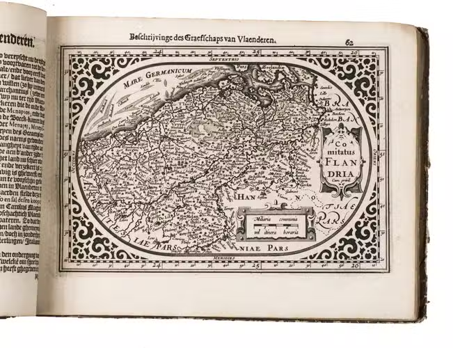
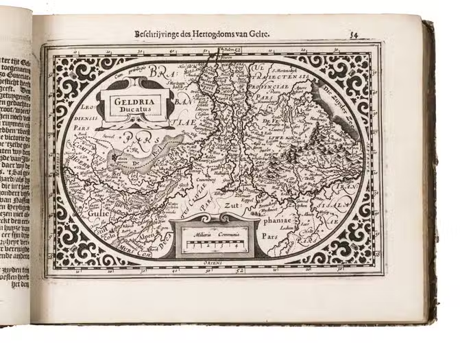
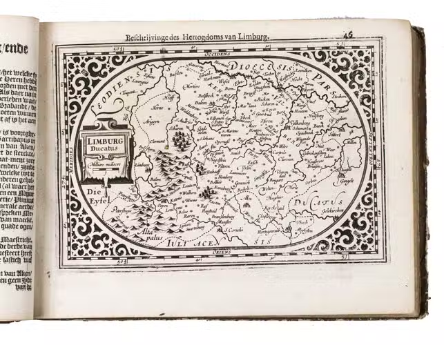
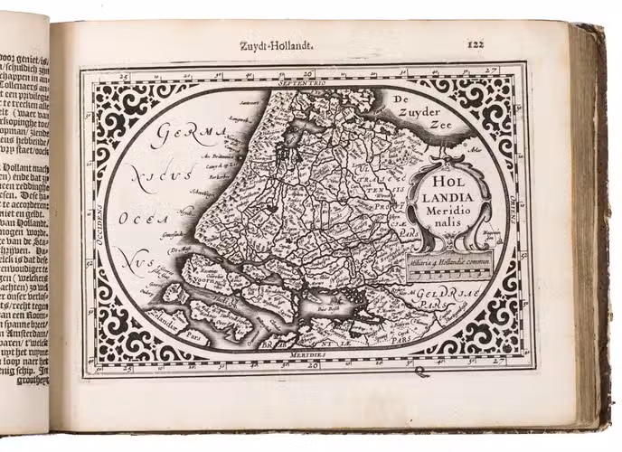
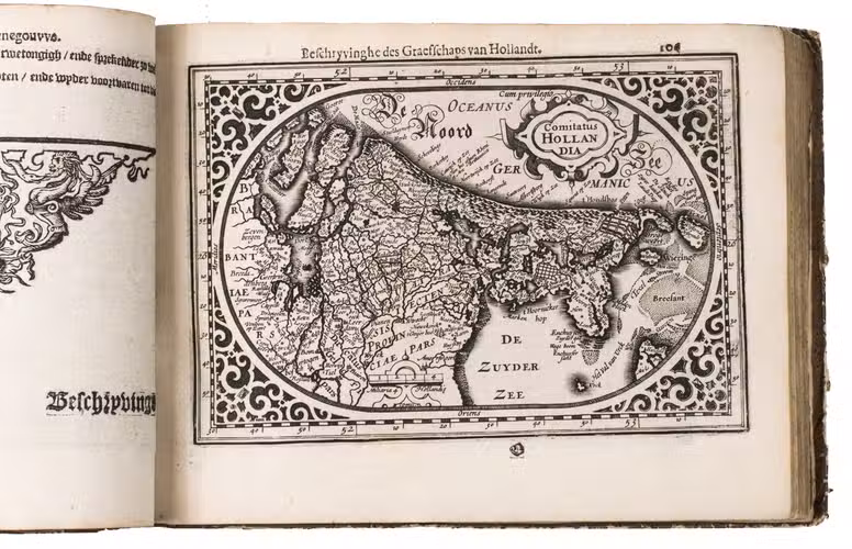
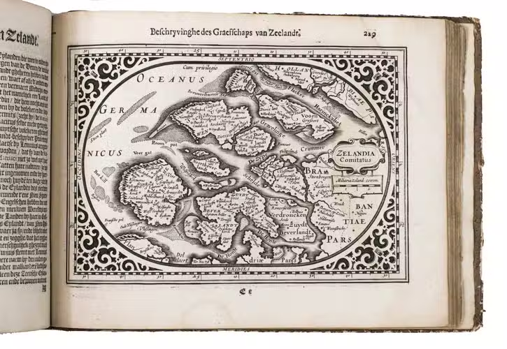
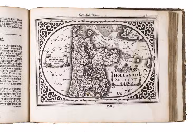
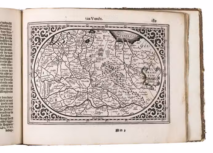
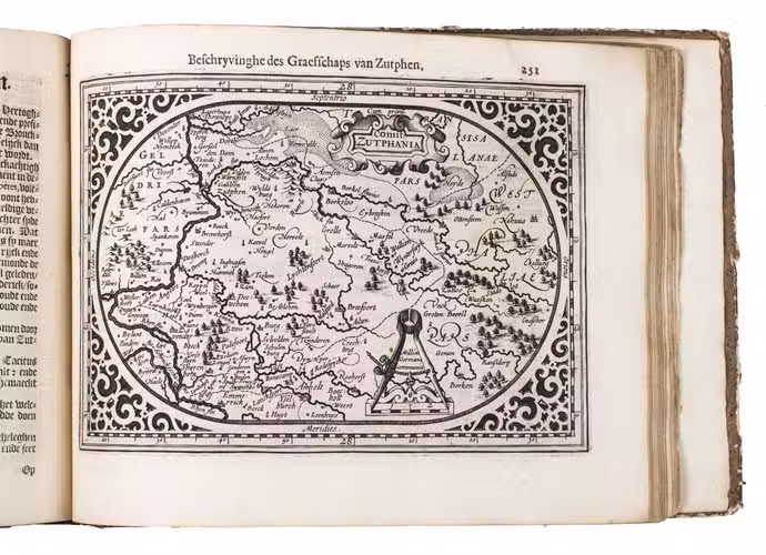
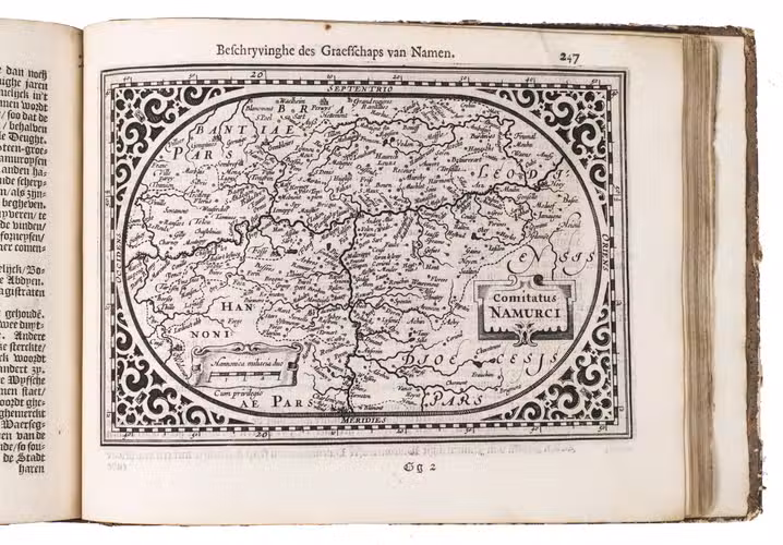
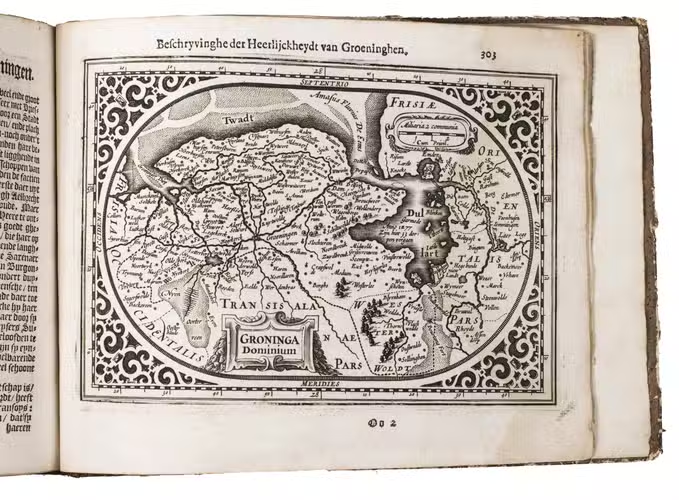
Rare first edition of one of the first atlases of the Low Countries, with 23 very detailed maps. It is the only atlas published by the mapmaker, Abraham Goos, himself. At the time the present atlas was published, the Seven United provinces (The Northern Netherlands) were still together with the 10 provinces of the Spanish or Habsburg Low Countries. The atlas includes two maps of the Low Countries as a whole, one map of each of the seventeen provinces (except Drenthe, which is included in the map of Overijssel), four additional maps of Holland, and one additional map of Brabant. Gooss maps were also used for the Atlas Minor, published by Johannes Janssonius in 1628.
The maps are elegantly designed with decorative title cartouches, finely engraved, and set in a decorative oval rectangular frame, while the corners are decorated in a Renaissance style. The work was reprinted by Janssonius in 1625, and Doncker in 1685. Only the first edition was printed by Goos himself. Koeman recognizes only one Goos issue, but Van der Krogt's reissue of Koeman's Atlantes Nederlandici distinguishes two, of which ours is the second. The two issues are nearly identical, but the second can be recognised by the imprint (which includes Goos's new address "inde Kalverstraet"), and the addition of the text "cum privilegio" to the maps, which Goos added after receiving his privilege for this atlas on 24 December 1615, and an honorarium of 120 guilders from the States General on 8 January 1616. Generally, 20 of the 23 maps of the second issue have this addition, but in the present copy it is 17: the text is not present on maps 3-5, 8, and 11-12.
The text was written by the poet and translator Reinier Telle (1559-1618), who based it mainly on Ludovicos Guicciardinis Beschrijvinghe van alle de Nederlanden, translated by Telle in 1613. Telles text was in turn the main source for the text in De Vyerighe Colom; finally, that text was again used for a new edition of Guicciardinis work, published by Jacob van Meurs in 1660.
Abraham Goos (ca. 1590-before 1643) was born in Antwerp as the son of Margaretha van den Keere, the sister of the famous mapmaker Hendrik van den Keere. In 1600 Goos moved to Amsterdam where he soon was employed and trained by the Hondius family and by Willem Jansz. Blaeu. He had his own shop named "In t vergulde Caertboeck", first located op den Dam, later, around 1615, in the Kalverstraat. Pieter Goos, Abrahams son, later became famous for his sea atlases and pilot guides.
With an erased ownerships entry at the head of the half-title, and 18th-century annotations on pp. 136-138. The edges and corners of the boards are scuffed, the boards have been rubbed, with some loss of material. The first few leaves are somewhat browned, a repaired hole in the lower margin of the title page, false folds in the half title, some marginal small tears, small holes in 2 leaves, with some loss of text, a repaired tear in the last leaf, a water stain in the outer half of the last few leaves. Otherwise in good condition. Krogt, P. van der, Koemans Atlantes Neerlandici, IIIB, § 363, pp. 612-615 (no. 363:01B); Koeman, Atlantes Neerl., II, p. 121 (Goo 1); STCN 853385556; USTC 1032942; cf. for the text: Fontaine Verwey, H. de la, Reinier Telle, hekeldichter, pamfletschrijver, vertaler, in: Uit de wereld van het boek, III, pp. 55-86, esp. 68.
Related Subjects: