Home
Shopping cart (0 items € 0)
Advanced search

8 large illustrated volumes of the most important voyages from the 15th to the end of the 17th century

AA, Pieter van der (editor) and Johann Ludwig GOTTFRIED. De aanmerkenswaardigste en alomberoemde zee- en landreizen der Portugeezen, Spanjaarden, Engelsen en allerhande natiën: zoo van Fransen, Italiaanen, Deenen, Hoogh- en Nederduitsen als van veele andere volkeren. Voornaamenlyk ondernomen tot ontdekking van de Oost- en Westindiën, midsgaders andere verafgelegene gewesten des aardryks.
The Hague, widow of Engelbrecht Boucquet and sons; Leiden, Jan van der Deyster, and Boudewijn and Pieter van der Aa, 1727. 8 volumes. 1mo and folio. With 7 (of 8) engraved frontispieces (lacking that of volume 4), 4 engraved dedications, 117 engraved maps on 61 leaves, 7 engraved plates and 502 engravings in text. Further with 127 (of 128) title-pages (including a general title-page, a title-page to 7 (of 8) volumes, lacking that of volume 4, and 118 for the separate works). Volume 1-3 & 5-8: contemporary mottled calf, gold-tooled spine and board edges; volume 4: modern calf. Full description
€ 65,000
Order Inquire Terms of sale

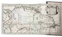
Exploring the Amazon River from Quito to the east with the extremely rare map

ACUÑA, Cristóbal Diatristán de. Relation de la Riviere des Amazones traduite par feu Mr de Gomberville de l'Académie Françoise. Avec un dissertation sur la riviere des Amazones pour servir de preface.
Paris, Claude Barbin, 1682. 4 parts in 2 volumes. 12mo. With a folding engraved map of the Amazon River. Contemporary calf, gold-tooled spine. 199, [1; 4], 218; 238, [2 blank]; 206 pp. Full description
€ 14,500
Order Inquire Terms of sale

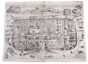
With attractive maps of the Holy Land

ADRICHEM, Christiaan van. Theatrum Terrae Sanctae et biblicarum historiarum cum tabulis geographicis aere expressis.
[Cologne, Officina Birckmannica, for Hermann Mylius, 1628]. Folio. With engraved allegorical title-page, numerous decorated woodcut initial letters and tailpieces, 11 maps of Israel and 1 map of Jerusalem (8 folding and 4 double-page). Contemporary calf, gold-tooled spine with red morocco title-label, blind-tooled sides, gilt binding edges. [12], 286, [30] pp. Full description
€ 10,000
Order Inquire Terms of sale

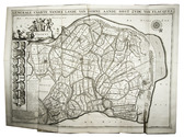
Description of Den Briel

ALKEMADE, Cornelis van and Pieter van der SCHELLING. Beschryving van de stad Briele, en den lande van Voorn, ...
Rotterdam, Philippus Losel, 1729. 2 parts in 1 volume. Folio. With a double-page engraved plan of Den Briel and 3 folding engraved maps of different parts of Voorne (each ca. 50 x 70.5 cm). Contemporary blind-tooled vellum. [28], 224, [8], 225-376; [8], 306, [20] pp. Full description
€ 2,500
Order Inquire Terms of sale

Extensively illustrated classic of cosmography, geodesy, mensuration, perspective and optics

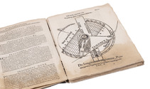
APIANUS (APIAN), Petrus and Gemma FRISIUS. Cosmographia.
Antwerp, Jan Verwithagen (colophon: printed by Verwithagen), 1574. 4to. With a large woodcut on the title-page (with a terrestrial globe and other instruments); 4 printed paper volvelles with moving parts and a woodcut sun dial with a string attached to its centre; a folding woodcut cordiform mappa mundi (block size 19×27.5 cm) with letterpress text in the margins; well over 100 further woodcut illustrations, diagrams, maps, etc., in the text. Recased in 17th-century(?) limp sheepskin parchment. [2], 64, [2] ll. plus folding woodcut. Full description
€ 12,500
Order Inquire Terms of sale

Surviving traffic in Saudi Arabia, a large folding map

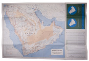
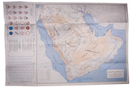
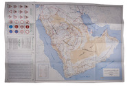
ARAMCO. Saudi Arabian road map.
Dammam, printed by the Al-Mutawa Press for the Arabian American Oil Company, 1973. Large folding map (60 x 90.5 cm), printed in colour, depicting the Kingdom of Saudi Arabia and its main roads. With on the right the title in both Arabic and English and a table with the distances from one city to another. Printed on two sides, one side with the map in English and the other in Arabic. Full description
€ 1,800
Order Inquire Terms of sale

Surviving traffic in Saudi Arabia, a large folding map

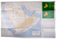
ARAMCO. Saudi Arabian road map.
Dammam, printed by the Al-Mutawa Press for the Arabian American Oil Company, 1975. Large folding map (60 x 90.5 cm), printed in colour, depicting the Kingdom of Saudi Arabia and its main roads. With on the right the title in both Arabic and English and a table with the distances from one city to another. Printed on two sides, one side with the map in English and the other in Arabic. Full description
€ 1,500
Order Inquire Terms of sale

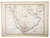
Highly detailed wall map of Asia and the Arabian peninsula, from the collection of the Governor of Ceylon

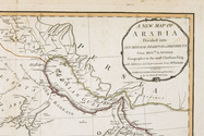
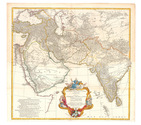
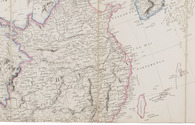
ARROWSMITH, Aaron. Asia.
London, Aaron Arrowsmith, 1 January 1801. Engraved wall map, hand coloured in outline, on 4 sheets joined as 2 (measuring 124 x 147 cm in total) on a scale of ca. 1:6,490,880, with an elaborately decorated cartouche at the head left, a dedication below ("To major James Rennell, Esqr. F.R.S. &c. &c.") and the name of the engraver at the foot right (George Allen). Mounted on cloth and divided into 32 sections. Contemporary slipcase, covered with marbled paper and a manuscript title-label on front. Full description
€ 7,500
Order Inquire Terms of sale

Presentation copy by the author

AVEZAC-MACAYA, Armand D'. Considérations géographiques sur l'histoire du Brésil. Examen critique d'une nouvelle histoire générale du Brésil recemment publiée en portugais a Madrid par M. François-Adolphe de Varnhagen chargé d'affaires du Brésil en Espagne. Rapport fait à la société de géographie de Paris dans ses séances des 1er Mai et 5 Juin 1857.
Paris, L. Marinet, 1857. 8vo. With 2 folding maps. Modern gold-tooled red half morocco, marbled boards, preserving the printed wrappers. [4], 271, [1] pp. Full description
€ 600
Order Inquire Terms of sale

“to this day a major source of information about the land and peoples of Paraguay and Río de la Plata”

AZARA, Félix Manuel de. Voyages dans l'Amérique Méridionale, ... depuis 1781 jusqu'en 1801; contenant la description géographique, politique et civile du Paraguay et de la rivière de La Plata; ...
Paris, Dentu, 1809. 8vo (4 text volumes) and folio (1 atlas volume). With 3 folding tables and 25 engraved maps, plans, views and plates of animals and birds. Modern black half calf, gold-tooled spine. LX, 389; [4], 388-562; [4], II, 479; [4], 380 pp. Full description
€ 12,500
Order Inquire Terms of sale
185 books found / Show all