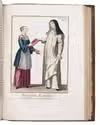

A worldy guide for Dutch ministers and other clergy men
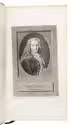
BACHIENE, Willem Albert.
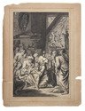
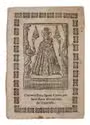
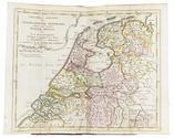
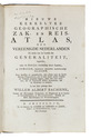
Nieuwe kerkelyke geografische zak- en reisatlas der vereenigde Nederlanden. Als mede van de landen der generaliteit, ingericht, naar de kerkelyke verdeeling dezer landen, in synoden, benevens derzelver onderhoorige klassen. Zeer dienstig en gemakkelyk, niet alleen voor de Eerw. heeren proponenten, om te zien onder welke classen de vakante plaatzen leggen, maar ook voor anderen, die de provintien willen doorreizen, om de reisroute te neemen.
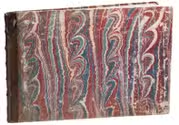
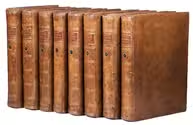
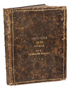
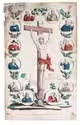
Amsterdam, De erven Dirk onder de Linden en zoon, 1794. Large, narrow 8vo. With a folding typographical title page and 13 folding double-page engraved maps by J. van Jagen, all coloured by a contemporary hand. The maps are mounted on stubs for ease of use (the maps fold out/open flat). Contemporary half tan mottled calf, red and black decorated paper sides, with remnants of a white paper label at the foot of the spine, and with two 20th-century library labels (of the "Verzameling Oudheidkamer Twente") on the back board. [14] folded leaves. Full description
€ 2,500
Amsterdam, De erven Dirk onder de Linden en zoon, 1794. Large, narrow 8vo. With a folding typographical title page and 13 folding double-page engraved maps by J. van Jagen, all coloured by a contemporary hand. The maps are mounted on stubs for ease of use (the maps fold out/open flat). Contemporary half tan mottled calf, red and black decorated paper sides, with remnants of a white paper label at the foot of the spine, and with two 20th-century library labels (of the "Verzameling Oudheidkamer Twente") on the back board. [14] folded leaves. Full description