EEKHOFF, Wopke.
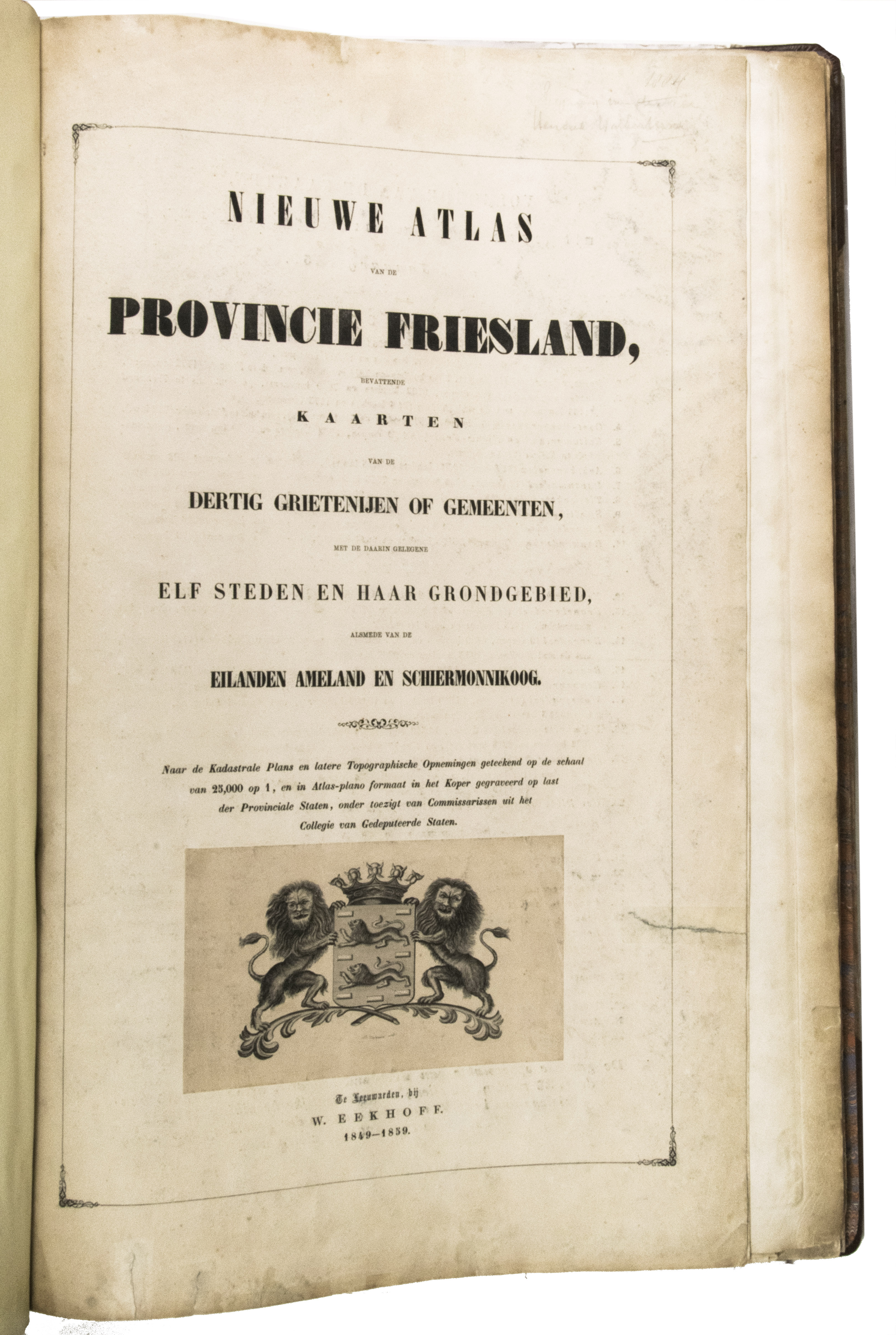
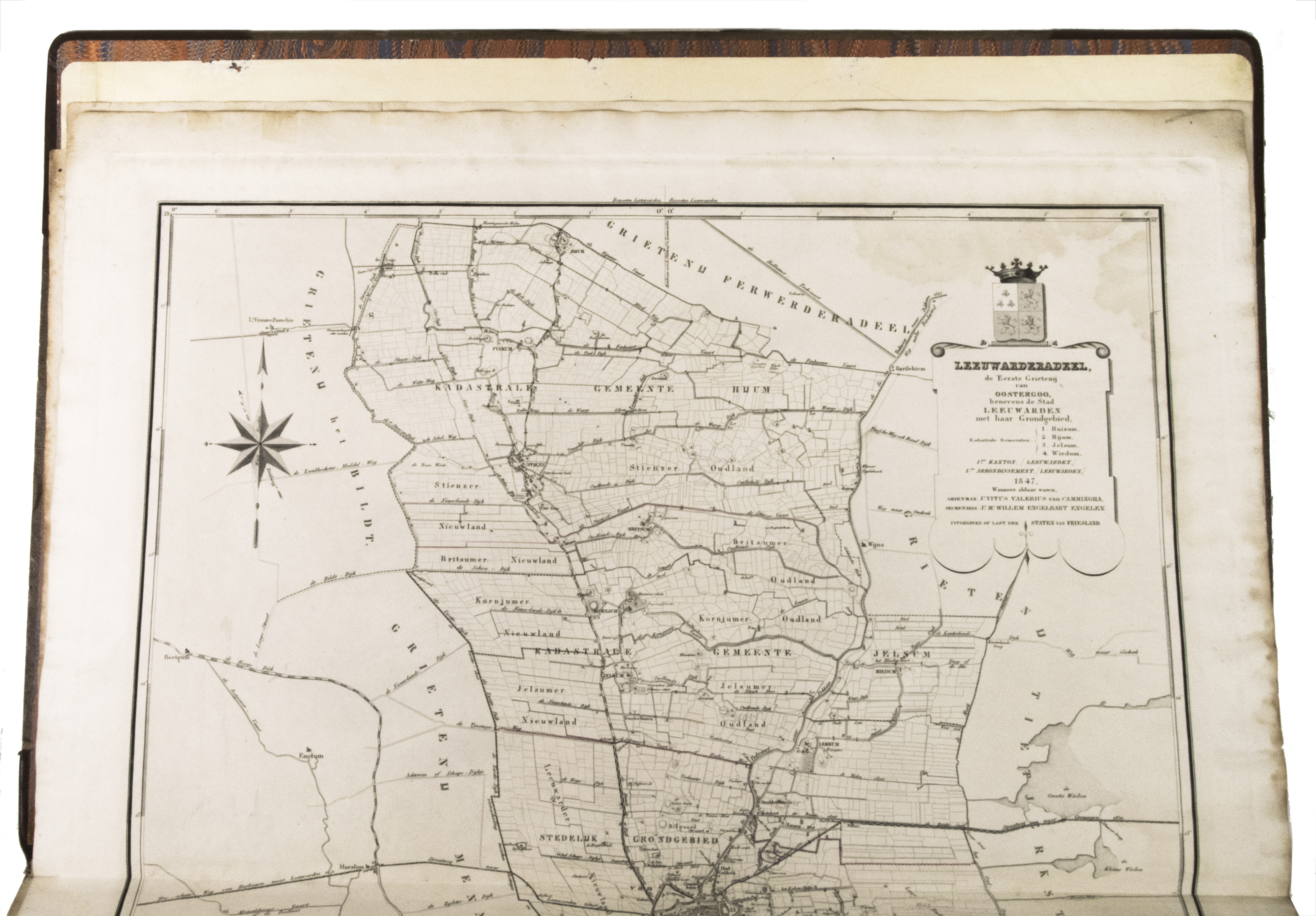
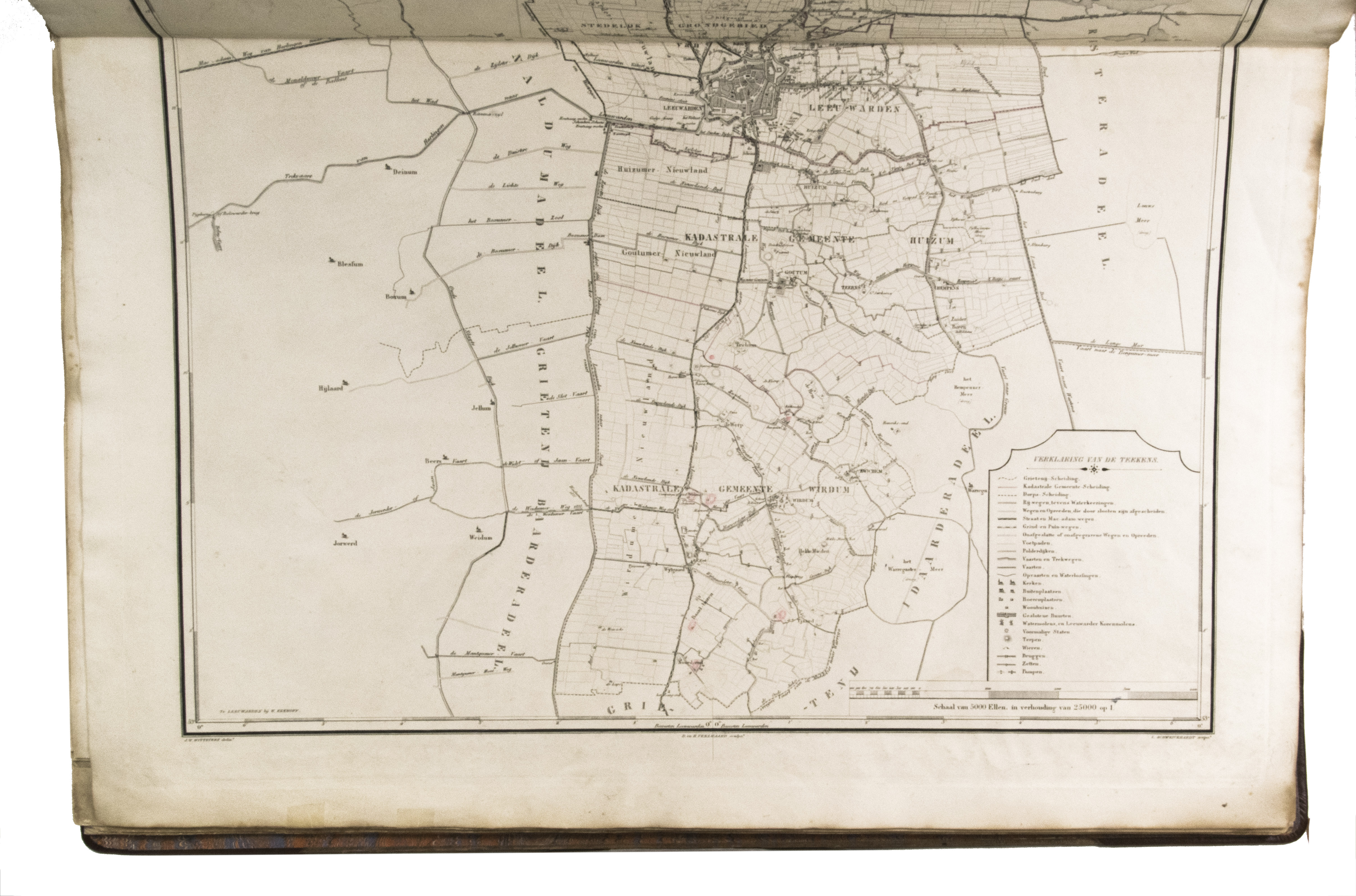
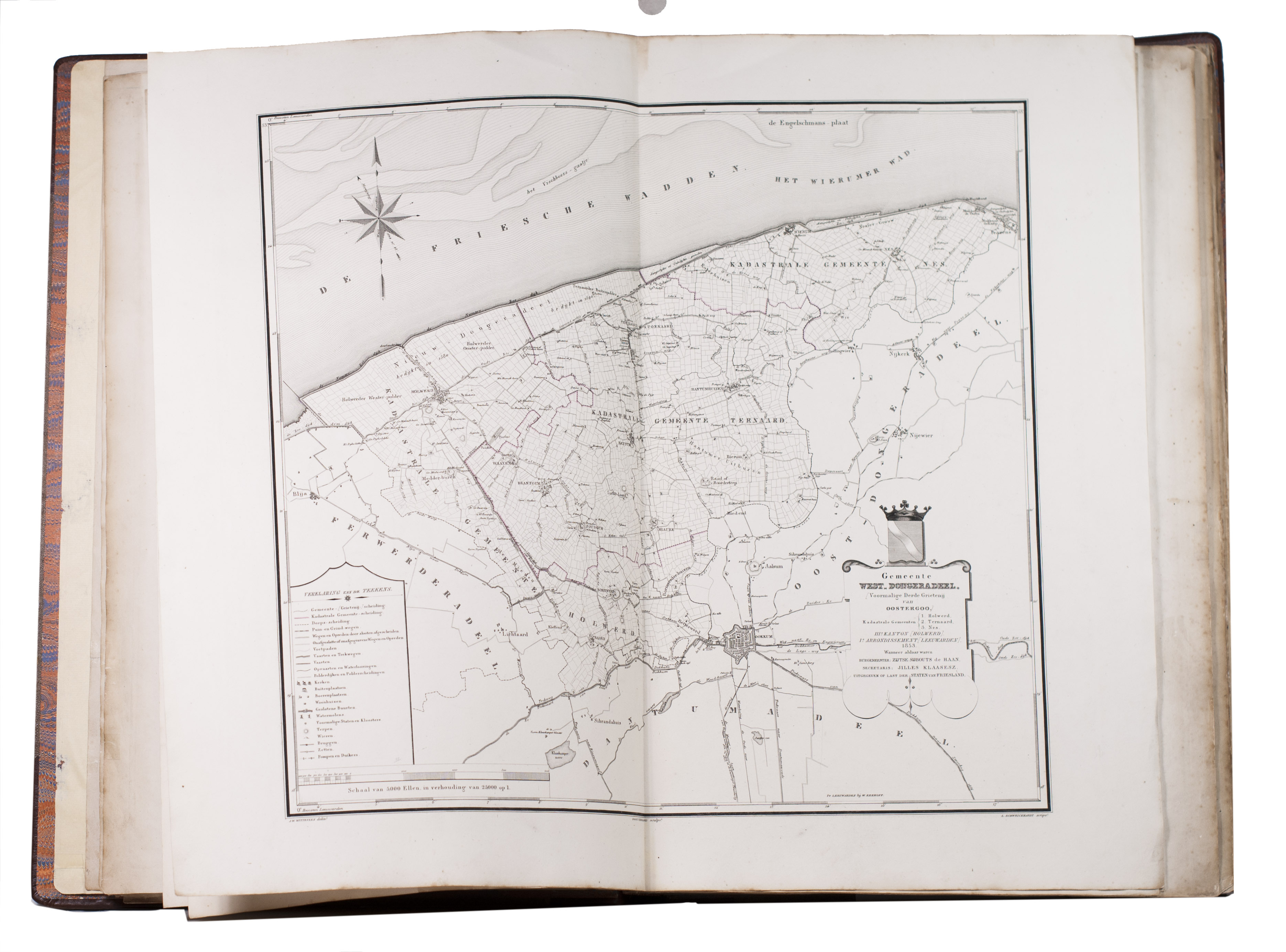
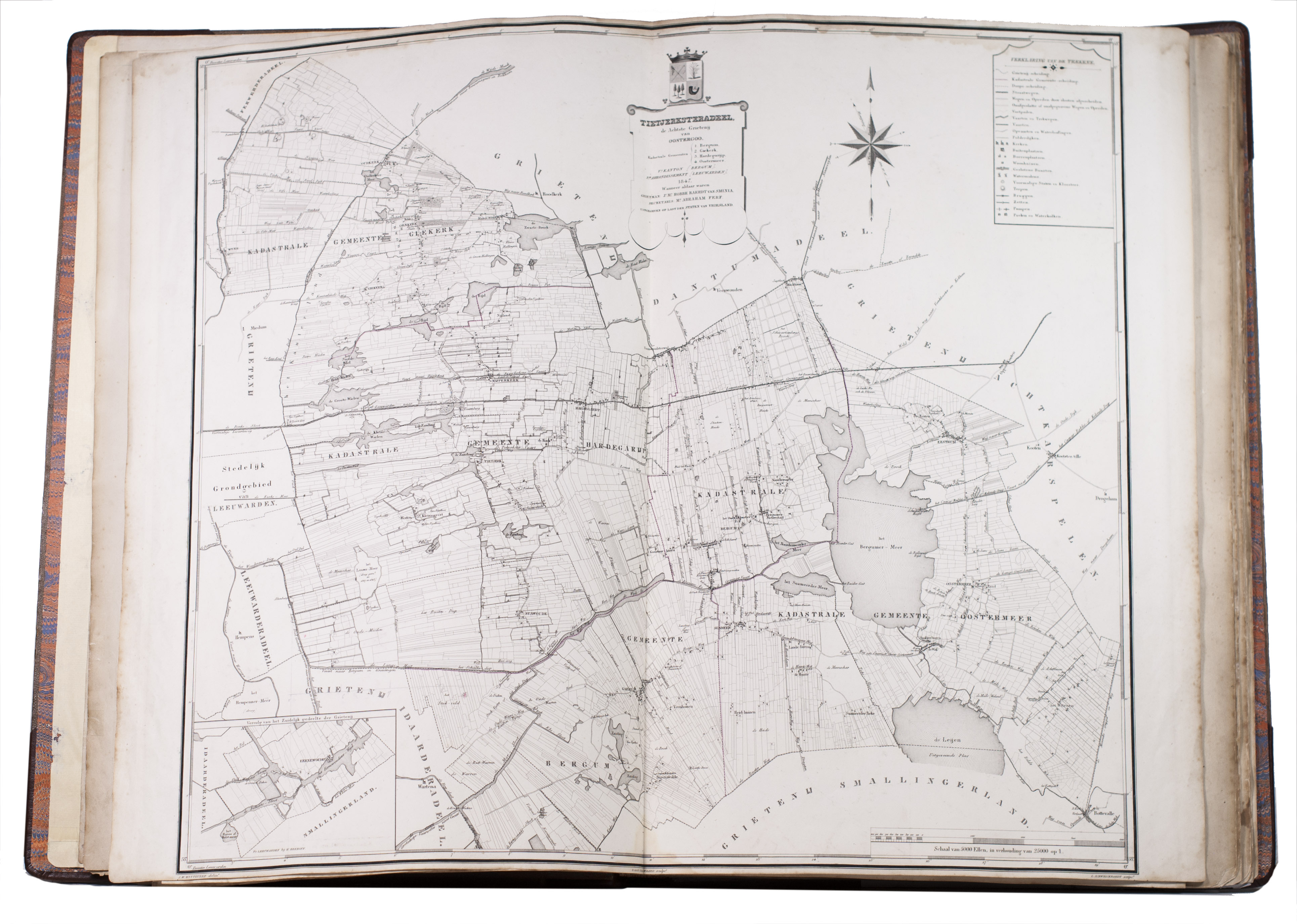
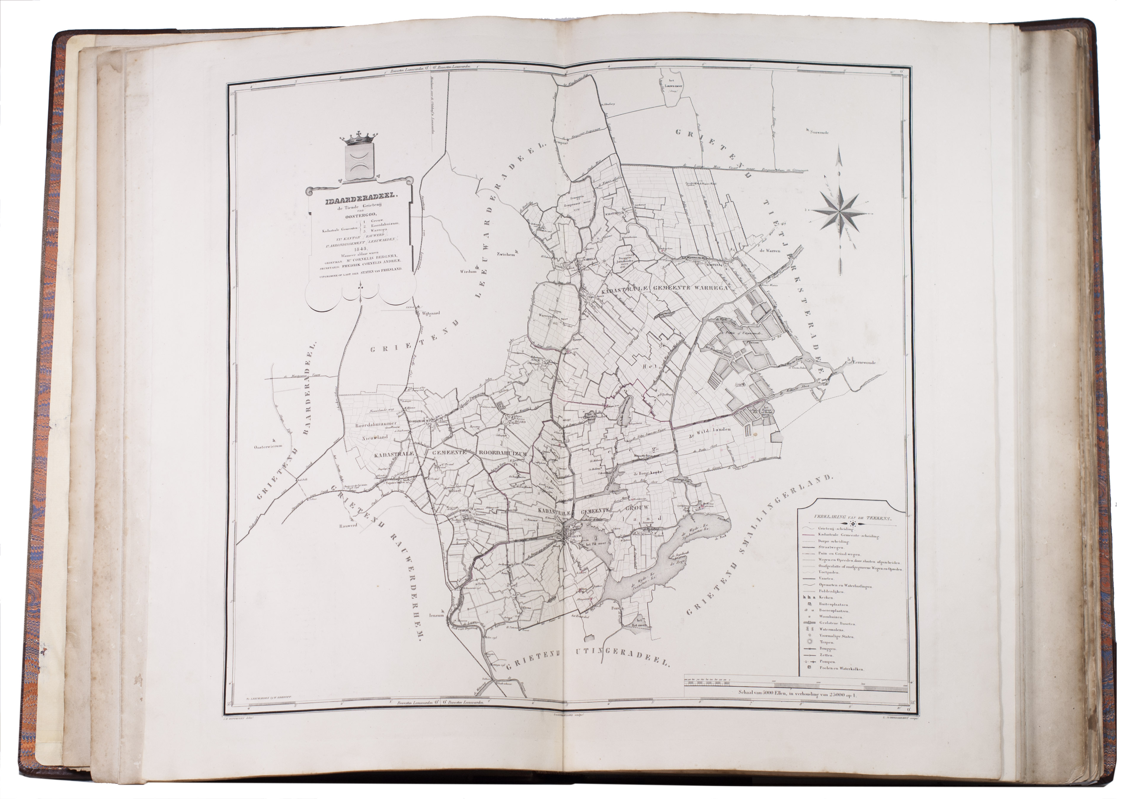
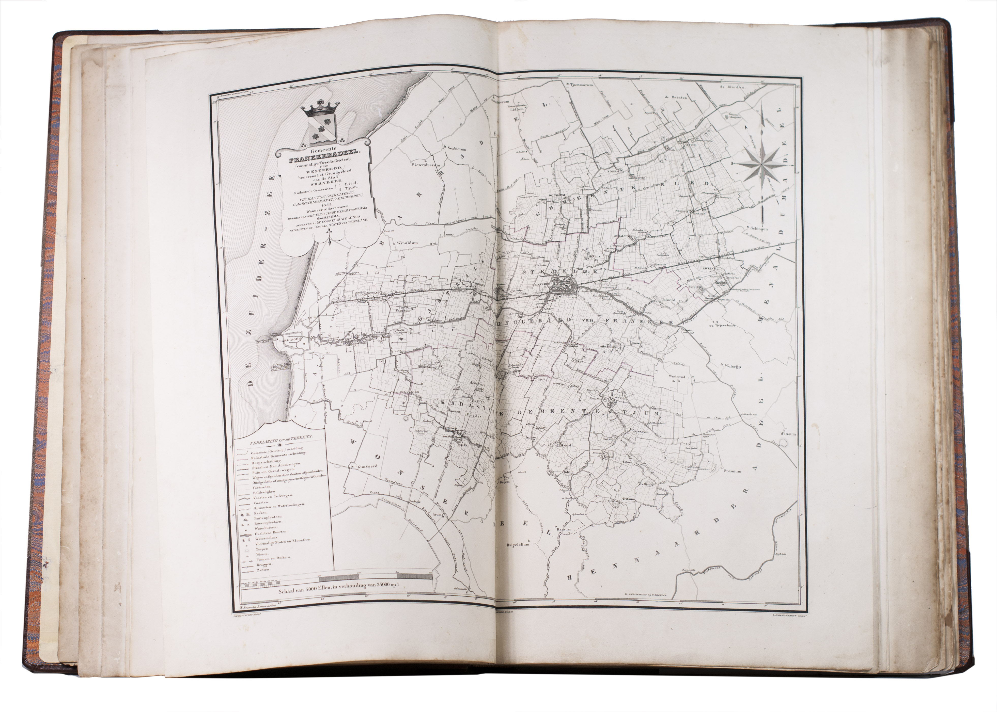
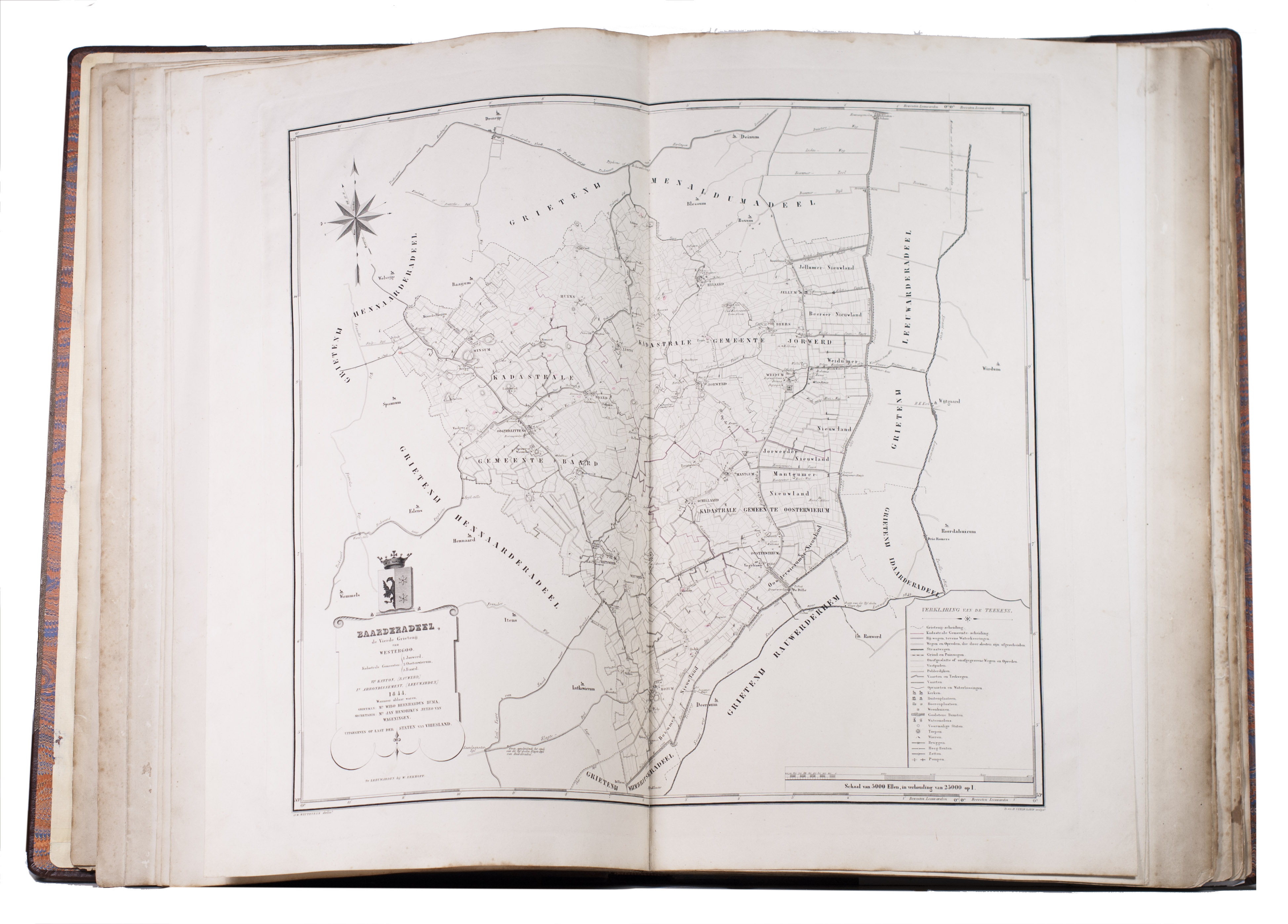
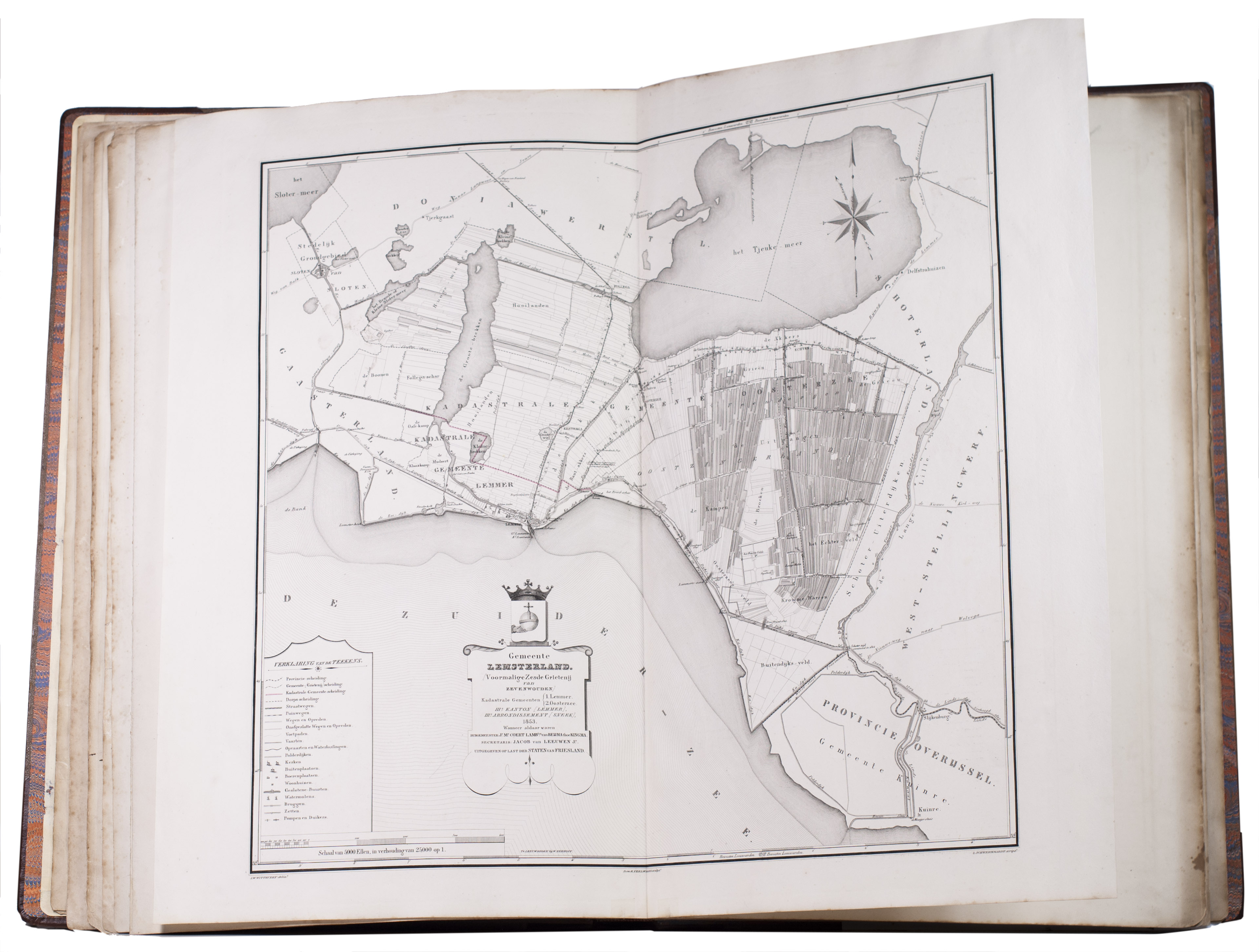
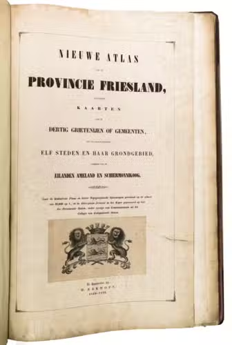
Nieuwe atlas van de provincie Friesland, bevattende kaarten van de dertig grietenijen of gemeenten, met de daarin gelegene elf steden en haar grondgebied, alsmede van de eilanden Ameland en Schiermonnikoog.
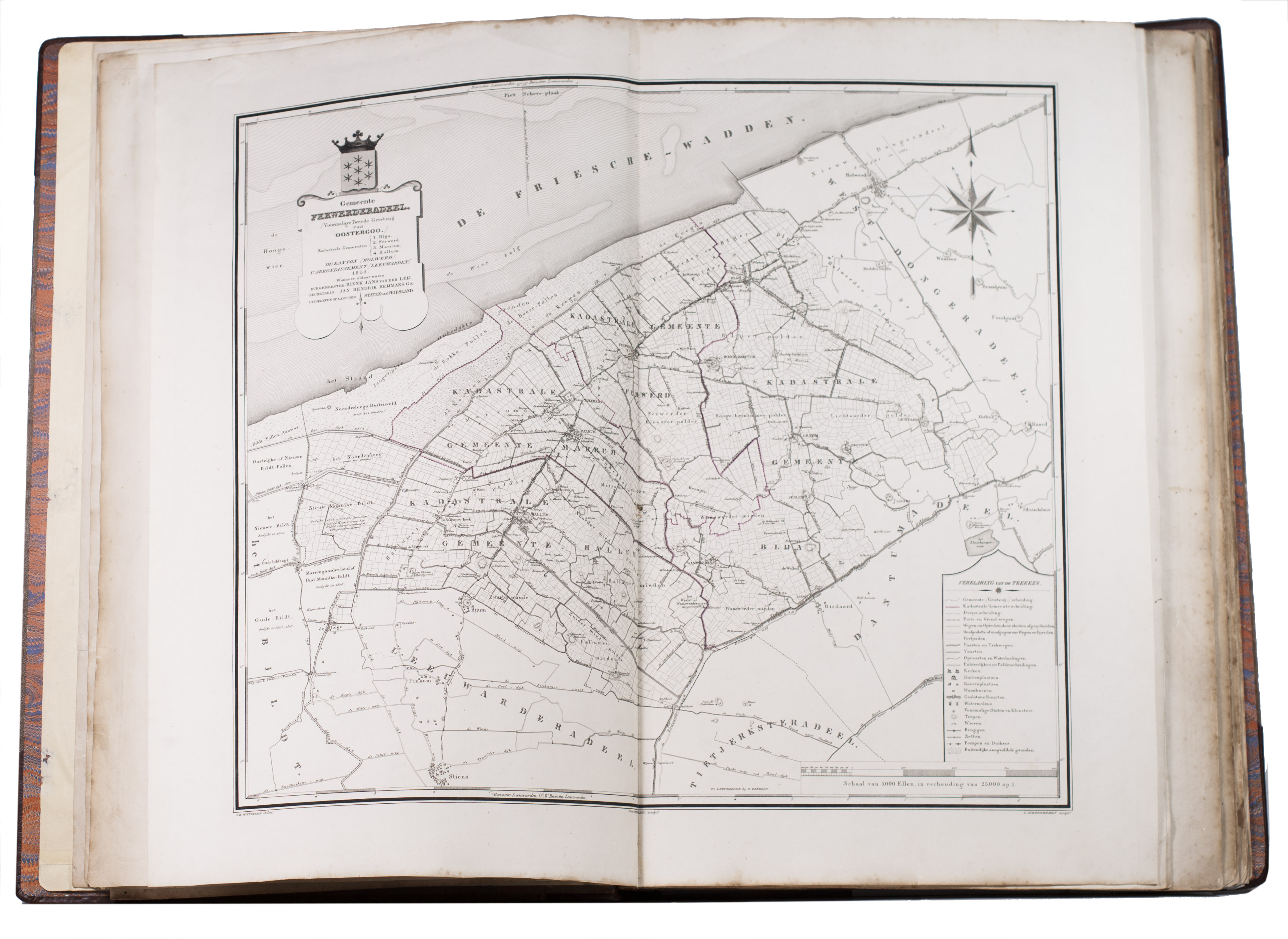
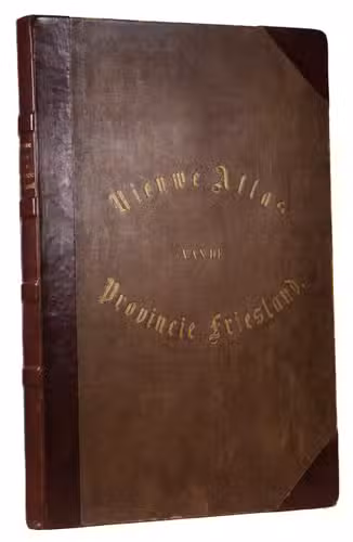
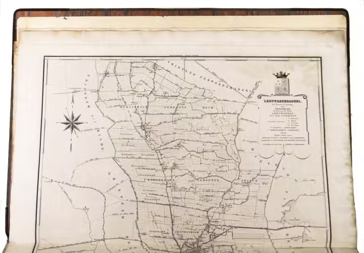
Leeuwarden, W. Eekhoff, 1849-1859. Large folio (68 x 41 cm). With 32 large double-page maps, of which 2 folding, engraved by D. & H. Veelwaard after J.W. Witteveen. Further with the engraved coat of arms of the Province of Friesland on the title page. Contemporary half brown morocco and pebble-grained brown cloth sides. [4] pp. + 32 maps.
€ 2,500
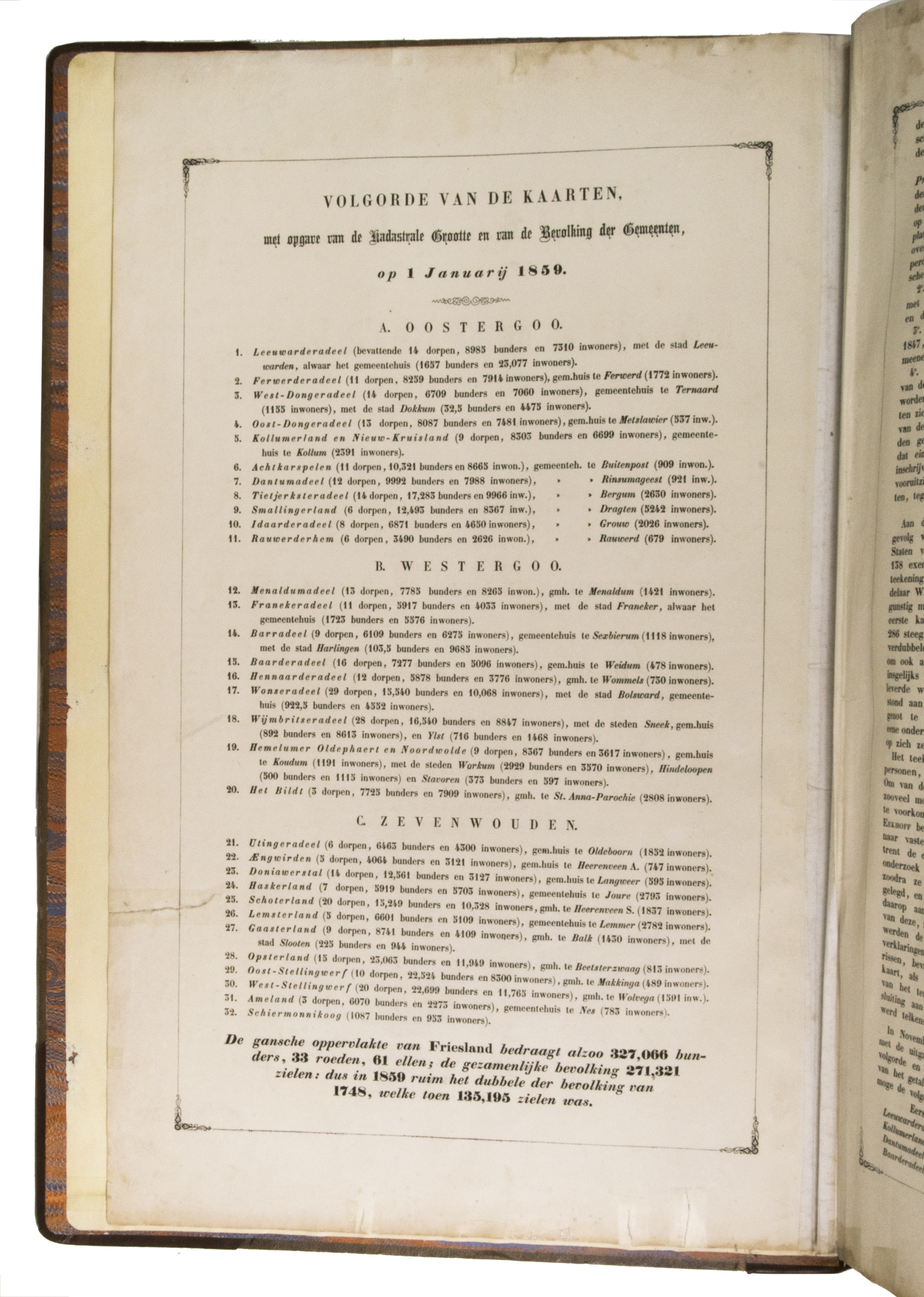
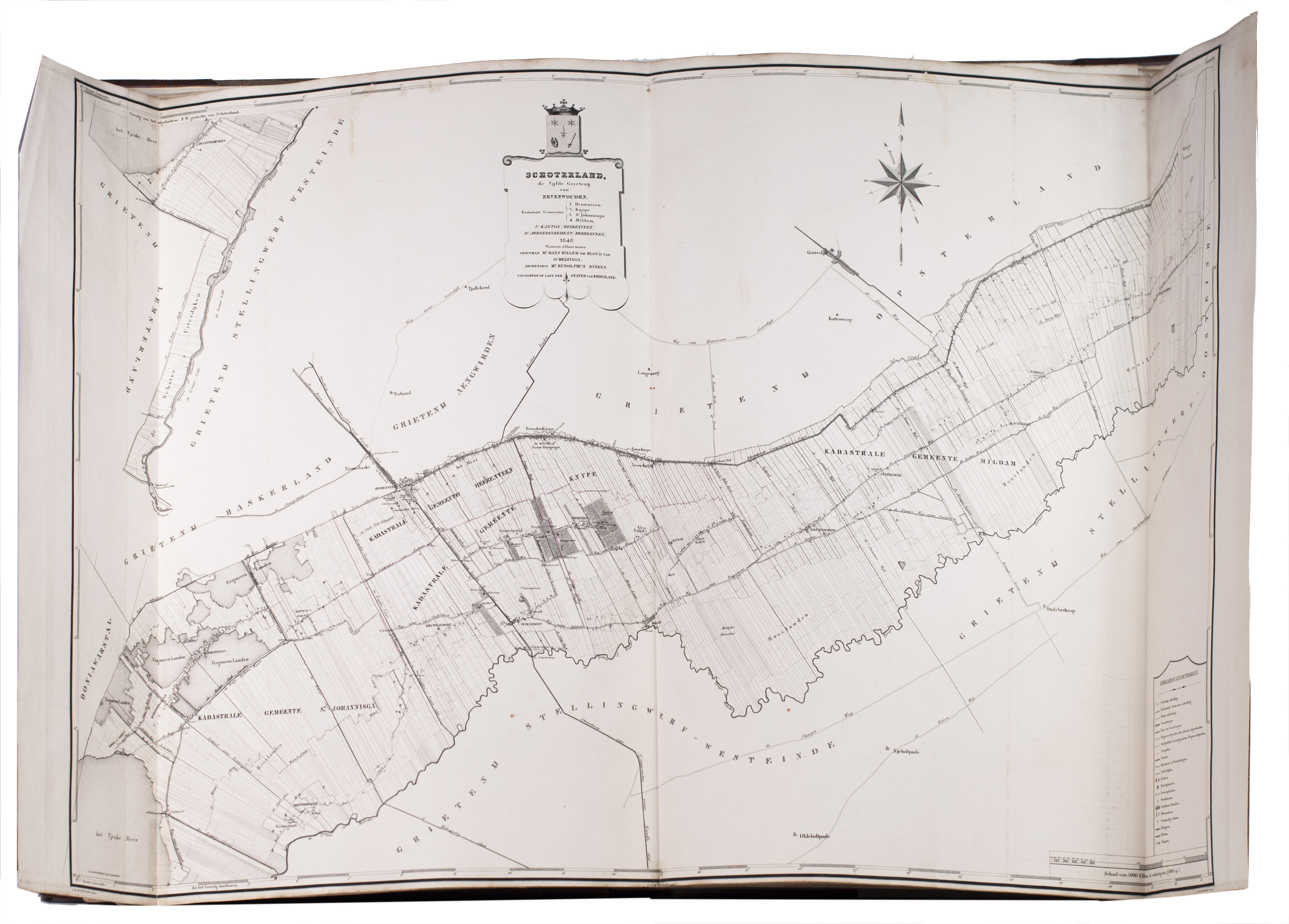
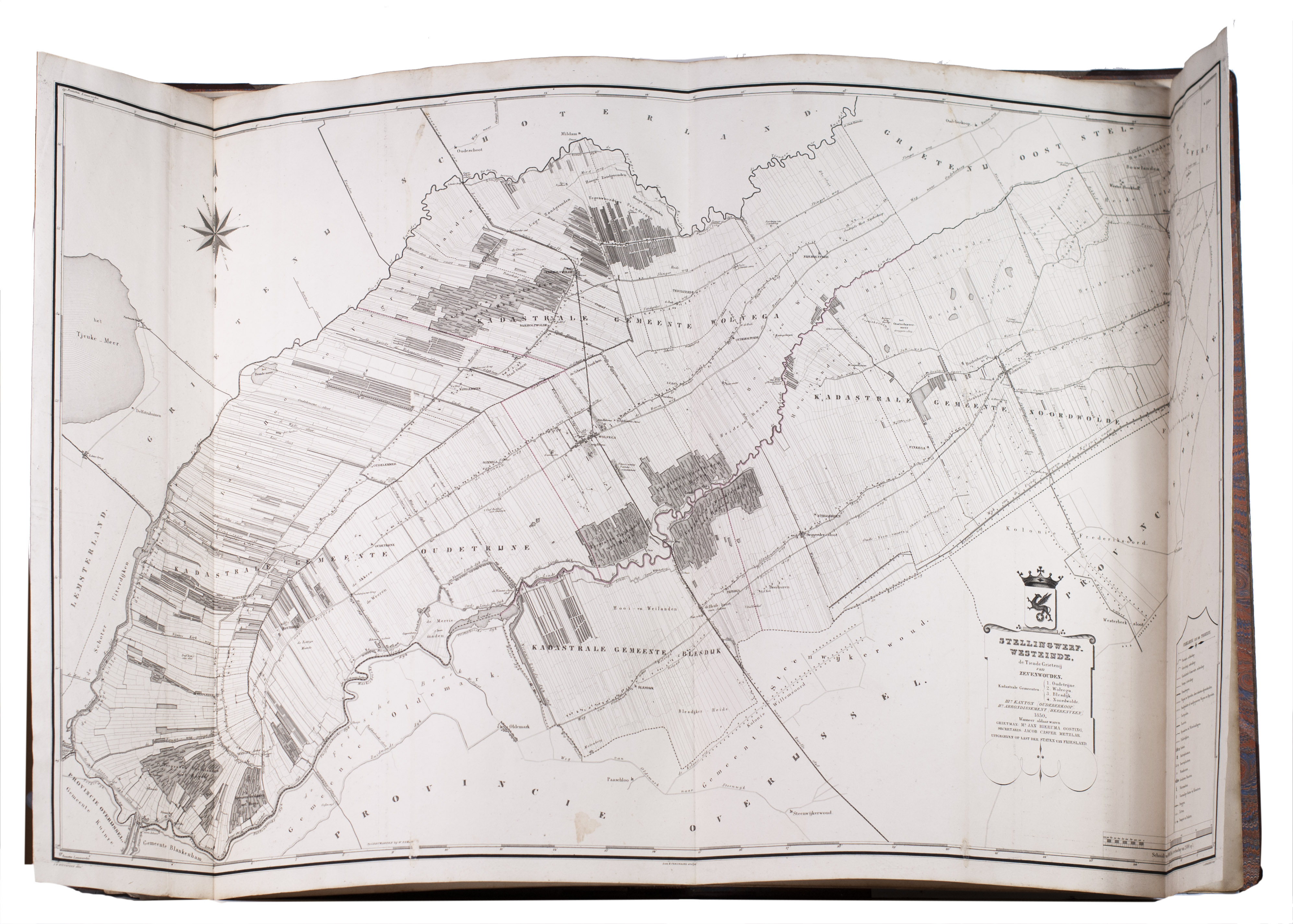
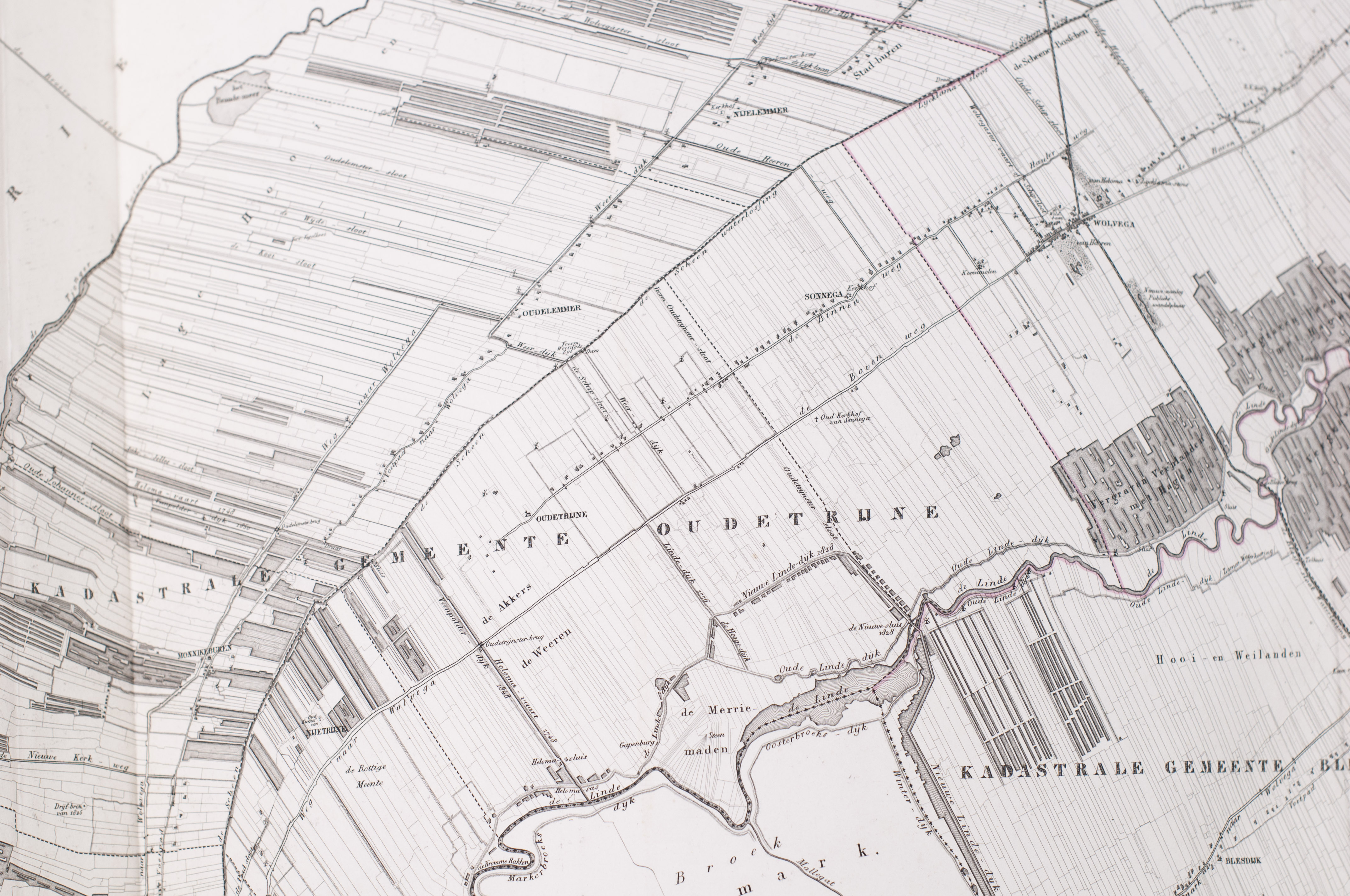
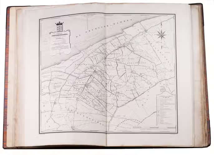
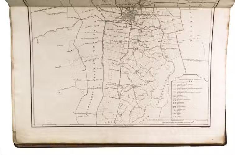
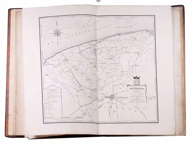
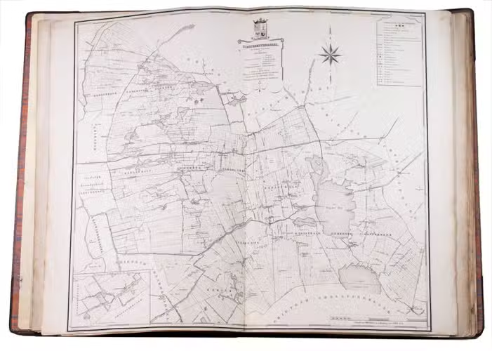
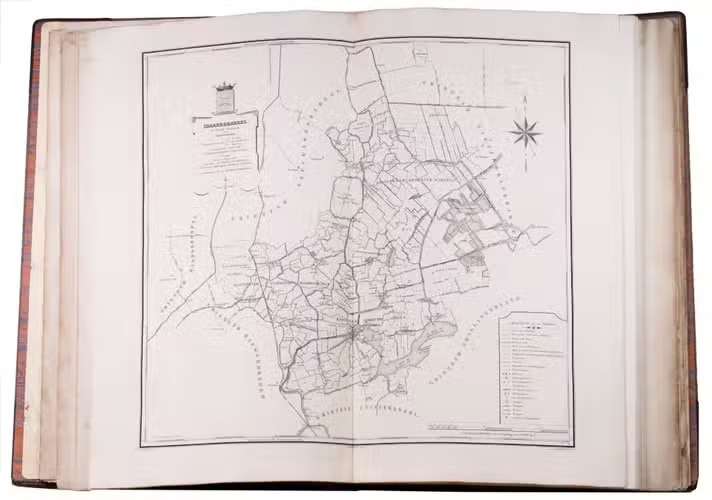
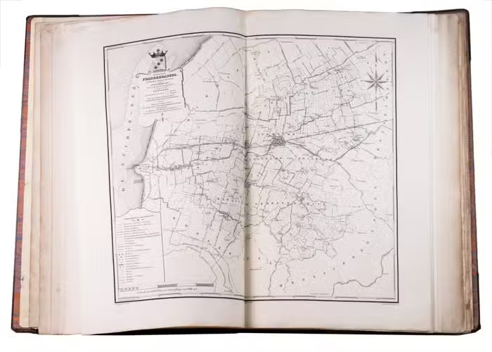
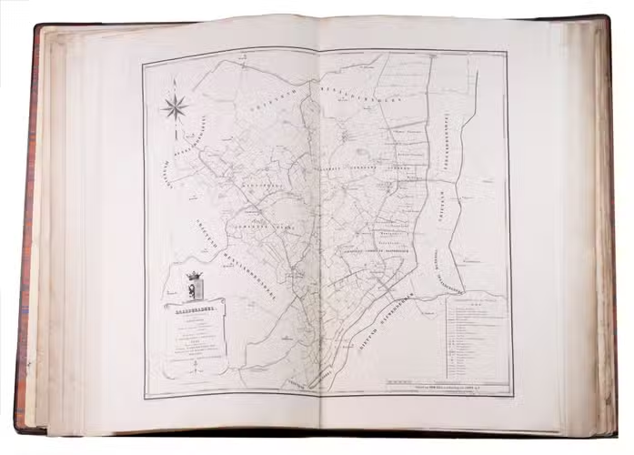
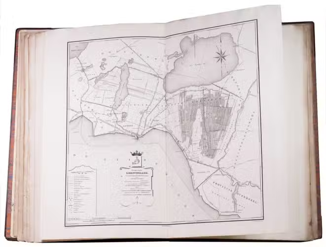
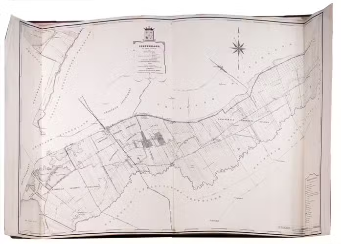
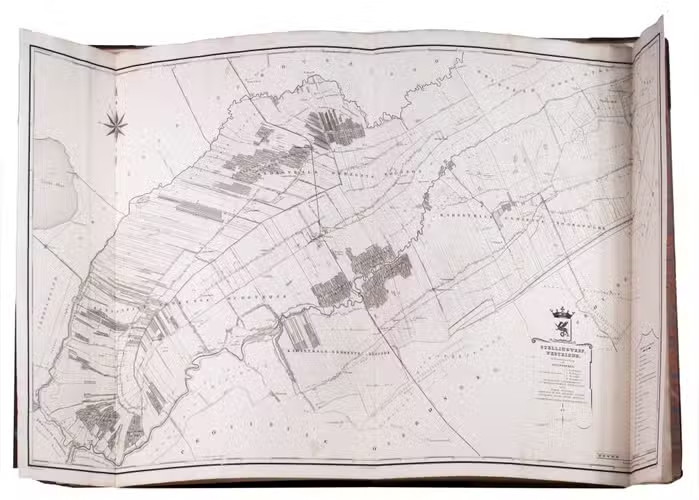
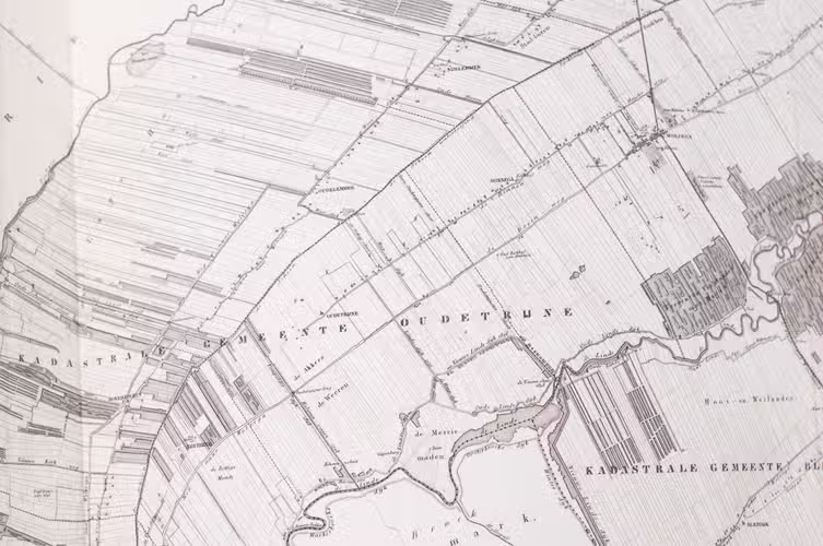
First and only edition of a detailed and accurate atlas of Friesland, one of the most detailed regional mapping projects of its period. The paper was especially made by J. Honig, Zaandijk. According to the preface there were 286 subscribers to the atlas, which was actually quite high according to Koeman. It was issued over a ten-year span, it comprises finely engraved cadastral-style maps of Frieslands thirty grietenijen (later municipalities), including the eleven Frisian cities and the islands of Ameland and Schiermonnikoog. The maps, drawn from official surveys and engraved on copper, are notable for their precision, decorative cartouches, and heraldic elements. The atlas remains an important monument of Dutch topographical cartography.
The edges of the boards show slight signs of wear, slight browning throughout, occasional staining. Otherwise in good condition. Koeman, Eek 1; Koeman, Geschiedenis van de kartografie van Nederland, pp. 231.
Related Subjects: