
Well-produced gospel harmony illustrated by Urs Graf
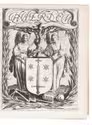
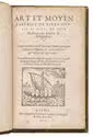
AGRICOLA, Daniel [and Urs GRAF (illustrator)].
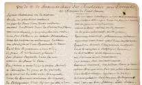
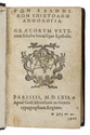
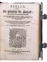
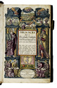
Passio domini nostri Jesu Christi s[ecundu]m serie[m] q[ua]ttuor eva[n]gelistaru[m].
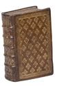
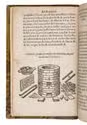
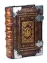
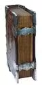
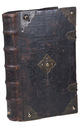
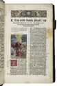
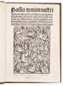
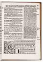
(Colophon: Basel, Adam Petri de Langendorff, 31 July 1514). 4to. With large woodcut (12 x 9.5 cm) on title-page and 20 small woodcuts in text (ca. 4.5 x 3.5 cm), all by Urs Graf. Modern light-brown calf. 39, [1] ll. Full description
€ 5,000
(Colophon: Basel, Adam Petri de Langendorff, 31 July 1514). 4to. With large woodcut (12 x 9.5 cm) on title-page and 20 small woodcuts in text (ca. 4.5 x 3.5 cm), all by Urs Graf. Modern light-brown calf. 39, [1] ll. Full description