Categories
Shopping cart (0 items € 0)
Advanced search ▾

Asia / China

Incunable edition of an influential second century description of the antique world,
including early mentions of China and Arabia
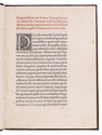
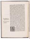
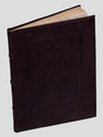
DIONYSIUS Periegetes. [Incipit :] ... de situ orbis habitabilis ...
[Colophon:] Venice, Franz Renner, 1478. Small 4to (19 x 14 cm). With the first four lines printed in red and 9 white on black decorated woodcut initials (1 series), plus 1 repeat. Set in roman type, 26 lines to a page, with two words in Greek. Modern blind-tooled calf. [36] ll. Full description
€ 35,000
Order Inquire Terms of sale

Travels in Siberia and China

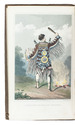
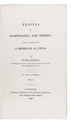
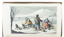
DOBELL, Peter. Travels in Kamtchatka and Siberia; with a narrative of a residence in China.
London, Henry Colburn and Richard Bentley (back of title-page: J.B. Nichols and son), 1830. 2 volumes. 12mo. With two hand-coloured aquatint frontispieces by J. Clarck. Contemporary boards. IX, [1 blank], 351, [1]; X, 341, [1 blank], [2] pp. Full description
€ 2,250
Order Inquire Terms of sale

17th-century Chinese drawings (some in colour) and a Japanese(?) woodblock print

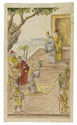
[DRAWING - CHINA - JAPAN]. [A series of 8 Chinese drawings plus a watercolour drawing and a woodblock print].
[China, the main series ca. 1660/75?]. A series of 8 Chinese drawings (ca. 24 x 14.5 cm: 5 coloured, 1 also highlighted in gold), showing scenes from a Chinese novel, many military or diplomatic, plus a Chinese watercolour drawing and a Japanese(?) woodblock print. Full description
€ 3,950
Order Inquire Terms of sale

Large paper copy of the original edition of the most comprehensive survey of China printed in the 18th century,
from the library of the Earls of Macclesfield

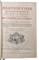
DU HALDE, Jean-Baptiste du. Description géographique historique, chronologique, politique, et physique de l'Empire de la Chine et de la Tartarie Chinoise, enrichie des cartes générales et particulieres de ces pays, de la carte générale & des cartes particulieres du Thibet, & de la Corée.
Paris, P.G. le Mercier, 1735. 4 volumes. Folio (ca. 43 x 28 cm). With 43 engraved maps (folding, double-page and full-page), 21 engraved plates (folding, double-page and full-page), numerous decorated woodcut initials and head- and tailpieces. Contemporary gold- and blind-tooled mottled calf. [4], VIII, LII, IV, 592; [4], IV, 725, [1]; [4], IV, 564, IX-[XII]; [4], II, 520 pp. Full description
€ 40,000
Order Inquire Terms of sale

Beijing in the late 19th century, illustrated with numerous photographs

FAVIER, Alphonse. Péking histoire et description.
Peking, Imprimerie des Lazaristes au Pe-Tang, 1897. 35.5 x 25.5 cm. 2 volumes bound as 1 (continuous page numbers). With a frontispiece to each part, 51 plates with photolithographs and collotypes, 1 tinted map, and 660 wood engraved illustrations in text. Modern half cloth, with the original wrappers bound in. XII [4], 336, [4], 337-“562” [= 552], [2] pp. Full description
€ 6,500
Order Inquire Terms of sale

A standard navigational directory for the Indian Archipelago

FINDLAY, Alexander George. A directory for the navigation of the Indian archipelago and the coast of China, from the Straits of Malacca and Sunda, and the passages east of Java, to Canton, Shanghai, the Yellow Sea, and Korea. With the descriptions of the winds, monsoons, and currents, and general instructions for the various channels, harbours, etc. Third edition.
London, Richard Holmes Laurie, 1889. Royal 8vo. With 11 folding maps and charts. Original publishers blindstamped cloth, lettered in gold. XLVIII, IV, 1478; [2], 8 pp. Full description
€ 2,500
Order Inquire Terms of sale

Exploring central China, with a large folding map

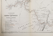
GARNIER, Francis. Voyage dans la Chine centrale, Vallée du Yang-Tzu, fait de mai à aout 1873.
Paris, E. Martinet for Ch. Delagrave, 1874. 8vo. With a large lithographed folding map (26 x 58 cm), with highlights in red, and several letterpress tables. Original publisher's printed yellow wrappers. [3], [1 blank], 39, [1 blank] pp. Full description
€ 1,250
Order Inquire Terms of sale

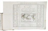
The state of all missionary activity around the world ca. 1820

[GAUSSEN, Francois Samuel Robert Louis?]. Exposé de l'état actuel des missions évangéliques chez les peuples infidèles, cel qu'on le connoissoit au commencement de l'année 1820.
Genève, [back of the title page: printing office of Guillaume Fick], 1821. 2 parts in 1 volume. 8vo. With a folding leaf (54 x 34.5 cm) containing a small coloured map of the world, engraved by Bovet, surrounded by letterpress tables of the principle mission stations around the world. Contemporary half brown sheepskin, decorated paper sides, gold-tooled spine, marbled edges. XII, LXXXII, IV, 408, [4] pp. Full description
€ 2,950
Order Inquire Terms of sale
116 books found / Show all