Categories
Shopping cart (0 items € 0)
Advanced search

Maritime History / Navigation

An important surveying voyage to the Pacific

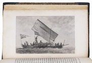
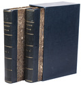
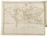
BELCHER, Edward. Narrative of a voyage round the world, performed in Her Majesty's ship Sulphur, during the years 1836-1842, including details of the naval operations in China, from Dec. 1840 to Nov. 1841.
London, Henry Colburn, 1843. 2 volumes. 8vo. With a folding map of the Canton river, folding map with the routes of the H.M.S. Sulphur, large world chart also showing the route of the Sulphur, 19 steel-engraved views and several illustrations in text. Gold-tooled blue sheepskin, shell-marbled sides. Rebacked. In modern slipcase. XXII, 387; VI, 474 pp. Full description
€ 2,950
Order Inquire Terms of sale

Wonderful and very rare nautical atlas for the Mediterranean

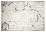
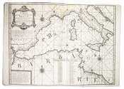
BERTHELOT, François. [Nautical atlas of the Mediterranean Sea].
Marseille, "se vend chez Benoît", 1720-1730. Large folio (40 x 55 cm). With 4 double-page engraved maps, with the first half of the first map as the front paste-down and the second half of the last map as the back pastedown. Contemporary vellum-backed boards, reinforced with light brown leather at the head and foot of the spine. 4 nautical maps on [8] pp. Full description
€ 8,500
Order Inquire Terms of sale

One of the most important pilot guides of the 17th century

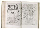
BLAEU, Willem Jansz. Zeespiegel, inhoudende een korte onderwijsinghe inde konst der zeevaert, en beschryvinghe der seen en kusten van de Oostersche, Noordsche, en Westersche schipvaert.Wt ondervindinghen van veel ervaren zeevaerders vergadert, en t'samen ghestelt.
Amsterdam, Willem Jansz. Blaeu, 1627. 3 parts in 1 volume, parts 2 and 3 consist of 6 books each. Folio. With 108 numbered engraved charts (1 folding, 104 double-page, 3 full-page), 2 half-page engraved charts, 2 volvelles, a woodcut vignette on the divisional title page of each part, and numerous woodcut illustrations in the text. Contemporary overlapping vellum, sewn on 5 supports laced through the joints, with the manuscript title (2x) and shelfmark ("15" and "32') on the spine. The work is preserved in a gold-tooled half red morocco clamshell box, with two green morocco title labels, lettered in gold, red buckram sides, and a green felt lining. [16], 64; 39, [1], 43, [1], 48, 32, 28, 24; 32, 52, 46, 43, [1], 40, 23, [1 blank] pp. Full description
€ 275,000
Order Inquire Terms of sale

Columbus or Vespucci: who discovered America?

CANOVAI, Père Stanislao. Elogio d'Amerigo Vespucci che ha riportato il premio della nobile Accademia Etrusca di Cortona nel dì 15. Ottobre dell'anno 1788. Con una dissertazione giustificativa di questo celebre navigatore, del P. Stanislao Canovai. Terza editione. Con illustrazioni ed aggiunte, e con una seconda dissertazione sulle vicende delle longitudini geografische.
[Modena], 1790. 3 parts in 1 volume. 4to. With a woodcut vignette on the title page, and 3 decorated woodcut initials (2 different series). Contemporary limp grey boards. XVII, 39, [1 blank]; 55, [1 blank]; 64, [2] pp. Full description
€ 3,500
Order Inquire Terms of sale

Winds and the weather in the coast of India and the Arabian and Persian Gulf:
first edition of a rare meteorological work

CAPPER, James. Observations on the winds and monsoons; illustrated with a chart and accompanied with notes, geographical and meteorological.
London, Charles Whittingham, 1801 4to. With 1 folding engraved map of the world depicting all the world-wide seas and waters and several tables printed within the text. Later half calf. XXVIII, 29-234 pp. Full description
€ 2,950
Order Inquire Terms of sale

Europe fortified: the fortifications of Marolois, Stevin and Vauban, beautifully mapped,
together with an atlas of the coasts of France, also with fortifications

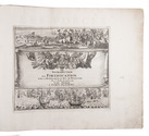
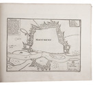
FER, Nicolas de. Les forces de l' Europe, ou description des principales villes; avec leurs fortifications. ... Premiere partie[-dixième partie].
Paris, "chez l'auteur" [= Nicolas de Fer, a false imprint], 1695-1696 [printed in Amsterdam, for Pieter Mortier, 1695-ca. 1702].
With: (2) FER, Nicolas de. Costes de France, sur l' ocean & sur la Mer Mediterranée &c. avec leurs fortifications. ... Tome I[-II].
Paris, "Nicolas de Fer" [a false imprint], 1695. [printed in Amsterdam, for Pieter Mortier]. 2 works in 12 parts or volumes, bound as 1. Oblong 1mo (30 x 37 cm). Ad 1 with 10 letterpress title pages in red and black for the 10 parts; 5 engraved titles for parts 1-5 (that for part 5 repeating that for part 2); plus 234 beautifully engraved plates (a few folding) with 366 maps and views of fortified cities. Ad 2 with an engraved title page, 2 letterpress title pages in red and black and 40 engraved plates (including 2 folding), labelled A-S in part 1 and T-Oo in part 2. Contemporary tanned sheepskin, sewn on 5 cords, gold-tooled spine with the title in the 2nd of 6 compartments. Full description
€ 17,500
Order Inquire Terms of sale

A standard navigational directory for the Indian Archipelago

FINDLAY, Alexander George. A directory for the navigation of the Indian archipelago and the coast of China, from the Straits of Malacca and Sunda, and the passages east of Java, to Canton, Shanghai, the Yellow Sea, and Korea. With the descriptions of the winds, monsoons, and currents, and general instructions for the various channels, harbours, etc. Third edition.
London, Richard Holmes Laurie, 1889. Royal 8vo. With 11 folding maps and charts. Original publishers blindstamped cloth, lettered in gold. XLVIII, IV, 1478; [2], 8 pp. Full description
€ 2,500
Order Inquire Terms of sale
72 books found / Show all