Categories
Shopping cart (0 items € 0)
Advanced search

Cartography & Exploration / Navigation

One of the most important pilot guides of the 17th century

BLAEU, Willem Jansz. 
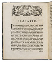
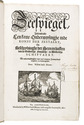
Zeespiegel, inhoudende een korte onderwijsinghe inde konst der zeevaert, en beschryvinghe der seen en kusten van de Oostersche, Noordsche, en Westersche schipvaert.Wt ondervindinghen van veel ervaren zeevaerders vergadert, en t'samen ghestelt.
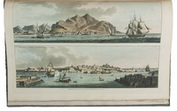
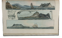
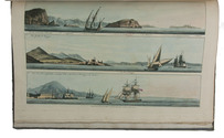
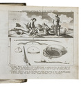
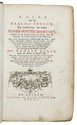
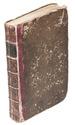
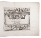
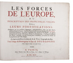
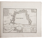
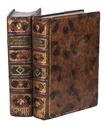
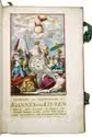
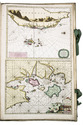
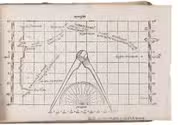
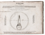
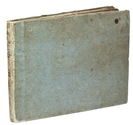
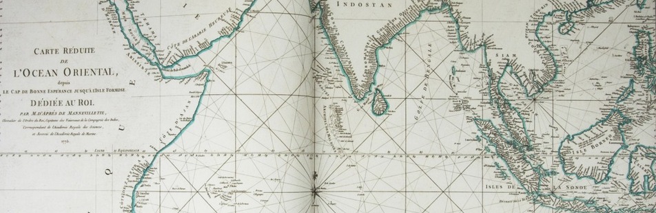
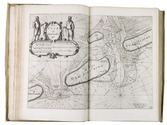
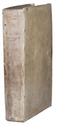
Amsterdam, Willem Jansz. Blaeu, 1627. 3 parts in 1 volume, parts 2 and 3 consist of 6 books each. Folio. With 108 numbered engraved charts (1 folding, 104 double-page, 3 full-page), 2 half-page engraved charts, 2 volvelles, a woodcut vignette on the divisional title page of each part, and numerous woodcut illustrations in the text. Contemporary overlapping vellum, sewn on 5 supports laced through the joints, with the manuscript title (2x) and shelfmark ("15" and "32') on the spine. The work is preserved in a gold-tooled half red morocco clamshell box, with two green morocco title labels, lettered in gold, red buckram sides, and a green felt lining. [16], 64; 39, [1], 43, [1], 48, 32, 28, 24; 32, 52, 46, 43, [1], 40, 23, [1 blank] pp. Full description
€ 275,000
Order Inquire Terms of sale

Fine untrimmed copy of a pilot guide, with coloured maps and aquatint profiles

BOUGARD, René and John Thomas SERRES. The little sea torch: or, true guide for coasting pilots.
London, J. Debrett for the "author" [Serres], G. & W. Nicol, et al. [printed by T. Rickaby], 1801. Large folio (47 x 30 cm). With 20 numbered aquatint plates containing 137 coastal profiles, and 12 partly numbered engraved plates containing 24 maps of port cities, harbours, islands and the Strait of Gibraltar. All coastal profiles and maps beautifully and subtly coloured by a contemporary hand. Contemporary boards. VI, 144, [5] pp. Full description
€ 14,500
Order Inquire Terms of sale

North-West Passage not through Hudson Bay

ELLIS, Henry. Reize naar de baai van Hudson, ter ontdekkinge van eenen Noord-wester doortogt, gedaan in de jaaren 1746. en 1747.
Leiden, Elie Luzac jun., 1750. 8vo. With large folding engraved map (18 x 44.5 cm), and 9 engraved plates, mostly folding by N. van Frankendaal, with captions in French and Dutch. Contemporary red half roan. XXXII, 440 pp. Full description
€ 2,950
Order Inquire Terms of sale

Europe fortified: the fortifications of Marolois, Stevin and Vauban, beautifully mapped,
together with an atlas of the coasts of France, also with fortifications

FER, Nicolas de. Les forces de l' Europe, ou description des principales villes; avec leurs fortifications. ... Premiere partie[-dixième partie].
Paris, "chez l'auteur" [= Nicolas de Fer, a false imprint], 1695-1696 [printed in Amsterdam, for Pieter Mortier, 1695-ca. 1702].
With: (2) FER, Nicolas de. Costes de France, sur l' ocean & sur la Mer Mediterranée &c. avec leurs fortifications. ... Tome I[-II].
Paris, "Nicolas de Fer" [a false imprint], 1695. [printed in Amsterdam, for Pieter Mortier]. 2 works in 12 parts or volumes, bound as 1. Oblong 1mo (30 x 37 cm). Ad 1 with 10 letterpress title pages in red and black for the 10 parts; 5 engraved titles for parts 1-5 (that for part 5 repeating that for part 2); plus 234 beautifully engraved plates (a few folding) with 366 maps and views of fortified cities. Ad 2 with an engraved title page, 2 letterpress title pages in red and black and 40 engraved plates (including 2 folding), labelled A-S in part 1 and T-Oo in part 2. Contemporary tanned sheepskin, sewn on 5 cords, gold-tooled spine with the title in the 2nd of 6 compartments. Full description
€ 17,500
Order Inquire Terms of sale

A standard navigational directory for the Indian Archipelago

FINDLAY, Alexander George. A directory for the navigation of the Indian archipelago and the coast of China, from the Straits of Malacca and Sunda, and the passages east of Java, to Canton, Shanghai, the Yellow Sea, and Korea. With the descriptions of the winds, monsoons, and currents, and general instructions for the various channels, harbours, etc. Third edition.
London, Richard Holmes Laurie, 1889. Royal 8vo. With 11 folding maps and charts. Original publishers blindstamped cloth, lettered in gold. XLVIII, IV, 1478; [2], 8 pp. Full description
€ 2,500
Order Inquire Terms of sale

Testing chronometers by Harrison's leading French rival

FLEURIEU, Charles Pierre Claret, Count d'Eveux de. Voyage fait par ordre du Roi en 1768 et 1769, à différentes parties du monde, pour éprouver en mer les horloges marines inventées par M. Ferdinand Berthoud. Première[-seconde] partie, ...
Paris, Imprimerie Royale, 1773. 2 volumes. Large 4to (27 x 20.5 cm). With 5 numbered folding engraved plates in volume 1 (4 maps of the Atlantic Ocean, the Canaries, the Azores, etc., and 1 plate with topographic diagrams), 1 folding engraved plate with geometrical figures illustrating the determination of latitude[!], and 5 folding letterpress tables in volume 2. Contemporary gold-tooled mottled calf. [2], LXXIX, [1 blank], 803, [1 blank]; [2], 622, XL, [2 blank] pp. Full description
€ 9,500
Order Inquire Terms of sale

Rare Swedish scientific dissertation on the making of nautical charts and their use

FRIBERG, Olavus and Olavus HERWECH. Q.B.V. Dissertatio academica, de constructione et usu mapparum hydrographicarum, quam consentiente ampliss. senatu philosoph. in regia academia Upsaliensi, publico eruditorum examini modeste submittunt auctor Olavus Friberg et respondens Olavus Herwech. ad. fil. Vermelandi, In auditorio Carolino Marjori die III. Maji Anno MDCCXLIV.
Uppsala, 1744. 4to. With 4 woodcut geometrical illustrations in the text, a large woodcut headpiece (with the words "constantia coronatur" in it) and one large woodcut decorated initial. Modern stiff (marbled?) paper boards with the title in gold on the spine. 16 pp. Full description
€ 750
Order Inquire Terms of sale

Spectacular 18th-century Dutch composite sea atlas with 3 detailed manuscript charts,
all charts and the engraved title page expertly coloured by a contemporary hand

[KEULEN, Gerard and Johannes van, and others]. [Composite sea atlas containing 56 detailed charts including 3 manuscript charts].
Amsterdam, [Johannes van Keulen and others, 1700-1753, engraved title page dated 1734]. Large folio (61.5 x40.5 cm). With an engraved allegorical title page by Aernout Nagtegael after Jan Luyken, and 56 detailed sea charts, the whole expertly coloured by a contemporary hand. The atlas includes 22 large folding charts, including 3 highly interesting manuscript charts, 27 double-page charts, 1 full-page chart, and 6 half-page charts, most of them with beautiful cartouches, depicting views, local people, and merchandise. The maps are engraved and originally edited by the most famous Dutch cartographers and map-publishers of the late 17th- and early 18th centuries. Contemporary blind-tooled vellum, with green cloth closing ties. Title page and 56 charts. Full description
€ 550,000
Order Inquire Terms of sale

Battle of words over the best practical solution to the determination of longitude before Harrison's chronometer

LEY, Jan Hendrick Jarichs van der. Het gulden zeeghel des grooten zeevaerts, daerinne beschreven wordt de waerachtige grondt vande zeylstreken en platte pas-caerten ...
Leeuwarden, Abraham vanden Rade, 1615. Oblong 4to (16.5 x 22 cm). With an emblematic engraved device/navigational diagram on the title-page and 27 (of 28) woodcut figures: 18 printed on integral leaves and the others on 3 folding plates. 18th-century(?) half vellum, blue-green paper sides, with manuscript author and title on spine. 114, [2] pp. Full description
€ 55,000
Order Inquire Terms of sale
22 books found / Show all