Categories
Shopping cart (0 items € 0)
Advanced search ▾

Cartography, Exploration & Voyages

"Not to be Published"
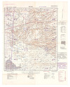
[IRAQ DESERT] 2 lithographic WWII maps: Rutba and Wadi Al Ubaiyidh.
[UK Government], Geographical Section, General Staff, War Office, 1940-1942. 2 topographic maps, colour-printed. Scale 1:500,000. 820 x 640 mm and 770 x 648 mm. Previously folded. Marked "Iraq Desert Sheet 1" and "Sheet 2". Generally well preserved. Full description
€ 1,250
Order Inquire Terms of sale

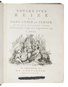
Historical narrative of a voyage to India and Persia written by a surgeon of the British Royal Navy

IVES, Edward. Reize naar Oost-Indië en Persië, en de daar omliggende landen. Ondernomen langs een' ongewoonen weg.
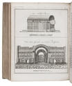
Amsterdam, De Compagnie, 1779. 2 volumes bound as 1. 4to. With 2 engraved title-pages, 2 folding engraved maps, one of India (44 x 51 cm), the other tracking Ives's journey from Basra to Latakia (ca. 42 x 56 cm), and 9 engraved plates (including 1 large folding). Early 20th-century boards. [16], 324; [1], [1 blank], [1], [1 blank], 379, [1] pp. Full description
€ 2,950
Order Inquire Terms of sale

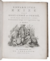
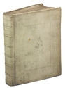
Historical narrative of a voyage to India and Persia written by a surgeon of the British Royal Navy

IVES, Edward. Reize naar Oost-Indië en Persië, en de daar omliggende landen. Ondernomen langs een' ongewoonen weg.
Amsterdam, De Compagnie, 1779. 2 parts in 1 volume. 4to. With 2 engraved title-pages, 2 folding engraved maps, one of India, the other tracking Ives's journey from Basra to Latakia, and 9 engraved plates (including 1 large folding). Contemporary blind-tooled vellum. [16], 324; [1], [1 blank], [1], [1 blank], 379, [1] pp. Full description
€ 3,950
Order Inquire Terms of sale

The beginning of the renewed contacts between France and Persia

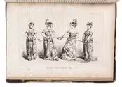
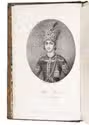
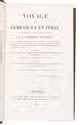
JAUBERT, Pierre Amédée Emilien Probe. Voyage en Arménie et en Perse, fait dans les années 1805 et 1806 ... accompagné d'une carte des pays compris entre Constantinople at Téhéran ... suivi d'une notice sur le Ghilan et le Mazenderan ...
Paris, Pélicier et Nepveu, 1821. 8vo. With 10 lithographed plates showing portraits, costumes, and views, most of them designed by Orlowski and lithographed by Aubry, 1 large engraved folding map showing the region between Constantinople and Teheran engraved by Flahaut. Contemporary gold-tooled marbled calf. [2], XII, 506, [2] pp. Full description
€ 1,750
Order Inquire Terms of sale

1681 dissertation on pygmies

JERNFELD, Crispin. … De pygmaeis, tractatus historico-philologicus quem divinâ affulgente gratiâ concensu inclytae facultatis philosophicae sub praesidio viri amplissimi Dn. Johannis Bilberg … d. 28 Maii ... M.DCLXXXI. publicè disputandum offert ...
Stockholm, Johan Georg Eberdt, [1681]. 8vo. Modern marbled paper over boards with printed spine label. [18], 110 pp. Full description
€ 1,950
Order Inquire Terms of sale

Captivating account of the life in the Carribean of one of the most influential Dutch naval writers
of the late eighteenth century

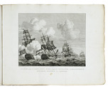
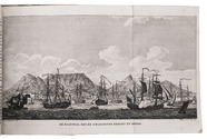
JONG, Cornelis de. Reize naar de Caribische Eilanden, in de jaren 1780 en 1781; door Cornelius de Jong, toen ter tijd als luitenant dienende, aan boord van s'Lands schip van oorlog Mars onder bevel van den schout bij nacht Willem Krul
Haarlem, François Bohn, 1807. 8vo. Two engravings, one portrait of Willem Krul (14 x 8.7 cm), the other engraving depicting Dutch and English battleships (14,5 x 18,5 cm) by Gerrit Groenewegen. Contemporary pasteboard binding. X, 326 pp. Full description
€ 1,250
Order Inquire Terms of sale

Over 200 scientific articles on Western & Central Asia and India, bound in 107 volumes

[JOURNALS – WESTERN AND CENTRAL ASIA; INDIA], Olaf CAROE, Aurel STEIN, Richard TEMPLE, Francis YOUNGHUSBAND et al. [Large collection of journal articles about the scientific exploration of Western and Central Asia and India].
Including:
- Journal of the Royal Asiatic Society.
- Geographical Journal.
- Journal of the Asiatic Society of Bengal.
- Journal of the Royal Central Asian Society.
- Journal of the Royal Geographical Society.
- Transactions of the Bombay Geographical Society.
- National Geographic.
Various places, a.o. London and Calcutta, various publishers, 1837-1981. 107 volumes, many containing multiple articles. 8vo. Some illustrated with plates and maps. Half calf with marbled sides and gilt lettering on spine or cloth with marbled sides and label on spine. Full description
€ 35,000
Order Inquire Terms of sale

Rare journal of De la Salle's last American voyage, exploring the Mississippi River,
including the large folding map, rarely included

JOUTEL, Henri (Monsieur DE MICHEL, ed.). Journal historique du dernier voyage que feu M. De la Sale fit dans le Golfe de Mexique, pour trouver l'embouchure & le cours de la riviere de Missicipi, nommée à présent la rivière de Saint Louis, que traverse la Louisiane. Où on voit l'histoire tragique de sa mort, & plusieurs choses curieuses du nouveau monde.
Paris, Estienne Robinot, 1713. 12mo. With a large folding engraved map. Contemporary calf. XXXIV, 386 pp. Full description
€ 10,000
Order Inquire Terms of sale
784 books found / Show all