Categories
Shopping cart (0 items € 0)
Advanced search ▾

Cartography, Exploration & Voyages

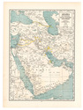
Declassified CIA map of the Middle East from the early 1970s

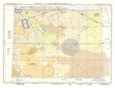
[MAPS - MIDDLE EAST - CIA]. Franklin's CIA maps of the Middle East Kuwait, Bahrain, Qatar, United Arab Emirates the Persian Gulf and Iraq.
King of Prussia, Pennsylvania, USA, Franklin Maps, [after 1986 (and probably before 1991)]. Ca. 87.5 x 114 cm. Three maps printed in colour on one large sheet of paper: one large overview map of the Middle East (also showing parts of the Soviet Union, North Africa, and Turkey) on one side, and the "title page" with two smaller maps - one of Iraq and one of the countries around the Persian Gulf - on the other side. Folded. Full description
€ 1,500
Order Inquire Terms of sale

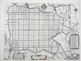
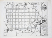
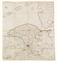
Collection of 6 maps of the Beemster polder 1644-1979

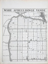
[MAP - NETHERLANDS - BEEMSTER]. FLORISZ. VAN BERCKENRODE, Balthasar and Daniel van BREEN. Beemsterlants caerte... [with a second title at the head:] Ware afbeeldinge vande bedyckte Beemster-landen... M.DC.XLIIII.
Amsterdam, 1644 [reprinted ca. 1769?].
And:
(2) [FLORISZ. VAN BERCKENRODE, Balthasar] and Daniel van BREEN. Beemsterlants caerte…
Amsterdam, 1658. Engraved map (43.5 x 58 cm).
(3) [MAP - NETHERLANDS - BEEMSTER]. Beemster landts kaarte, aenwijsende de hoogte vande ringhdyck. Als mede de diepte vande tocht & wech slooten.
[Amsterdam(?), ca. 1696].
(4-5) DORLAND, C. [2 maps of the Beemster].
Amsterdam, Tresling & Co., March 1908.
(6) [MAP - NETHERLANDS - BEEMSTER]. Waterschap de Beemster.
February 1970, updated to 1979. Large map (64 x 50 cm).
Collection of 6 maps (the first in 6 sheets). Engraved map in 6 sheets (each 56 x 44 cm). With the main title in a large cartouche at right, the statement about its production and a scale of Rijnland rods in a pedestal at the foot, a Latin verse in praise of the Beemster polder by Caspar van Baerle at lower right, a compass rose at upper right, and the arms of Beemster at the head. Bound in modern cloth (57.5 x 47 cm). Full description
€ 3,750
Order Inquire Terms of sale

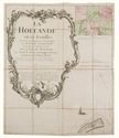
Rare 18th-century wall map of the Netherlands

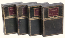
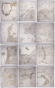
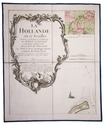
[MAP - NETHERLANDS]. [LE ROUGE, George-Louis]. La Hollande en 12 feuilles.
Paris, Jean Dezauche, 1790. Published on 12 sheets, numbered as 48 quarter-sheets. An engraved wall map of the Netherlands (excluding Zeeland), with the main title in a large cartouche at upper left, the Latin title at upper right. Many cities and coastlines, and a few other features, highlighted in colour. Cut, mounted on cloth and folded, in 4 contemporary gold-tooled green morocco boxes. Full description
€ 8,500
Order Inquire Terms of sale

Map of North Holland printed on cloth

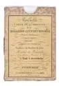
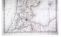
[MAP - NORTH HOLLAND]. Hollande septentrionale divisée en arrondisemens et cantons de justice de paix.
The Hague, F. J. Weygand, 1836. Ca. 89 x 61.5 cm. An engraved map with hand coloured outlines, printed on coated linen. The map is folded and housed in the original brown cloth slipcase with a paper title label mounted on the front. Full description
€ 1,250
Order Inquire Terms of sale

Large map of the Pyrenees

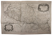
[MAP - PYRENEES]. SANSON, Nicolas. Les Monts Pyrenées, ou sont remarqués les Passages de France en Espagne.
Paris, Hubert Jaillot, 1719. Engraved map on 2 assembled sheets (54.5 x 88 cm). With title in decorated cartouche (signed F.C.) in upper right corner and scalebars in decorated cartouche in the lower left corner. Coloured in outline. Full description
€ 500
Order Inquire Terms of sale

Two large wall maps of the Dutch provinces, from the library of Marco-Antonio III (1730-1800), Prince Borghese

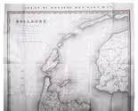
[MAPS - NETHERLANDS]. [LE ROUGE, George-Louis]. La Hollande en 12 feuilles dont les six premieres contiennent la Hollande ...
Paris, Jean A. Dezauche, successor of Delisle & Buache, 1790. Together ca. 230 x 155 cm. Engraved map, hand-coloured in outline. Printed on 12 sheets, each divided into 4 segments, numbered 1-48. The 12 sheets are mounted on contemporary linen and folded, the edges reinforced with blue ribbon.
With: (2) LE ROUGE, George Louis. Topographie de la Zelande en 9 feuilles traduitte de l'Hollandois. [Second title:] Partie orientale de la Flandre Hollandoise, ...
Paris, Jean A. Dezauche, 1790. Large engraved wall map, hand-coloured in outline, printed on 9 numbered sheets, each divided into 4 segments, numbered 1-36 (each sheet 48 x 56.5 cm); the 36 segments are mounted on contemporary linen, the edges reinforced with blue ribbon. Each map in contemporary box. Full description
€ 8,950
Order Inquire Terms of sale

Large map of Spain and Portugal

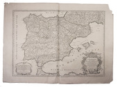
[MAP - SPAIN & PORTUGAL]. SANSON, Nicolas. l'Espagne divisée en tous ses royaumes et principautés suivant qu'ils sont compris sous les Couronnes de Castille et d'Aragon, possedees par le Roy Catholique et sous la couronne de Portugal possedee par le Roy de Portugal.
Paris, Hubert Jaillot, [1708]. Engraved map on 2 assembled sheets (55.5 x 78 cm), engraved by Cordier. With title in decorated cartouche on the bottom right corner, scales and privilege in decorated cartouche on the bottom left corner, and a few lines coloured in green. Full description
€ 650
Order Inquire Terms of sale
784 books found / Show all