Categories
Shopping cart (0 items € 0)
Advanced search

Cartography, Exploration & Voyages / Atlases, Charts, Maps & Globes

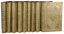
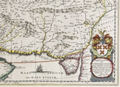
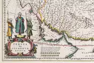
"The greatest and finest atlas ever published", with 610 maps, plans and views,
coloured by a contemporary hand
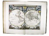
BLAEU, Joan. Grooten atlas, oft werelt-beschryving, in welcke t aerdryck, de zee, en hemel, wort vertoont en beschreven.
Amsterdam, Joan Blaeu, 1664-1665. 9 volumes. Imperial folio (55.5 × 36.5 cm). With 9 engraved title pages, an engraved frontispiece and 610 engraved maps, views, plans, etc., mostly double-page (53.5 × 64 cm, plate size ca. 42 × 53 cm), 7 larger folding, a few single-page and a few smaller, many including additional inset maps, plans and views, and decorated with coats of arms, human & mythological figures, animals, produce, etc. With the engraved title-pages, frontispiece, other engravings (except for the compass rose and 2 inscriptions), woodcut devices on 4 title-pages and 1 woodcut initial coloured by a contemporary hand (the maps mostly in outline but with their decorations fully coloured) and some (mostly the engraved title-pages) with extensive use of gold. Contemporary gold-tooled vellum. Full description
€ 675,000
Order Inquire Terms of sale

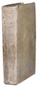
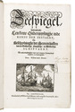
One of the most important pilot guides of the 17th century

BLAEU, Willem Jansz. Zeespiegel, inhoudende een korte onderwijsinghe inde konst der zeevaert, en beschryvinghe der seen en kusten van de Oostersche, Noordsche, en Westersche schipvaert. ...
Amsterdam, Willem Jansz. Blaeu, 1627. 3 parts in 1 volume, parts 2 and 3 consist of 6 books each. Folio. With 108 numbered engraved charts, 2 half-page engraved charts, 2 volvelles, a woodcut vignette on the divisional title page of each part, and numerous woodcut illustrations in the text. Contemporary overlapping vellum. The work is preserved in a gold-tooled half red morocco clamshell box, with two green morocco title labels, lettered in gold, red buckram sides, and a green felt lining. [16], 64; 39, [1], 43, [1], 48, 32, 28, 24; 32, 52, 46, 43, [1], 40, 23, [1 blank] pp. Full description
€ 120,000
Order Inquire Terms of sale

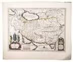
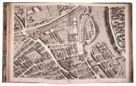
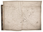
The greatest map of Paris, 240 x 316 cm, here with the 20 sheets and key map bound as an atlas
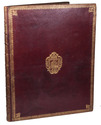
in contemporary gold-tooled morocco with the Paris city arms

BRETEZ, Louis. Plan de Paris commencé l'année 1734. Dessiné et gravé, sous les ordres de Messire Michel Etienne Turgot, Marquis de Sousmons ... Achevé de graver en 1739.
[Paris, 1739]. Grand-Aigle folio (56 x 45.5 cm). An enormous engraved map of Paris in 20 numbered sheets plus a key map, at a scale of about 1:2000, each segment measuring 55 x 84 cm (plate size 51.5 x 80.5 cm; image 48 x 79 cm) which would give an assembled map with image size about 240 x 316 cm! The key map is slightly larger than the segments and folds out at the head. Bound as an atlas (but with segments 18 and 19, containing the cartouche, assembled to make a long fold-out) in contemporary gold-tooled red morocco, each board with as centrepiece the Paris coat of arms (a ship with chief a field of fleurs-de-lis). Full description
€ 15,000
Order Inquire Terms of sale

France elaborately mapped: a famous and rare atlas including key maps for travellers

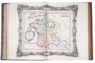
BRION DE LA TOUR, Louis & Louis Charles DESNOS. Coup d'oeil général sur la France, pour servir d'introduction au tableau analytique et géographique de ce Royaume. Dressé par différens géographes, dont les ouvrages sont aussi connus qu'estimés, faisant partie de l'atlas historique de la France ancienne & moderne ...
Paris, Grangé, Guillyn, Desnos, et al., 1765. 2 works in 1 volume, the first in 3 parts. 4to. With a double-page frontispiece by Le Charpentier after De Sève, with a view of the Place de la Concorde in Paris, 2 large folding engraved maps of France by Rizzi Zannoni, 40 double-page engraved maps and charts of France, 10 folding road maps, 2 "Cartes odographiques" with the distances between French cities, and 3 double-page engraved part-titles, all but the frontispiece and titles in a contemporary hand colouring.
Comprising: (2) DESNOS, Louis Charles. Tableau analytique de la France.
Paris, chez l'auteur, 1765.
(3) ZANNONINI, Rizzi. Le petite Neptune François ou carte des côtes maritimes du Royaume.
Paris, chez le Sr. Desnos, 1765.
(4) MICHEL. L'indicateur fidèle ou guide des voyageurs.
Paris, à l'enseigne du globe, 1765.
With: (5) [CATALOGUE]. Catalogue des Ouvrages, tant anciens que modernes, du Fonds du Sr. Desnos.
Paris, à l'enseigne du globe et de la sphere, 1765. Contemporary gold- and blind-tooled marbled calf. 15, [1 blank], [3], [1 blank], 8, 10; 16 pp. + 56 plates Full description
€ 3,250
Order Inquire Terms of sale

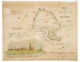
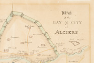
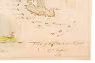
Hand coloured battle plan for the 1816 attack on Algiers

[BRITISH NAVY - BATTLE PLAN - ALGIERS]. Plan of the Bay and City of Algiers.
[London?, 1816]. 35 x 44. With an illustration of the plan of attack and a view of the fortifications on the Mole at Algiers. Full description
€ 1,750
Order Inquire Terms of sale

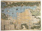
Early 19th-century edition of a woodcut plan imaging Nagasaki and Deshima

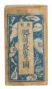
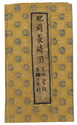
BUNKINDO HAN. Hishu Nagasaki (no) zu [= plan of Nagasaki, Hizen province].
[Nagasaki, Bunkindo, 1821]. 61.5 x 87 cm. Large folding woodcut map of the port and city of Nagasaki, printed in three colours (ochre, blue and green) on four sheets. In Japanese ochre paper etui decorated with blue and white flowers and title label with Japanese characters pasted on, preserved in later dark blue cloth slipcase in Japanese style closing with two ivory clasps. Full description
€ 2,950
Order Inquire Terms of sale

Beautifully illustrated expeditions searching for ancient Egyptian antiquities

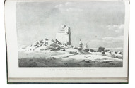
CAILLIAUD, Frédéric and Bernardino DROVETTI. Voyage a l'Oasis de Thèbes et dans les déserts situés a l'orient et a l'occident de la Thébaïde, fait pendant les années 1815, 1816, 1817 et 1818.
Paris, Royal press, 1821.
With: (2) CAILLIAUD, Frédéric and Bernardino DROVETTI. Voyage a l'Oasis de Syouah ... pendant leurs voyages dans cette oasis, en 1819 et en 1820.
Paris, Rignoux, 1823. 2 works in 1 volume. Folio. Ad 1: with 24 numbered engraved plates, including 2 engraved maps (1 folding), 1 plate coloured by hand and 1 double-page. Ad 2: with 20 numbered plates (1 engraved map and 19 lithographed plates). Contemporary green goatskin morocco, richly gold-tooled spine, chemical-marbled sides, marbled edges. [2 blank], XVII, [1], 120; [12], 28 pp. Full description
€ 19,500
Order Inquire Terms of sale

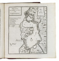
Rare Dutch translation of a work on Spanish America, with 4 maps

CAMPBELL, John. De tegenwoordige staat der volken van het Spaansche ryk in Amerika, met een byzonder verhaal, van den koophandel uit Oud-Spanje, met de galjoenen, flota, &c.; en van den verboden handel der Hollanders, Engelschen, Franschen, Deenen en Portugezen, in de West-Indiën.
Amsterdam, Bernardus Mourik, [ca. 1745 or ca. 1748]. 8vo. With 4 folding engraved maps, showing the city and harbours of Veracruz, Havana, Portobelo and Cartagena. Contemporary red half sheepskin (roan). [8], 328 pp. Full description
€ 1,200
Order Inquire Terms of sale

Magnificent plates of one of Amsterdam's most important monuments

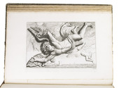
[CAMPEN, Jacob van, Hubert QUELLINUS and Jacob VENNEKOOL]. Architecture peinture et sculpture de la maison de ville d'Amsterdam, representée en CIX. Figures en taille-douce.
Amsterdam, David Mortier, 1719. Royal folio. With a title-page in red and black with an engraved device (a portrait of Erasmus in an elaborate cartouche with allegorical figures), and 124 engraved architectural and sculptural illustrations on 109 numbered plates (6 double-page, 103 full-page).
Contemporary quarter brown sheepskin. 22 pp. + 109 plates Full description
€ 1,950
Order Inquire Terms of sale
171 books found / Show all