Categories
Shopping cart (0 items € 0)
Advanced search

Cartography, Exploration & Voyages / Low Countries

A rare pocket atlas for officers and travellers, with 25 maps

[ATLAS - EUROPE]. CLEYNHENS, Bernardus. 
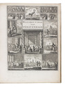
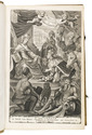
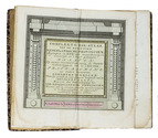
Accuraat geografisch kaart-boekje of zak-atlas van het keyzerryk en geheel Duytsland, de Oostenrykse Nederlanden, ...
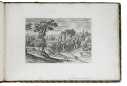
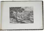
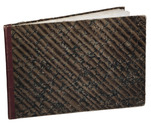
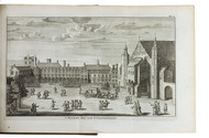
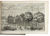
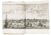
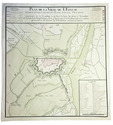
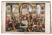
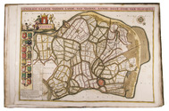
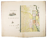
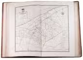
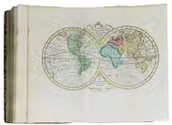
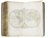
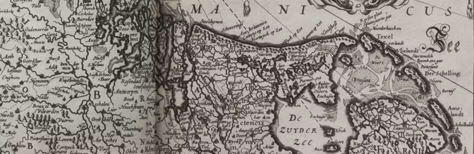
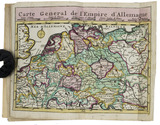
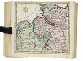
Haarlem, Bernardus Cleynhens, [ca. 1747?]. Small 8vo (16 x 10 cm). With 25 double-page engraved maps (2 overview maps), and an engraved plate with 8 scales, all hand-coloured, partly in outline. Half textured red cloth (ca. 1860?). 40, 23, [1 blank] pp. plus maps and plate of scales. Full description
€ 5,000
Order Inquire Terms of sale

The complete series of Collaert's views around Brussels in its first state

COLLAERT, Hans I [after Hans BOL or Jacob GRIMMER?]. [Views in the vicinity of Brussels].
[Antwerp], Hans van Luyck, [ca. 1575/80]. Oblong folio album (24.5 x 35.5 cm). Series of 24 engravings (plate size ca. 20 x 14 cm) with views of landscapes around Brussels, by Hans I Collaert possibly after Hans Bol or Jacob Grimmer, each with a caption in the plate (plates 8 and 20 also with Van Luyck and Collaert's monograms "H.V.L.EX[cudit]" and "H.C.F[ecit]"). Trimmed down to the plate edge and mounted on album leaves, numbered in pencil on the album leaves, next to the engravings. Modern red half cloth, marbled sides. [24] ll. Full description
€ 15,000
Order Inquire Terms of sale

First edition of an account of The Hague, with 2 frontispieces and 9 plates

CRETSER, Gysbert de and Constantijn HUYGENS. Beschryvinge van 's Gravenhage, behelsende desselfs eerste opkomste, stichtinge en vermakelyke situatie, het Graven-hof aldaar gebouwt ... Mitsgaders de oude coustumen ... Waar achter bygevoegt is de Zeestraat op Scheveninge door de Heer van Zuylichem [= Constantijn Huygens].
Amsterdam, Jan ten Hoorn, 1711. 3 part in 1 volume. 4to. With 2 engraved frontispieces (by Jan Luyken and Jan van Lamsvelt] and 9 engraved plates (4 folding). Contemporary vellum. [16], 140, [8], 104, [8]; 56 pp. Full description
€ 1,250
Order Inquire Terms of sale

The first substantial, influential and magnificently illustrated description and history of Amsterdam

DAPPER, Olfert. Historische beschryving der stadt Amsterdam: waer in de voornaemste geschiedenissen ... die ... hier ter stede voor-gevallen zijn, verhandelt, en al de ... gebouwen, in meer als tzeventigh kopere platen ... vertoont worden ...
Amsterdam, Jacob van Meurs, 1663. Folio (ca. 30.5 x 20 cm). With an engraved allegorical frontispiece, a full-page engraved coat-of-arms of the Witsen family and a loosely inserted extra engraving of the same coat-of-arms, 72 double-page (of which 4 somewhat larger and folded, including the well-known profile view of Amsterdam seen from the IJ, and 3 bird's-eye plans from 1482, 1613, and the plan published by Dapper for this 1663 edition) maps, plans and views of Amsterdam buildings and churches after the drawings of Jan Veenhuysen, and 1 half-page engraving in the text. Contemporary blind-tooled vellum. [12], 48, [8], 49-152, 145-152, 145-456, 449-456, 449-456, 449-552, [84] pp. Full description
€ 8,500
Order Inquire Terms of sale

Manuscript fortification plan of Sluis, signed by Napoleon's future Minister of War

DEJEAN, Jean-François-Aimé. Plan de la ville de l'Ecluse et de l'attaque de cette place par les Français.
[Netherlands, ca. 1800]. Manuscript fortification plan (54 x 49.5 cm) in ink on paper, with watercolour in green and red. With large panel at lower right with keys to important locations and the locations of the troops during the attack and title in large panel at the head. Scale ca. 1:9500. Signed "Vu Dejean". Full description
€ 2,250
Order Inquire Terms of sale

Beautiful atlas of the Land van Voorne, in full contemporary colour

DIJCK (DYCK), Heyman van. Voorne caart-boeck van alle de dorpen, en polders gelegen inden lande van Oost, ende West Voorne, mitsgaders over Flacquée.
[Netherlands, ca. 1701]. Imperial folio (ca. 55 x 38 cm). Etched double-page title-page by Romeyn de Hooghe, dated "1701", and 32 engraved double-page maps (numbered I- VI, A-F and 1-9) engraved by Jan Stemmers and etched by Jan and Caspar Luyken after drawings by A. Steyaart, all in beautiful contemporary colouring. Contemporary red half sheepskin. Full description
€ 25,000
Order Inquire Terms of sale

Beautiful hand-coloured wall map of Rijnland

DOU, Jan Jansz. (Johannes Dou I), Steven van BROECKHUYSEN and Melchior BOLSTRA. 'T Hooge Heemraedschap van Rhynland.
[Amsterdam], Isaak Tirion, 1746. Atlas folio (58.5 x 37.3 cm). With 15 double-page engraved plates, all coloured by hand, including 13 maps. The plate size is mostly ca. 44.5 x 55 cm and ca. 41.5 x 55 cm, the map of the Haarlemmermeer has plate size 55 x 63 cm. An illustration of existing and projected sluices for drainage of the polder and another illustration with title, both after drawings by Melchior bolstra. All plates mounted on stubs so that they open flat. Half red sheepskin and intricately marbled paper sides. Full description
€ 6,000
Order Inquire Terms of sale

First and only edition of a detailed and accurate atlas of Friesland

EEKHOFF, Wopke. Nieuwe atlas van de provincie Friesland, bevattende kaarten van de dertig grietenijen of gemeenten, met de daarin gelegene elf steden en haar grondgebied, alsmede van de eilanden Ameland en Schiermonnikoog.
Leeuwarden, W. Eekhoff, 1849-1859. Large folio (68 x 41 cm). With 32 large double-page maps, of which 2 folding, engraved by D. & H. Veelwaard after J.W. Witteveen. Further with the engraved coat of arms of the Province of Friesland on the title page. Contemporary half brown morocco and pebble-grained brown cloth sides. [4] pp. + 32 maps. Full description
€ 2,500
Order Inquire Terms of sale

Pocket atlas of the Low Countries with the world & the continents

ELWE, Jan Barend. Compleete zak-atlas, van de zeventien Nederlandsche Provinciën.
Amsterdam, J.B. Elwe & D.M. Langeveld, 1786. 8vo. With a double-page engraved title, 29 numbered folding engraved maps (the first 5 signed by A. van Krevelt) and 2 folding engraved tables, all coloured by a contemporary hand. Contemporary half calf, gold-tooled spine. 239, [1] pp. Full description
€ 2,950
Order Inquire Terms of sale

Pocket atlas of the Low Countries with the world and the continents,
coloured by a contemporary hand

ELWE, Jan Barend. Compleete zak-atlas, van de zeventien Nederlandsche provinciën, begreepen in XXXI ... in 't koper gebragte kaarten.
Amsterdam, Jan Barend Elwe and Dirk Meland Langeveld, 1786. 8vo. With double-page engraved title-page, 29 folding engraved maps and 2 folding engraved tables, all coloured by a contemporary hand. Contemporary half calf, rebacked with the original gold-tooled backstrip. 243, [1] pp. text Full description
€ 2,950
Order Inquire Terms of sale
59 books found / Show all