Categories
Shopping cart (0 items € 0)
Advanced search

Cartography, Exploration & Voyages / Low Countries

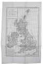
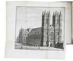
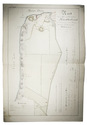
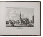
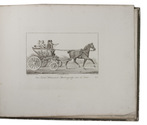
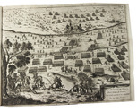
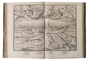
Very rare Dutch edition of Forster’s travels through the Low Countries accompanied by Alexander von Humboldt

FORSTER, Georg. 
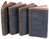
Reisen van George Forster in den jaare MDCCXC. Uit het Hoogduitsch vertaald.
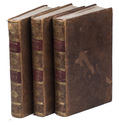
Haarlem, Christiaan Plaat, 1792-1793. 8vo. 4 volumes. Original publisher's letterpress printed stiff wrappers. 8 [incl. first 2 blank], 190, [1], [1 blank]; [4], 174, [2]; 4, 3-182; [4], 196 pp. Full description
€ 1,750
Order Inquire Terms of sale

French edition of Forster’s acclaimed and influential Ansichten vom Niederrhein

FORSTER, Georg. Voyage philosophique et pittoresque, sur les rives du Rhin, a Liège, dans la Flandre, le Brabant, la Hollande, l'Angleterre, la France, etc. fait en 1790, ...
Paris, F. Buisson and Charles Pougens, l'an VIII [= 1800]. 3 volumes. 8vo. With a folding engraved map of Great Britain and 9 folding engraved views of famous English buildings. Contemporary mottled, tanned sheepskin (tree pattern), gold-tooled spines. [4], XVI, 408; [4], 446; 8, 407 pp. Full description
€ 2,650
Order Inquire Terms of sale

Manuscript plan of the "Stelling Den Helder": the oldest surviving defence line in Dutch military history, including the important marine shipyard Willemsoord

[FORTIFICATION PLAN - DEN HELDER - WILLEMSOORD]. KRAG, Rasmus. Kort over en deel af provindsen Nordholland med befestningen af de Helder, maritime & etablissementet Willemsoort samt en deel af den nye Nordhollandske Canal.
[The Netherlands?], 1825. Double Elephant 1mo sheet (92 x 63 cm). With a pen and ink-drawn fortification plan (ca. 85 x 55 cm) of the Den Helder fortifications and the marine shipyard Willemsoord, coloured by a contemporary hand, with a manuscript title, scales and a key in Danish, written in a fine and legible 19th-century hand surrounding the plan. On Whatman wove paper. Folded. [1] sheet. Full description
€ 1,800
Order Inquire Terms of sale

Manuscript atlas and ownership records of parcels in the Prins Willem polder,
northeast of Oostburg, in the southwest corner of the Netherlands

GERSOM, Gerrit van. Caerte en omlooper van Prins Willem Polder. Bedijkt anno 1650 en 1651. ...
[Oostburg?], 1723. Royal folio (41 x 27.5 cm). With a hand-coloured title page, a large folding map of the dikes along the border of the polder, a large folding general map of the polder showing the numbered parcels at a scale of about 1:18,000, and 17 folding detail maps showing the individual plots within the parcels at a larger scale, all executed in brown ink and watercolours and tipped onto the fore-edges of 19 of the 144 numbered text leaves. Contemporary sheepskin parchment. 151 ll. (ll. 1 & 145-151 blank). Full description
€ 9,500
Order Inquire Terms of sale

A general in the Spanish army on the battles and sieges in Flanders 1601-1609,
during the Dutch war for independence, with 29 folding maps and plans

GIUSTINIANO, Pompeo. Delle guerre di Flandra libri VI. ... Posti in luce da Gioseppe Gamurini ...
Antwerp, J. Trognesio, 1609. 4to. With engraved architectural title-page and 29 folding engraved maps and plans of sieges and fortifications. White sheepskin (ca. 1700 or possibly later). [4], 329, [1 blank], [15], [3 blank] pp. Full description
€ 2,950
Order Inquire Terms of sale

The only atlas published by Abraham Goos: the 17 provinces of the Habsburg Low Countries

GOOS, Abraham. Nieuw Nederlandtsch caertboeck. Waer in volkomentlijcker als oyt te voren vertoont werden de XVII. Nederlanden, soo in t geheel, als elck besonder met grote neersticheyt ende kosten gesneden ende in t licht gebracht. Mitsgaders een nieuwe beschryvinge uijt verscheyden autheuren ordentlyck tsamen gestelt door Reinier Telle ... .
Amsterdam, Abraham Goos in de Kalverstraet, [1616]. Oblong 4to (ca. 16 x 21 cm). With an engraved title page (signed by P.S[erwouter] scul. (bottom right) after D.V[inck] B[oons] (bottom left)), 23 full page maps, several decorated woodcut initials and woodcut tailpieces. 19th-century quarter calf. [7], "305" [=294], [2], [1 blank] pp. Full description
€ 4,500
Order Inquire Terms of sale

12 engraved views and costumes from North Holland

GREEVEN, Hendrik. Tableaux des costumes, moeurs, coutumes et vues, de la Nord-Hollande, de Zaandam, Broek, Alkmaar, Assendelft et de l'Île de Marken.
Amsterdam, Evert Maaskamp, [ca. 1826]. Oblong 4to (22.5 x 29 cm). With an engraved map of North Holland by C.H. Koning on title-page and 11 engraved plates, mostly engraved by Willem van Senus after Hendrik Greeven, all protected by tissue guards. Contemporary boards; preserved in a modern cloth clamshell box. [2] ll. + 10 plates. Full description
€ 1,750
Order Inquire Terms of sale

Italian fortification atlas of the Low Countries

GUALDO PRIORATO, Galeazzo. Teatro del Belgio ò sia descritione delle diecisette provincie del medesimo; con le piante delle città, e fortezze principali; da chi al presente possesse; come, in qual modo, & in qual tempo acquistate.
Vienna, Michael Thurnmayer, 1673. Folio. With engraved frontispiece with the coat-of-arms of all Seventeen Provinces, engraved military scene on the title-page, folding engraved map of the Low Countries, 2 folding engraved views of a sea-battle and an army crossing the Rhine, and 120 double-page engraved fortification plans. Contemporary mottled sheepskin, gold-tooled spine. [14], 148, [6] pp. text Full description
€ 5,000
Order Inquire Terms of sale

First edition of Guicciardini's celebrated 16th-century description of the Low Countries

GUICCIARDINI, Lodovico. Descrittione ... di tutti i Paesi Bassi, altrimenti detti Germania Inferiore.
Antwerp, Willem Silvius, 1567. Folio. With the title, the large coat of arms of Philip II, and his portrait set within a woodcut architectural frame with allegorical figures on separate pages, 5 double-page woodcut maps (including 1 folding), 4 double-page woodcut views of cities, 6 double-page woodcut plans of cities, and 2 double-page illustrations of buildings (1 woodcut, 1 engraved). Further with 15 woodcut divisional title-pages for the illustrations and descriptions of the regions and cities set within a woodcut ornamental frame and numerous woodcut decorated initials (at least 4 series). Later overlapping vellum, sewn on 3 parchment tapes laced through the joints. [3], [1 blank], [16], "296"[= 339], [1 blank], [19], [1 blank] pp. Full description
€ 7,500
Order Inquire Terms of sale
59 books found / Show all