Categories
Shopping cart (0 items € 0)
Advanced search

Cartography & Exploration / Low Countries

Dutch trade, whaling, herring fishery, etc., with magnificent views of the harbours of the Netherlands
and the Dutch East Indies ca. 1772-ca. 1781, including a wide variety of boats and ships
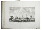
AA, Cornelis van der (illustrated by Dirk de JONG & Hendrik KOBELL jr.). Atlas van de zeehavens der Bataafsche Republiek, die van Batavia en Onrust. Mitsgaders de afbeeldingen van de haring visscherij en de walvisch vangst. In een-en-dertig kunstplaaten naar het leven afgebeeld ...
Amsterdam, Evert Maaskamp, [printed by Paul Etienne Briët?], 1805. Large folio (39.5 x 28.5 cm). With a finely engraved title-page in various styles of decorated lettering and flourishes, executed by Klockhoff, and 31 double-page engraved views (ca. 28.5 x 39.5 cm) showing Dutch harbours with a wide variety of sailing boats and ships, the harbours of Batavia and the island Onrust in the Dutch East Indies (now Djakarta and Pulau Kapal in Indonesia), and 2 views of herring fishing and whaling.
With the loosely inserted "prospectus" (actually an advertisement issued on publication):
[MAASKAMP, Evert]. Berigt aan kooplieden, zeevarenden en verzamelaars van vaderlandsche kunstprinten.
[Amsterdam], [Evert Maaskamp], printed by Paul Etienne Briët, [1805]. 4to (27.5 x 22 cm).
Contemporary boards (including a paperboard spine), as issued by the publisher. XII, 135, [1 blank] pp. plus engraved title-page, 31 plates and the loosely inserted prospectus. Full description
€ 14,500
Order Inquire Terms of sale

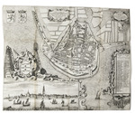
Description of Den Briel

ALKEMADE, Cornelis van and Pieter van der SCHELLING. Beschryving van de stad Briele, en den lande van Voorn, ...
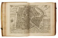
Rotterdam, Philippus Losel, 1729. 2 parts in 1 volume. Folio. With a double-page engraved plan of Den Briel and 3 folding engraved maps of different parts of Voorne (each ca. 50 x 70.5 cm). Contemporary blind-tooled vellum. [28], 224, [8], 225-376; [8], 306, [20] pp. Full description
€ 2,500
Order Inquire Terms of sale

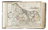
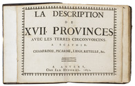
2nd known copy of the only Antwerp edition (1652) of Colom’s 1635 atlas of the Low Countries

[ATLAS - LOW COUNTRIES]. [COLOM, Jacob Aertsz.]. La description de XVII. Provinces, avec les Terres Circonvoicins, a Scavoir Champagnie, Picardie, Liege, Retelle, &c.
Antwerp, Jan Huyssens, 1652. 4to (18 x 14.5 cm). With a double-page letterpress title-page, with a frame built up from typographic ornaments, and 39 unnumbered double-page engraved maps of the northern and southern Low Countries by Jacob Aertsz. Colom, each map coloured in outline. Interleaved with 38 blank leaves and with a manuscript table of contents ([3], [3 blank] pp.) at the end. Later 17th-century mottled calf. Double-page title-page and 39 double-page maps. Full description
€ 4,950
Order Inquire Terms of sale

With important provenance

BOCKENBERG, Pieter Cornelisz. Catalogus & brevis historia pontificum Ultraiectensium. Item catalogus & brevis historia antistitum Egmondanorum.
Leiden, Jan Jacobsz. Paets, 1586 (Colophon: 'Extant Goudae, apud Leonardum Theodori Librarium, ad pontem Hornensem'). Small 8vo. [16], 99, [12] [1 blank] pp. Full description
€ 1,500
Order Inquire Terms of sale

Appealing wall map of the Slaperdijk in the Gelderse Vallei

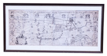
[MAP - NETHERLANDS - GELDERSE VALLEI]. BROECKHUIJSEN, Justus van. Caarte vanden Slaperdijk streckende vande Stichtse bergen tot aan de hoogte van Gelderland.
Utrecht, Slaperdijk Managing Board ("College tot Directie van de Slaperdijk"), (engraved:) 1705. Engraved wall map printed on 8 sheets (measuring: 76 x 194 cm as assembled) by Caspar Specht after Justus van Broeckhuijsen (scale ca. 1:5600). Framed (107 x 220 cm). Full description
€ 12,500
Order Inquire Terms of sale

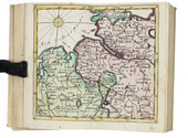
A rare pocket atlas for officers and travellers, with 25 maps

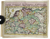
[ATLAS - EUROPE]. CLEYNHENS, Bernardus. Accuraat geografisch kaart-boekje of zak-atlas van het keyzerryk en geheel Duytsland, de Oostenrykse Nederlanden, ...
Haarlem, Bernardus Cleynhens, [ca. 1747?]. Small 8vo (16 x 10 cm). With 25 double-page engraved maps (2 overview maps), and an engraved plate with 8 scales, all hand-coloured, partly in outline. Half textured red cloth (ca. 1860?). 40, 23, [1 blank] pp. plus maps and plate of scales. Full description
€ 5,000
Order Inquire Terms of sale

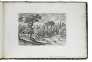
The complete series of Collaert's views around Brussels in its first state

[VIEWS - BRUSSELS AREA]. COLLAERT, Hans I [after Hans BOL or Jacob GRIMMER?]. [Views in the vicinity of Brussels].
[Antwerp], Hans van Luyck, [ca. 1575/80]. Oblong folio album (24.5 x 35.5 cm). Series of 24 engravings (plate size ca. 20 x 14 cm) with views of landscapes around Brussels, by Hans I Collaert possibly after Hans Bol or Jacob Grimmer, each with a caption in the plate (plates 8 and 20 also with Van Luyck and Collaert's monograms "H.V.L.EX[cudit]" and "H.C.F[ecit]"). Trimmed down to the plate edge and mounted on album leaves, numbered in pencil on the album leaves, next to the engravings. Modern red half cloth, marbled sides. [24] ll. Full description
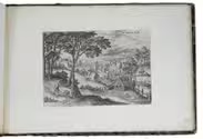
€ 19,500
Order Inquire Terms of sale

First edition of an account of The Hague, with 2 frontispieces and 9 plates

CRETSER, Gysbert de and Constantijn HUYGENS. Beschryvinge van 's Gravenhage, behelsende desselfs eerste opkomste, stichtinge en vermakelyke situatie, het Graven-hof aldaar gebouwt ... Mitsgaders de oude coustumen ... Waar achter bygevoegt is de Zeestraat op Scheveninge door de Heer van Zuylichem [= Constantijn Huygens].
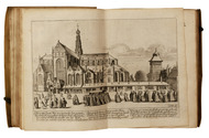
Amsterdam, Jan ten Hoorn, 1711. 3 part in 1 volume. 4to. With 2 engraved frontispieces (by Jan Luyken and Jan van Lamsvelt] and 9 engraved plates (4 folding). Contemporary vellum. [16], 140, [8], 104, [8]; 56 pp. Full description
€ 1,250
Order Inquire Terms of sale

Manuscript fortification plan of Sluis, signed by Napoleon's future Minister of War

DEJEAN, Jean-François-Aimé. Plan de la ville de l'Ecluse et de l'attaque de cette place par les Français.
[Netherlands, ca. 1800]. Manuscript fortification plan (54 x 49.5 cm) in ink on paper, with watercolour in green and red. With large panel at lower right with keys to important locations and the locations of the troops during the attack and title in large panel at the head. Scale ca. 1:9500. Signed "Vu Dejean". Full description
€ 2,250
Order Inquire Terms of sale

Beautiful atlas of the Land van Voorne, in full contemporary colour

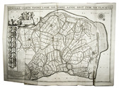
DIJCK (DYCK), Heyman van. Voorne caart-boeck van alle de dorpen, en polders gelegen inden lande van Oost, ende West Voorne, mitsgaders over Flacquée.
[Netherlands, ca. 1701]. Imperial folio (ca. 55 x 38 cm). Etched double-page title-page by Romeyn de Hooghe, dated "1701", and 32 engraved double-page maps (numbered I- VI, A-F and 1-9) engraved by Jan Stemmers and etched by Jan and Caspar Luyken after drawings by A. Steyaart, all in beautiful contemporary colouring. Contemporary red half sheepskin. Full description
€ 25,000
Order Inquire Terms of sale
48 books found / Show all