Categories
Shopping cart (0 items € 0)
Advanced search

Asia / Cartography & Exploration

Rare folio edition with accounts of the most important voyages
undertaken by Western Europeans in the early modern period

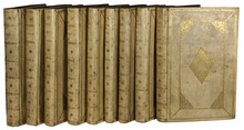
AA, Pieter van der. De aanmerkenswaardigste en alomberoemde zee- en landreizen der Portugeezen, Spanjaarden, Engelsen en allerhande natiën: zoo van Fransen, Italiaanen, Deenen, Hoogh- en Nederduitsen, Als van veele andere volkeren. Voornaamenlyk ondernomen tot ontdekking van de Oost- en West-Indiën, mitsgaders andere verafgelegene gewesten des aardryks.
The Hague and Leiden, widow of Engelbrecht Boucquet and sons, Jan van der Deyster, and Boudewijn and Pieter van der Aa, 1727. 8 volumes. Folio. With a general title-page printed in red and black, 8 engraved allegorical frontispieces, 4 engraved dedications, 116 engraved maps, 7 full-page engraved plates, and 502 engravings in the text. Further with 8 title-pages with a vignette, and another 128 separate divisional title-pages with a vignette. Contemporary elaborately gold-tooled marbled calf, with a red morocco title-label lettered in gold on each of the spines. Full description
€ 75,000
Order Inquire Terms of sale

8 large illustrated volumes of the most important voyages from the 15th to the end of the 17th century

AA, Pieter van der (editor) and Johann Ludwig GOTTFRIED. De aanmerkenswaardigste en alomberoemde zee- en landreizen der Portugeezen, Spanjaarden, Engelsen en allerhande natiën: zoo van Fransen, Italiaanen, Deenen, Hoogh- en Nederduitsen als van veele andere volkeren. Voornaamenlyk ondernomen tot ontdekking van de Oost- en Westindiën, midsgaders andere verafgelegene gewesten des aardryks.
The Hague, widow of Engelbrecht Boucquet and sons; Leiden, Jan van der Deyster, and Boudewijn and Pieter van der Aa, 1727. 8 volumes. 1mo and folio. With 7 (of 8) engraved frontispieces (lacking that of volume 4), 4 engraved dedications, 117 engraved maps on 61 leaves, 7 engraved plates and 502 engravings in text. Further with 127 (of 128) title-pages (including a general title-page, a title-page to 7 (of 8) volumes, lacking that of volume 4, and 118 for the separate works). Volume 1-3 & 5-8: contemporary mottled calf, gold-tooled spine and board edges; volume 4: modern calf. Full description
€ 65,000
Order Inquire Terms of sale

Fauna of the Indian Sea, with 98 illustrations

ALCOCK, Alfred William. A naturalist in Indian seas or, four years with the Royal Indian marine survey ship "Investigator".
London, John Murray (colophon: printed by Oliver and Boyd, Edinburgh), 1902. 8vo. With a photogravure frontispiece depicting the Investigator, a folding map and 98 illustrations on 58 plates. Contemporary black-blocked cloth; rebacked with brown board, modern endpapers. XXIV, 328 pp. Full description
€ 450
Order Inquire Terms of sale

A classic work on Japan, with numerous chromolithographed illustrations

ALCOCK, Sir Rutherford. The capital of the tycoon: a narrative of a three years' residence in Japan.
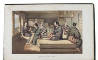
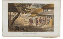
London, Longman, Green, Longman, Roberts, & Green (colophons: printed by Spottiswoode & Co.), 1863 [reissued with publisher's advertisements dated April 1875]. 2 volumes. 8vo. With 2 chromolithographed frontispieces, 2 folding engraved maps (partly coloured), 14 tinted, double-tinted and chromolithographed plates (at least one highlighted with silver colour) drawn mostly by Charles Wirgman (1832-1891) and lithographed by Hanhart, 2 black & white wood-engraved plates (engraved by Pearson) and numerous wood-engraved illustrations in text (some signed by Pearson). Original publisher's gold- and blind-blocked green cloth. XXXII, 469, [2]; X, 539 pp. Full description
€ 1,250
Order Inquire Terms of sale

Highly detailed wall map of Asia and the Arabian peninsula, from the collection of the Governor of Ceylon

ARROWSMITH, Aaron. Asia.
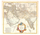
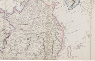
London, Aaron Arrowsmith, 1 January 1801. Engraved wall map, hand coloured in outline, on 4 sheets joined as 2 (measuring 124 x 147 cm in total) on a scale of ca. 1:6,490,880, with an elaborately decorated cartouche at the head left, a dedication below ("To major James Rennell, Esqr. F.R.S. &c. &c.") and the name of the engraver at the foot right (George Allen). Mounted on cloth and divided into 32 sections. Contemporary slipcase, covered with marbled paper and a manuscript title-label on front. Full description
€ 7,500
Order Inquire Terms of sale

Asia and the Middle East in 1952, with many borders on the Arabian Peninsula still undefined

[MAP – ASIA – MIDDLE EAST]. NATIONAL GEOGRAPHIC SOCIETY. Southwest Asia, India, Pakistan, and Northeast Africa.
Washington, DC, National Geographic Society, 1952. Colour printed map, 68.5 x 95 cm. Scale 1:7,5000,000. With an inset map of "the Moslem World; percentage of Moslems in total population". Full description
€ 850
Order Inquire Terms of sale

Graphically stunning 3-volume historical manuscript atlas

[ATLAS - HISTORICAL]. Atlas historique. - Souvenirs historiques. - Tableaux et cartes.
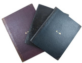
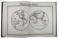
[Montpellier?], [date on spine of vol. 1:] 1851. 3 volumes. Folio (vol. 1) and large 4to (vols. 2-3). Neatly written manuscripts on paper with 23 graphically vibrant maps, coloured in outline with subtly shaded washes in grey (for the coasts) and numerous bright colours (for political boundaries), and with calligraphic headings. Contemporary bindings: vol. 1 red half goatskin; vol. 2 black half goatskin; vol. 3 black sheepskin. [1], [26 double]; [1], [22 double]; [1], 30 double, [1] ll. Full description
€ 1,750
Order Inquire Terms of sale

A Franciscan discovering the Holy Land. From the library of King Louis-Philippe

[BEAUGRAND, Felix]. Relation fidele du voyage de la Terre Sainte dans laquelle se voit tout ce qu' il y a de remarquable, tant par mer que par terre, depuis le départ de Marseille jusqu' au retour de ce saint voyage.
Paris, Gabriel Valleyre, 1760. 8vo. With a small woodcut vignette on title, several woodcut head- and tailpieces. Contemporary mottled calf, gold-tooled spine, with yellow morocco title label, gold-tooled binding edges, red edges. [4], 248, [10] pp. Full description
€ 5,000
Order Inquire Terms of sale

"The greatest and finest atlas ever published", with 610 maps, plans and views,
coloured by a contemporary hand

BLAEU, Joan. Grooten atlas, oft werelt-beschryving, in welcke t aerdryck, de zee, en hemel, wort vertoont en beschreven.
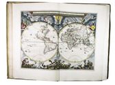
Amsterdam, Joan Blaeu, 1664-1665. 9 volumes. Imperial folio (55.5 × 36.5 cm). With 9 engraved title-pages, an engraved frontispiece and 610 engraved maps, views, plans, etc., mostly double-page (53.5 × 64 cm, plate size ca. 42 × 53 cm), 7 larger folding, a few single-page and a few smaller, many including additional inset maps, plans and views, and decorated with coats of arms, human & mythological figures, animals, produce, etc. With the engraved title-pages, frontispiece, other engravings (except for the compass rose and 2 inscriptions), woodcut devices on 4 title-pages and 1 woodcut initial coloured by a contemporary hand (the maps mostly in outline but with their decorations fully coloured) and some (mostly the engraved title-pages) with extensive use of gold. Contemporary gold-tooled vellum. Full description
€ 675,000
Order Inquire Terms of sale
174 books found / Show all