Categories
Shopping cart (0 items € 0)
Advanced search

Middle East & Islamic World / Cartography, Exploration, Travel & Voyages

8 large illustrated volumes of the most important voyages from the 15th to the end of the 17th century

AA, Pieter van der (editor) and Johann Ludwig GOTTFRIED. 
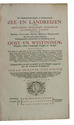
De aanmerkenswaardigste en alomberoemde zee- en landreizen der Portugeezen, Spanjaarden, Engelsen en allerhande natiën: zoo van Fransen, Italiaanen, Deenen, Hoogh- en Nederduitsen als van veele andere volkeren. Voornaamenlyk ondernomen tot ontdekking van de Oost- en Westindiën, midsgaders andere verafgelegene gewesten des aardryks.
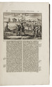
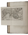
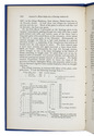
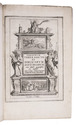
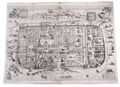
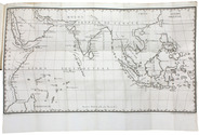
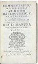
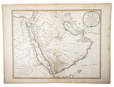
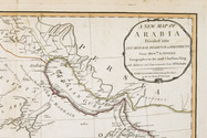
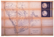
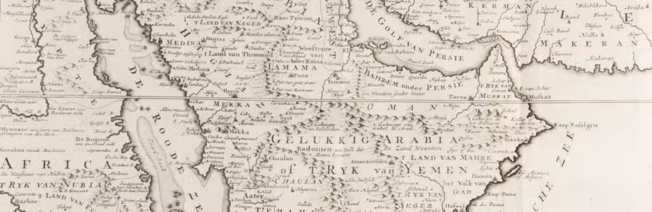
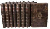
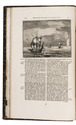
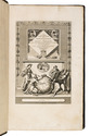
The Hague, widow of Engelbrecht Boucquet and sons; Leiden, Jan van der Deyster, and Boudewijn and Pieter van der Aa, 1727. 8 volumes. 1mo and folio. With 7 (of 8) engraved frontispieces (lacking that of volume 4), 4 engraved dedications, 117 engraved maps on 61 leaves, 7 engraved plates and 502 engravings in text. Further with 127 (of 128) title-pages (including a general title-page, a title-page to 7 (of 8) volumes, lacking that of volume 4, and 118 for the separate works). Volume 1-3 & 5-8: contemporary mottled calf, gold-tooled spine and board edges; volume 4: modern calf. Full description
€ 65,000
Order Inquire Terms of sale

With attractive maps of the Holy Land

ADRICHEM, Christiaan van. Theatrum Terrae Sanctae et biblicarum historiarum cum tabulis geographicis aere expressis.
[Cologne, Officina Birckmannica, for Hermann Mylius, 1628]. Folio. With engraved allegorical title-page, numerous decorated woodcut initial letters and tailpieces, 11 maps of Israel and 1 map of Jerusalem (8 folding and 4 double-page). Contemporary calf, gold-tooled spine with red morocco title-label, blind-tooled sides, gilt binding edges. [12], 286, [30] pp. Full description
€ 7,500
Order Inquire Terms of sale

The first European to enter the Gulf: the final edition of Albuquerque's works

ALBUQUERQUE, Alfonso de. Commentarios do grande Afonso Dalboquerque capitao geral que foi das Indias orientaes em tempo do muito poderoso rey D. Manuel o primeiro deste nome.
Lisbon, Regia officina typografica, 1774. 4 volumes. Small 8vo. With a woodcut of Albuquerques coat of arms on all four title-pages, engraved portrait, an engraved illustration above the dedication, large engraved folding map and woodcut illustration in text. The map reaches from Egypt and Madagascar in the west to the Philippines and New Guinea in the east, including the Arabian Peninsula, the south of China, the east coast of Africa and most of the East Indies. Contemporary Portuguese mottled sheepskin with gold-tooled spines with red title labels, blue sprinkled edges, marbled endpapers. [6], XXX, [14], 343, [1]; [12], 285, [1], [2 blank]; [12], 289, [1], [2 blank]; [12], 256 pp. Full description
€ 7,500
Order Inquire Terms of sale

Private photographs of a visit to the oilfields of the APOC, by the founder of Toc H

[ANGLO-PERSIAN OIL COMPANY - PHOTOGRAPHS]. [CHAPPELL, Henry Pegg (photographer)]. A Christmas pilgrimage to the Anglo-Persian Oil Co. in Persia made by P.B.C.. S.C.. H.P.C.
[Greece, Palestine, Iran, Iraq, Egypt, 1931-1932]. Oblong photograph album (20.5 x 32 cm). With 72 sepia photographs (ca. 6 x 8.5 cm). [19], [5 blank] ll. Full description
€ 8,500
Order Inquire Terms of sale

Large folding road map of Saudi Arabia

[ARAMCO]. Saudi Arabian road map.
Dammam, Al-Mutawa press company, 1973. Large folding map (60 × 90.5 cm), printed in light orange with darker purple, depicting the Kingdom of Saudi Arabia and its main roads. With on the right the title in both Arabic and English and a table with the distances from one city to another. Full description
€ 1,800
Order Inquire Terms of sale

Surviving traffic in Saudi Arabia, a large folding map

ARAMCO. Saudi Arabian road map.
Dammam, printed by the Al-Mutawa Press for the Arabian American Oil Company, 1973. Large folding map (60 x 90.5 cm), printed in colour, depicting the Kingdom of Saudi Arabia and its main roads. With on the right the title in both Arabic and English and a table with the distances from one city to another. Printed on two sides, one side with the map in English and the other in Arabic. Full description
€ 1,800
Order Inquire Terms of sale

Surviving traffic in Saudi Arabia, a large folding map

ARAMCO. Saudi Arabian road map.
Dammam, printed by the Al-Mutawa Press for the Arabian American Oil Company, 1975. Large folding map (60 x 90.5 cm), printed in colour, depicting the Kingdom of Saudi Arabia and its main roads. With on the right the title in both Arabic and English and a table with the distances from one city to another. Printed on two sides, one side with the map in English and the other in Arabic. Full description
€ 1,500
Order Inquire Terms of sale

Highly detailed wall map of Asia and the Arabian peninsula, from the collection of the Governor of Ceylon

ARROWSMITH, Aaron. Asia.
London, Aaron Arrowsmith, 1 January 1801. Engraved wall map, hand coloured in outline, on 4 sheets joined as 2 (measuring 124 x 147 cm in total) on a scale of ca. 1:6,490,880, with an elaborately decorated cartouche at the head left, a dedication below ("To major James Rennell, Esqr. F.R.S. &c. &c.") and the name of the engraver at the foot right (George Allen). Mounted on cloth and divided into 32 sections. Contemporary slipcase, covered with marbled paper and a manuscript title-label on front. Full description
€ 7,500
Order Inquire Terms of sale
189 books found / Show all