Categories
Shopping cart (0 items € 0)
Advanced search

Africa

In search of curiosities in the West Indies, Africa, and the Holy Land

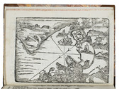
MOCQUET, Jean. De grote nieuw-bereisde wereld: begrypende zes reizen, zo na Lybien, d'Eilanden van Kanarien en Barbaryen; stroom der Amazonen, Karipouzen en Karibanen; na Marocco; Moren-Land of Ethiopien, Mozambique en Goa; als mede na Syrien en een zeer nauwkeurige beschrijvinge van't Heilig Land ... Den tweden druk.
Leeuwarden, Jan Klassen (colophon: printed by Meindert Injema), 1717. 4to. With an engraved title-page, 3 etched plates, and some woodcut decorated initials and tail pieces. Contemporary vellum, later endpapers. [19], [1 blank], 195, [1 blank] pp. Full description
€ 1,950
Order Inquire Terms of sale

Excellent, attractively coloured large map of the Ottoman Empire at its height

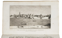
MOLL, Herman. The Turkish empire in Europe, Asia and Africa, divided into all its governments, together with the other territories that are tributary to it, as also the dominions of the Emperor of Marocco.
London, Herman Moll, John Bowles, Thomas Bowles & John King, ca. 1730. A large engraved map in two sheets (61 x 101 cm as assembled) at a scale of about 1:7,100,000, with 3 insets containing 6 topographic and architectural views. Coloured. Full description
€ 8,500
Order Inquire Terms of sale

The pinnacle of Coptic church architecture in Egypt:
the churches the Red and White Monastery near Sohag

MONNERET DE VILLARD, Ugo. Les couvents près de Sohâg (Deyr el-Abiad et Deyr el-Ahmar).
Milan, Tipografia Pontif. Arciv. S. Giuseppe, 1925-1926. 2 volumes. 4to. With 222 numbered illustrations on coated paper (photographic half-tone views, and architectural plans reproduced sometimes in line and sometimes in half-tone) bound at the end of each volume, and numerous small line illustrations printed with the text. Contemporary half green cloth, beige paper sides, grey endpapers. 135, [5] pp. Full description
€ 2,500
Order Inquire Terms of sale

First complete edition of Cosmas's Christiana topographia describing his travels
in the Red Sea and the Arabian Gulf

MONTFAUCON, Bernard de (editor). Collectio nova patrum et scriptorum Graecorum, Eusebii Caesariensis, Athanasii, & Cosmae Aegyptii.
Paris, Claudius Rigaud, 1707. 2 volumes. Folio. With 4 engraved plates, and 3 woodcut illustrations in the text. Each volume with an engraved headpiece, the first incorporating the coat of arms of Pope Clement XI, and the second that of Jean-Paul Bignon. Contemporary calf, richly gold-tooled spine and binding edges. [14], XL, [1], [1 blank], 732, [26], [2 blank]; [16], LXVIII, 112, [2], I-XXIV, 113-593, [26], [1 blank] pp. Full description
€ 25,000
Order Inquire Terms of sale

1752 treaty between the Dutch Republic and the Sultan of Morocco

[MOROCCO - TREATY - STATES GENERAL]. Tractaat van vreede en commercie, geslooten tusschen sijne Majesteit den Keiser van Marocco en de ... Staaten Generaal der Vereen. Nederlanden.Including:[drop-title:] Formulier van het pasport ...
[drop-title:] Translaat van de brief van Muley Abdala, Keiser van Marocco, ...
The Hague, Jacobus Scheltus, 1777. Small 4to. With the woodcut arms of the States General on the title-page. Disbound. 26, [2 blank] pp. Full description
€ 1,250
Order Inquire Terms of sale

Ship's journal from Seychelles and Madagascar,
with numerous maps and earlier illustrated anatomical lecture notes

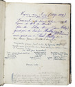
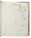
[MANUSCRIPT - SHIP'S JOURNAL]. MORSE, Edward George. A journal of remarks and observations as kept by E. G. M. . ..
[mostly on board the barque Sarah of London], April 1831-14 March 1833 (with additions to 1835). with an engraved view as frontispiece, 15 full-page, 1 nearly full-page and 1 smaller manuscript maps and coastal profiles, plus a small engraved view ("Tomb of Napoleon") mounted on 1 page.
Including: MORSE, Edward George. Lecture Book [notes on anatomical lectures by Joseph Constantine Carpue].
[London], November-December 1828. with a matching pair of engravings of a scull on and facing the title-page, and 27 pencil and/or ink anatomical drawings (including 2 full-page), some also with red. 4to (19.5×16.5 cm). Contemporary sheepskin parchment. [191] ll. Including paste-downs and about 55 blanks. Full description
€ 35,000
Order Inquire Terms of sale

Arabic ABC primer

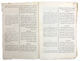
MUHAMMAD ALI UTAY. [Egyptian ABC book].
[Cairo, ca. 1925]. 8vo. Illustrated throughout with numerous black and white illustrations in the text. The title-page with a frame of foliage (oval inside, rectangular outside) and part of its text printed from a woodblock. Further with a portrait of King Fuad I of Egypt and illustrations of animals, etc. Original publishers printed-paper wrappers, matching the title-page but with the frame in green and the text in red. 46, [2 blank] pp. Full description
€ 950
Order Inquire Terms of sale

Official publications concerning the British and German claim on Angra Pequena (Lüderitz), Namibia

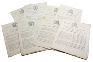
[NAMIBIA - AFRICA]. Angra Pequena. Correspondence respecting the settlement at Angra Pequena, on the S.W. coast of Africa. ... [C.-4190].
With:(2) Copy of a despatch from the Right Honourable the Earl of Derby, K.G., Her Majesty's high commissioner in South Africa, relative to the establishment of a German protectorate at Angra Pequena and along the neighbouring coast. ... [C.-4265].(3) Further correspondence respecting the settlement at Angra Pequena on the south-west coast of Africa (in continuation of [C.-4190] ...) ... [C.-4262].
London, Eyre and Spottiswoode, 1884. 3 works in 1 volume. Folio. With a folding map in ad 1 and a full-page map in ad 3. Modern blue paper wrappers. X, 60; 13, [1]; X, 75, [1 blank] pp. Full description
€ 750
Order Inquire Terms of sale

Navigating the Red Sea and Gulf of Aden

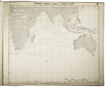
[NAVIGATION - RED SEA]. Red Sea and Gulf of Aden pilot comprising the Suez canal, the gulfs of Suez and 'Aqaba, the Red Sea, the Gulf of Aden, ...
Including: Supplement no. 1-1957 relating to the Red Sea and Gulf of Aden pilot, tenth edition ...
London, published by the Hydrographic Department, Admiralty, 1955-1957. 8vo. With a folding map (printed on both sides), 2 coloured plates with diagrams (printed on both sides), 28 plates showing coastlines and occasionally a map (many printed on both sides), and many some illustrations in text. Original blue cloth; supplement with original printed paper wrappers. LI, [1 blank], 518, [1], [1 blank] pp. Full description
€ 1,750
Order Inquire Terms of sale
272 books found / Show all