Categories
Shopping cart (0 items € 0)
Advanced search

Africa / Cartography & Exploration

14th-century tales of travels in Turkey, the Middle East, Near East, India and the East Indies,
illustrated with about 60 woodblocks

MANDEVILLE, John [= Jehan d'OUTREMEUSE]. The voyages & travels of Sir John Mandevile, Knight, ... to the Holy Land, and to Hierusalem: as also to the lands of the Great Caan, and of Prestor John: to Inde, and divers other countries: ...
London, Richard Chiswell, Benjamin Walford, Matthew Wotton, George Conyers, 1696. 4to. With a woodcut ship on the title-page and about 60 woodcut illustrations in the text (mostly about 5.5 x 8 cm) plus about 10 repeats. Gold-tooled, red goatskin morocco by Robert Riviere in London (ca. 1875/80), one of England's best binders. [4], “139” [= 135], [5] pp. Full description
€ 22,500
Order Inquire Terms of sale

Cross-cultural mapping of the Red Sea: Bruce's chart in an early Egyptian manuscript copy

[MAP - ARABIAN PENINSULA]. BRUCE, James. Carte de la mer Rouge, relevée sur celle de James Bruce.
[Egypt, probably Cairo], 1827. Folio leaf (46 x 31.5 cm). Manuscript map in pen and ink with watercolour, with a French text on Middle Eastern hand-made paper. Full description
€ 15,000
Order Inquire Terms of sale

The climate of the East African coast

[ARABIAN GULF]. Weather in the Indian Ocean to Latitude 30° S. and Longitude 95° E. Including the Red Sea and Persian Gulf. Volume II. Local information. Part 9 Coast of East Africa from the equator to Cape Delgado [...].
London, Meteorological Office, Air Ministry, 1940. 8vo. With map frontispiece and several illustrations and tables in the text. Original publisher's printed red wrappers. 63 pp., final blank page. Full description
€ 1,500
Order Inquire Terms of sale

Highly detailed maritime atlas

GREAT BRITAIN METEOROLOGICAL OFFICE. Monthly current charts for the Indian Ocean. From information collated & prepared in the Meteorological Office.
London, Admiralty Hydrographic Office, under the superintendence of Rear-Admiral W. J. L. Wharton, 1895-1896. Plano. Oblong Royal 1mo (full-sheet leaves: 51 x 62 cm). An atlas of 12 large black and white nautical charts. Limp cloth with gold-tooled title on front cover. [12] ll. plus the 1-page “Advertisement”. Full description
€ 3,500
Order Inquire Terms of sale

Excellent, attractively coloured large map of the Ottoman Empire at its height

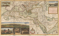
MOLL, Herman. The Turkish empire in Europe, Asia and Africa, divided into all its governments, together with the other territories that are tributary to it, as also the dominions of the Emperor of Marocco.
London, Herman Moll, John Bowles, Thomas Bowles & John King, ca. 1730. A large engraved map in two sheets (61 x 101 cm as assembled) at a scale of about 1:7,100,000, with 3 insets containing 6 topographic and architectural views. Coloured. Full description
€ 8,500
Order Inquire Terms of sale

First complete edition of Cosmas's Christiana topographia describing his travels
in the Red Sea and the Arabian Gulf

MONTFAUCON, Bernard de (editor). Collectio nova patrum et scriptorum Graecorum, Eusebii Caesariensis, Athanasii, & Cosmae Aegyptii.
Paris, Claudius Rigaud, 1707. 2 volumes. Folio. With 4 engraved plates, and 3 woodcut illustrations in the text. Each volume with an engraved headpiece, the first incorporating the coat of arms of Pope Clement XI, and the second that of Jean-Paul Bignon. Contemporary calf, richly gold-tooled spine and binding edges. [14], XL, [1], [1 blank], 732, [26], [2 blank]; [16], LXVIII, 112, [2], I-XXIV, 113-593, [26], [1 blank] pp. Full description
€ 25,000
Order Inquire Terms of sale

Ship's journal from Seychelles and Madagascar,
with numerous maps and earlier illustrated anatomical lecture notes

[MANUSCRIPT - SHIP'S JOURNAL]. MORSE, Edward George. A journal of remarks and observations as kept by E. G. M. . ..
[mostly on board the barque Sarah of London], April 1831-14 March 1833 (with additions to 1835). with an engraved view as frontispiece, 15 full-page, 1 nearly full-page and 1 smaller manuscript maps and coastal profiles, plus a small engraved view ("Tomb of Napoleon") mounted on 1 page.
Including: MORSE, Edward George. Lecture Book [notes on anatomical lectures by Joseph Constantine Carpue].
[London], November-December 1828. with a matching pair of engravings of a scull on and facing the title-page, and 27 pencil and/or ink anatomical drawings (including 2 full-page), some also with red. 4to (19.5×16.5 cm). Contemporary sheepskin parchment. [191] ll. Including paste-downs and about 55 blanks. Full description
€ 35,000
Order Inquire Terms of sale

Navigating the Red Sea and Gulf of Aden

[NAVIGATION - RED SEA]. Red Sea and Gulf of Aden pilot comprising the Suez canal, the gulfs of Suez and 'Aqaba, the Red Sea, the Gulf of Aden, ...
Including: Supplement no. 1-1957 relating to the Red Sea and Gulf of Aden pilot, tenth edition ...
London, published by the Hydrographic Department, Admiralty, 1955-1957. 8vo. With a folding map (printed on both sides), 2 coloured plates with diagrams (printed on both sides), 28 plates showing coastlines and occasionally a map (many printed on both sides), and many some illustrations in text. Original blue cloth; supplement with original printed paper wrappers. LI, [1 blank], 518, [1], [1 blank] pp. Full description
€ 1,750
Order Inquire Terms of sale

Important contribution to the study of the Middle East

NIEBUHR, Carsten. Voyage en Arabie & en d'autres pays circonvoisins. Tome premier[- second]. Traduit de l'Allemand.
Amsterdam, Steven Jacobus Baalde; Utrecht, Barthelemy Wild (colophon: printed by Joh. Jos. Besseling, Utrecht, 1775), 1775-1780. 2 volumes. 4to. With 2 engraved integral title-pages, 124 engraved plates (many folding) and a folding map of Yemen (in partial colour). Contemporary gold-tooled calf. VIII, [6], 409, [1], [1 blank]; VI, [10], 389, [1] pp. Full description
€ 6,000
Order Inquire Terms of sale
86 books found / Show all