Categories
Shopping cart (0 items € 0)
Advanced search ▾

Asia

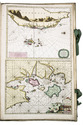
Spectacular 18th-century Dutch composite sea atlas with 3 detailed manuscript charts,
all charts and the engraved title page expertly coloured by a contemporary hand
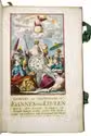
[KEULEN, Gerard and Johannes van, and others]. [Composite sea atlas containing 56 detailed charts including 3 manuscript charts].
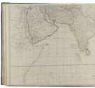
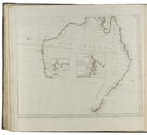
Amsterdam, [Johannes van Keulen and others, 1700-1753, engraved title page dated 1734]. Large folio (61.5 x40.5 cm). With an engraved allegorical title page by Aernout Nagtegael after Jan Luyken, and 56 detailed sea charts, the whole expertly coloured by a contemporary hand. The atlas includes 22 large folding charts, including 3 highly interesting manuscript charts, 27 double-page charts, 1 full-page chart, and 6 half-page charts, most of them with beautiful cartouches, depicting views, local people, and merchandise. The maps are engraved and originally edited by the most famous Dutch cartographers and map-publishers of the late 17th- and early 18th centuries. Contemporary blind-tooled vellum, with green cloth closing ties. Title page and 56 charts. Full description
€ 495,000
Order Inquire Terms of sale

A landmark of hadith scholarship: rare first English edition of a noted Sunni text, printed in Calcutta

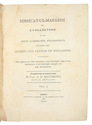
KHATIB AL-TIBRIZI, Muhammad ibn ’Abd Allah (Arnold N. Matthews, trans.). Mishcàt-ul-Masábìh, or, A collection of the most authentic traditions, regarding the actions and sayings of Múhammed; exhibiting the origin of the manners and customs, the civil, religious and military policy of the Muslemàns.
Calcutta, T. Hubbard at the Hindoostanee Press, 1809-1810. 2 volumes. Small folio (23.5 x 31 cm). Contemporary sheepskin, flat spines with red morocco labels. [6], IX, [1], VI, 665, [1]; [2], VI, 817, [13] pp. Full description
€ 15,000
Order Inquire Terms of sale

Richly illustrated and influential 17th-century book on China

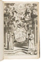
KIRCHER, Athanasius. Tooneel van China.
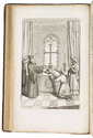
Amsterdam, Johannes Janssonius van Waesberge and the widow of Elizaeus Weyerstraten, 1668. Folio. With engraved frontispiece, engraved author's portrait, 24 engraved plates (including 2 double-page maps and 1 folding plate) and 60 engraved illustrations in text (plus another copy on a separate leaf, without letterpress text, of the engraving on 2F3v). Including maps of China and Asia, traditional Chinese costumes, illustrations of the Chinese and the Mughal rulers in abundantly decorated rooms, linguistic illustrations, zoological illustrations, etc. Contemporary gold-tooled sprinkled calf, with a red morocco title label on the spine lettered in gold, gold-tooled board edges, later endpapers (re-cased). [12], 286, [10] pp. Full description
€ 8,000
Order Inquire Terms of sale

World atlas including one 6-sheet and eleven 4-sheet wall maps

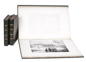
KITCHIN, Thomas and others. Kitchin's general atlas, describing the whole universe.
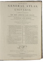
London, Robert Laurie, James Whittle, 1808. Imperial folio (53 x 39.5 cm). With 28 engraved maps (numbered in 41 parts) assembled from 67 sheets. Most include elaborate cartouches with pictorial decoration. With the maps coloured in outline. Contemporary half calf. 1 leaf plus maps. Full description
€ 18,000
Order Inquire Terms of sale

Rare work of the Basel Missionary Press in Mangalore

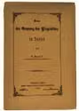
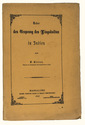
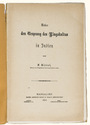
KITTEL, Ferdinand. Ueber den Ursprung des Lingakultus in Indien.
Mangalore, [printed by Stolz & Hirner, Basel Mission Press, Mangalore, for:] Basel mission book & tract depository, 1876. 8vo. With the title on the front wrapper in a printed decorative frame. Orange printed paper wrappers. [2], 48 pp. Full description
€ 650
Order Inquire Terms of sale

Rare work of the Basel Missionary Press in Mangalore

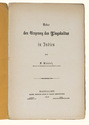
KITTEL, Ferdinand. Ueber den Ursprung des Lingakultus in Indien.
Mangalore, [printed by Stolz & Hirner, Basel Mission Press, Mangalore, for:] Basel mission book & tract depository, 1876. 8vo. With the title on the front wrapper in a printed decorative frame. Orange printed paper wrappers. [2], 48 pp. Full description
€ 650
Order Inquire Terms of sale

A rare and extensive photogravure portfolio of the Malay Peninsula

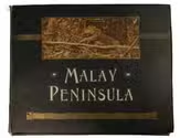
KLEINGROTHE, Charles J. Malay peninsula (straits settlements & federated Malay states).
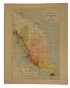
Medan, 1907. Oblong folio (36.3 x 45.5 cm) With 172 photogravures, 1 illustrated map of the Malay Peninsula in colour, and 1 illustrated diagram of the fruit of the rubber tree on 72 leaves, together with a title leaf. 73 loose leaves kept in a decorated black cloth portfolio, with "Malay Peninsula" stamped in white and gold along with some gold-stamped decorations and a ca. 27 x 11 cm. photogravure of a trapped tiger on the front board. The pastedowns and tabs are covered with gold floral paper. [73] ll. Full description
€ 15,000
Order Inquire Terms of sale

The first Russian circumnavigation

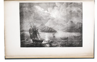
KRUSENSTERN, Adam Johann Crusius von. Voyage autour du monde, fait dans les années 1803, 1804, 1805 et 1806, par les ordres de Sa Majesté Impériale Alexandre Ier, empereur de Russie, sur les vaisseaux la Nadiejeda et la Neva, commandés par M. de Krusenstern, capitaine de vaisseau de la marine impériale.
Paris, Librairie de Gide et Fils, 1821. 2 text volumes and 1 atlas. 8vo and folio atlas. With 30 engraved plates (21 views and portraits, 9 maps and charts, of which 3 folding). Contemporary blind-tooled dark green goatskin, with a dark green morocco title label and a dark green morocco volume label on the spine, dark green buckram sides, marbled end papers. The atlas in contemporary gold- and blind-tooled dark green quarter goatskin, with the title lettered in gold on the spine, blue green cloth sides, marbled end papers. XII, 418, [2 blank]; [2 blank], [4], 531, [1 blank]; [4] pp. + 30 plates. Full description
€ 40,000
Order Inquire Terms of sale
548 books found / Show all