The official printed record of the most important 19th-century exploratory expedition into Indochina
GARNIER, Francis.
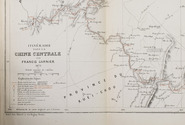
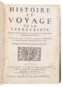
Voyage d'exploration en Indo-Chine effectué pendant les années 1866, 1867 et 1868 par une commission Française présidiée par M. le capitaine de frégate Doudart de Lagrée et publié dans les ordres du ministre de la marine sous la direction de M. le lieutenant de vaisseau Francis Garnier avec le concours de M. Delaporte, lieutenant de vaisseau et de MM. Joubert et Thorel, médécins de la marine, membres de la commission.
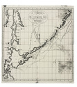
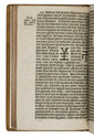
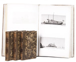
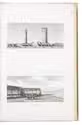
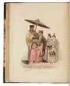
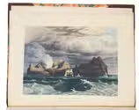
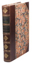
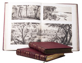
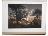
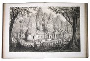
Paris, Librairie Hachette et Cie, 1873. 2 text volumes and 1 atlas volume in 2 parts. Large 4to text volumes, and folio atlas. With a lithographed portrait of Doudart de Lagrée, 53 full-page maps and views, and 157 illustrations in the text. The atlas with 69 lithographed maps, plans and views. Contemporary gold- and blind-tooled quarter red morocco, with the title lettered in gold on the spine, red cloth sides with blind tooled borders on the front and back, gilt edges, watered silk end papers. V, [3], 580, [4]; [6], 523, [5]; [6], XII pp. Full description
€ 35,000
Paris, Librairie Hachette et Cie, 1873. 2 text volumes and 1 atlas volume in 2 parts. Large 4to text volumes, and folio atlas. With a lithographed portrait of Doudart de Lagrée, 53 full-page maps and views, and 157 illustrations in the text. The atlas with 69 lithographed maps, plans and views. Contemporary gold- and blind-tooled quarter red morocco, with the title lettered in gold on the spine, red cloth sides with blind tooled borders on the front and back, gilt edges, watered silk end papers. V, [3], 580, [4]; [6], 523, [5]; [6], XII pp. Full description