Categories
Shopping cart (0 items € 0)
Advanced search

Cartography & Exploration

One of the great voyage collections

CHURCHILL, Awnsham and John CHURCHILL. A collection of voyages and travels, some now first printed from original manuscripts, others translates out of foreign languages, and now first published in English.
London, printed by assignment from Messrs Churchill, 1732. 6 volumes. Folio. With 164 engraved plates (folding, double-page and full-page), 2 portrait frontispieces, 2 engraved titles, numerous illustrations in text, and engraved arms of 28 named subscribers. Contemporary gold-tooled brown calf, with a red morocco title label on the spine. Full description
€ 30,000
Order Inquire Terms of sale

Very rare and little known collection of Italian Renaissance merchant voyages to India

CIGNANO, Ludovico. Quieta solitudine di varii ragionamenti, discorsi, et concetti, ove si narra quattro navigationi ...
Bologna, Alessandro Benacci, 1587. Small 4to. With the woodcut coat of arms of the dedicatee Giovanni Luigi Scappi, elaborately helmed, crested and mantled, on the title-page, a woodcut tailpiece (plus 1 repeat), woodcut decorated initials (at least 4 series), decorations built up from cast typographic ornaments.
Goatskin morocco (ca. 1870/80?), richly gold-tooled spine and turn-ins, signed in foot of front turn-in by the Paris bookbinders "DARLAUD FRÈRES", gold fillets on sides and board edges, combed curl-marbled endpapers, edges gilt over marbling, headbands worked in white and beige, and a yellow, red and green ribbon marker. 166 pp. Full description
€ 45,000
Order Inquire Terms of sale

First edition of a highly detailed account of the expedition of the Aurora (1884-1885) to Brazil and the Rio de la Plata basin
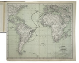
[CIRCUMNAVIGATION OF THE GLOBE by the CORVETTE AURORA]. [BOSQUET, Victor]. Die Reise S.M. Corvette "Aurora" nach Brasilienen und den La Plata-Staaten in den Jahren 1884-1885.
Vienna, Carl Gerold's Sohn, 1885. Large 8vo. With 3 lithographed folding maps (one coloured) showing the route of His Majesty's Ship Aurora along the east coast of South America. Contemporary half brown cloth with the original publisher's printed wrappers mounted on the boards. 56 pp. Full description
€ 4,750
Order Inquire Terms of sale

Hitherto considered unobtainable: the spectacular, complete series of more than 200 photographs
of the Middle East and Spain by Louis De Clercq, uniformly bound

CLERCQ, Louis De. Voyage en Orient - Voyage en Espagne, 1859-1860
[Paris, France], J. Blondeau et Antonin, 1860. 6 volumes bound in 5 albums. Oblong 1mo (ca. 45 x 60 cm). With 222 photographs, albumen prints from waxed paper negative, including 23 panoramas, all mounted on cardboard, each plate with a lithographed number and caption. Album I contains photos of cities, monuments, and other picturesque views of Syria (49 prints including 11 panoramas); II: castles from the time of the Crusaders in Syria (37 prints including 5 panoramas); III: views of Jerusalem and holy places in Palestine (30 prints including 1 panorama); IV (bound together with III): the stations of the cross along the Via Dolorosa in Jerusalem (14 prints); V: monuments and picturesque sites in Egypt (41 prints including 1 panorama); VI: cities, monuments, and other picturesque views in Spain (51 prints including 5 panoramas). The sizes of the albumen prints vary from ca. 20 x 27 cm. to ca. 112 x 20 cm.

Uniform, original red leather-grained cloth with the title and name of the author lettered in gold on the front board. Full description
€ 850,000
Order Inquire Terms of sale

A rare pocket atlas for officers and travellers, with 25 maps

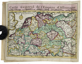
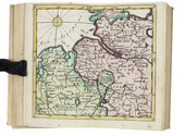
[ATLAS - EUROPE]. CLEYNHENS, Bernardus. Accuraat geografisch kaart-boekje of zak-atlas van het keyzerryk en geheel Duytsland, de Oostenrykse Nederlanden, ...
Haarlem, Bernardus Cleynhens, [ca. 1747?]. Small 8vo (16 x 10 cm). With 25 double-page engraved maps (2 overview maps), and an engraved plate with 8 scales, all hand-coloured, partly in outline. Half textured red cloth (ca. 1860?). 40, 23, [1 blank] pp. plus maps and plate of scales. Full description
€ 5,000
Order Inquire Terms of sale

Cochrane's travels on foot through Siberia

COCHRANE, John Dundas and Robert LYALL. Reize te voet door het Russische Rijk en Siberië ... voorafgegaan door eene beschouwing van het karakter en de zeden der Russen, door R. Lyall, en eene geschiedkundige inleiding van den vertaler.
Delft, the widow of Johannes Allart, 1826. 2 volumes. 8vo. With lithographed frontispiece showing a Russian peasant family, and a folding table. Publisher's boards, uncut. VIII, 448; XII [= X], 376 pp. Full description
€ 850
Order Inquire Terms of sale

An account of the former King of Portugal’s visit to Morocco, the first book printed in Tangiers

COLAÇO, José Daniel. Viagem de Sua Magestade El Rei o Senhor Dom Fernando a Marrocos, seguido da descripção da entrega da Grão Cruz da Torre e Espada ao Sultão Sid Mohammed.
Tangiers, Abrines, 1882. 8vo. Modern maroon half morocco, preserving the original publisher's printed wrappers. VI, 122, [1 blank], [2], [1 blank] pp. Full description
€ 3,000
Order Inquire Terms of sale

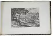
The complete series of Collaert's views around Brussels in its first state

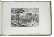
[VIEWS - BRUSSELS AREA]. COLLAERT, Hans I [after Hans BOL or Jacob GRIMMER?]. [Views in the vicinity of Brussels].
[Antwerp], Hans van Luyck, [ca. 1575/80]. Oblong folio album (24.5 x 35.5 cm). Series of 24 engravings (plate size ca. 20 x 14 cm) with views of landscapes around Brussels, by Hans I Collaert possibly after Hans Bol or Jacob Grimmer, each with a caption in the plate (plates 8 and 20 also with Van Luyck and Collaert's monograms "H.V.L.EX[cudit]" and "H.C.F[ecit]"). Trimmed down to the plate edge and mounted on album leaves, numbered in pencil on the album leaves, next to the engravings. Modern red half cloth, marbled sides. [24] ll. Full description
€ 19,500
Order Inquire Terms of sale

Cross-cultural navigation: Turkish-inscribed maritime pilot

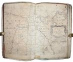
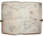
COLOM, Jacob Aertsz. [Description de la mer méditerranée].
[Amsterdam, ca. 1670]. Folio (29 x 45 cm). With 9 double-page engraved charts only, each sheet ca. 44 × 55 cm, each mounted on stiff paper with maps back-to-back, with thick red and black ink borderlines. 8 of 9 maps are by Colom, numbered 2-9 in the plates from; plate 1 has been replaced with Johannes de Rams map of the Mediterranean: "Paskaart vande Middelandsche Zee In twee deelen vertoont". Contemporary stiff paper wrappers, with a manuscript label pasted upside down on the back wrapper, reading: "Carta Marinaresca del Mar Mediterraneo". Full description
€ 25,000
Order Inquire Terms of sale
693 books found / Show all