Categories
Shopping cart (0 items € 0)
Advanced search

Cartography & Exploration

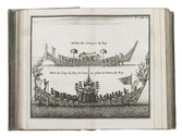
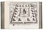
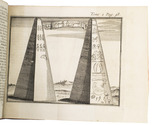
Seminal guide to the East and West Indies, with 42 double-page and folding plates, including 6 maps, all engravings beautifully coloured by a contemporary hand

LINSCHOTEN, Jan Huyghen van. Histoire de la navigation ... aux Indes Orientales ... Avec annotations de B. Paludanus, ... Troixiesme edition augmentee.
Including:
LINSCHOTEN, Jan Huyghen van. Le grand routier de mer, ...
[LINSCHOTEN, Jan Huygen van]. Description de l'Amerique & des parties d'icelle, ...
Amsterdam, Evert Cloppenburg, 1638. Folio (32.5 x 21 cm). With 3 title-pages (2 from the same full-page engraving and 1 letterpress with an engraving of a ship in a cartouche with 4 inset city views), a nearly full-page engraved portrait of the author in a cartouche with 4 inset views, 42 engraved plates including 6 maps (31 double-page & 11 larger folding). All plates coloured by a contemporary hand. Near contemporary mottled calf, gold-tooled spine. [8], 206 pp.; [4], 181, [1 blank]; [1], [1 blank], “86” [= 80], [2 blank] pp. Full description
€ 275,000
Order Inquire Terms of sale

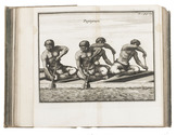
Drawing of a scene on the Coromandel Coast for an engraving in a book by Johann Georg Jacobi

[COROMANDEL COAST]. LIPS, Johann Heinrich. Die Küste Coromandel.
[Zürich, 1803]. Pen drawing (10.3 x 6.3 cm) in grey ink with washes on paper (12.5 x 8.5 cm), signed by the artist in the lower right corner of the illustration and with the title in pencil in the lower margin. The whole mounted on a larger paper leaf (with notes: "dessin no 522" and "Lips f." in ink), with a passepartout and in a gilt wooden frame. Full description
€ 6,500
Order Inquire Terms of sale

Ground-breaking work on Brazilian ports

LISBOA, Alfredo (editor). Portos do Brasil 1822-1922. Texto e atlas.
Rio de Janeiro, Norte (vol. 1) and Castro, Mendonça & Cia. (vol. 2), 1922 & 1923. 2 volumes in 1. 4to. With 30 folding maps, 24 of which are coloured in blue and partly in red. Original publisher's dark green leather over paperboards, rebacked in black cloth. [1], [1 blank], IX, [1], “338” [= 336], [6]; [1], [1 blank] pp. Full description
€ 2,500
Order Inquire Terms of sale

Rare world atlas with 56 large copper-engraved maps.

L'ISLE, Guillaume de. Atlas nouveau, contenant toutes les parties du monde, ou sont exactement remarquées les empires, monarchies, royaumes, etats, republiques &c.
Including: SANSON, Guillaume. Introduction à la Geographie où sont la geographie astronomique qui explique la correspondance du globe terrestre avec la sphere.
Amsterdam, Johannes Covens and Cornelis Mortier, 1730.
Folio. With a large allegorical frontispiece and 56 large copper-engraved maps (most 54 x 65 cm and a few larger, folding ones). Previous owners have added one large copper-engraved map of Normandie by Jean Baptiste Nolin from 1742, and 2 smaller etchings by Israel Silvestre with views of du Havre and Chateau Jametz. The original artwork of these views is from the 1670s, but these prints are from a later date. Contemporary blind-tooled vellum, green closing ties. [1 blank], [6], 32 pp. Full description
€ 45,000
Order Inquire Terms of sale

Very rare pocket atlas of the Rhineland, owned by the commander of the Buffs
during the Battle of Fontenoy and containing the original entry in his ledger

L'ISLE (DELISLE), Guillaume, and others. Le flambeau de la guerre allumee au Rhin; representee en 36 nouvelles cartes geographiques, ... = De fakkel des oorlogs ontstoken aan den Rhyn; verbeeld in 36 nieuwe geographische landkaarten, ...
Amsterdam, Petrus Schenk II, 1735. 8vo. With a double-page engraved title, two double-page engraved pages of text in Dutch and French, a folding engraved map and 36 double-page engraved maps; all coloured by hand. Original publisher's red sheepskin with a flap and wrapping band. Full description
€ 7,500
Order Inquire Terms of sale

Detailed observations of life in the Ottoman Empire, Egypt
and elsewhere in the Levant and Middle East ca. 1610

LITHGOW, William. Willem Lithgouws 19 jaarige lant-reyse, uyt Schotlant nae de vermaerde deelen des werelts Europa, Asia en Africa.
Amsterdam, Jacob Benjamin (colophon: printed by Christoffel Cunradus), 1653. 2 parts in 1 volume. 4to. With engraved frontispiece by Crispijn de Passe, 1 engraved plate and 6 engraved illustrations in the text. 19th-century half vellum. [8], 186, 98 pp. Full description
€ 1,950
Order Inquire Terms of sale

Detailed observations of life in the Ottoman Empire, Egypt and elsewhere in the Levant and Middle East ca. 1610

LITHGOW, William. Nineteen years travels through the most eminent places in the habitable world.
London, for John Wright & Thomas Passinger, 1682. 8vo. With a folding woodcut frontispiece and 6 folding woodcut plates and 1 woodcut in the text. 19th-century dark brown sheepskin, sewn on 3 recessed cords, brown spine label, Stormont on shell marbled endpapers. [8], 481, [7] pp. Full description
€ 3,500
Order Inquire Terms of sale

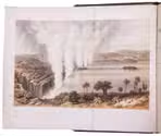
First edition of Livingstone's account of his first mission to southern Africa, with 27 plates,
including the first published view of Victoria Falls

LIVINGSTONE, David. Missionary travels and researches in South Africa; including a sketch of sixteen years' residence in the interior of Africa, and a journey from the Cape of Good Hope to Loanda on the west coast; thence across the continent, down the river Zambesi, to the eastern ocean.
London, John Murray (back of title-page: W. Clowes and sons), 1857. 8vo. With a folding tinted lithographed plate as frontispiece, a wood-engraved illustration on the title-page, a lithographed portrait of Livingstone, 20 lithographed plates, 2 tinted lithographed plates, a folding lithographed plate with a geological cross section, a lithographed folding map of southern Africa, a lithographed folding map pasted on cloth, with Livingstone's route from west to east Africa highlighted in red, and many wood-engraved illustrations in text. Original publisher's blind-blocked brown cloth. IX, [1], 687, [1], 8 pp. Full description
€ 1,350
Order Inquire Terms of sale
694 books found / Show all