Categories
Shopping cart (0 items € 0)
Advanced search

Cartography & Exploration

Charming aquatints of Dutch historical monuments and folklore

[MAASKAMP, Evert (editor)]. Merkwaardige gezigten, gebouwen, monumenten en standbeelden in de noordelijke provintien van het Koningrijk der Nederlanden. | Vues remarquables, edifices, monumens et statues dans les provinces septentrionales du Royaume des Pays-Bas.
Amsterdam, Evert Maaskamp, 1816. Oblong 8vo. With an engraved illustration on title-page and 37 sepia aquatints by Ludwig Portman after Gerrit Jan Michaëlis, Franciscus Aandreas Milatz, and Cornelius Overman. Contemporary gold-tooled dark blue boards. [40] ll. + 37 plates. Full description
€ 1,750
Order Inquire Terms of sale

Historical map of the Netherlands, printed on silk, together with the separately published manual, with a hand-coloured world map

MAASKAMP, Evert. Geschiedkundige kaart der Nederlanden. | Carte historique des Pays-Bas.
Amsterdam, Evert Maaskamp, 1830. Map (plate size 48 x 38 cm) engraved by "Giersbergen et fils", printed on silk and hand-coloured in outline, with the title at upper left, a dedication at lower left, and a key and scale (ca. 1:1,000,000) at lower right.
With: (2) MAASKAMP, Evert. Handboek, ter verklaring der geschiedkundige kaart van het Koningrijk der Nederlanden, en der wereldkaart; behelzende eene opgave van de roemrijkste en lofwaardste daden der Nederlanders, derzelver krijgsbedrijven te land en ter zee, scheepstochten, ontdekkingen, uitvindingen enz.; als mede van zoodanige voorname personen, die in wetenschap, kunst of heldenmoed, hebben uitgeblonken.
Amsterdam, Evert Maaskamp, 1830. 8vo. With a folding engraved map of the world, with the continents hand-coloured. Contemporary red boards, boards gold-tooled along the extremities. VIII, 8, 1-38, 37-77, [1 blank], [1], [1 blank]. Full description
€ 1,500
Order Inquire Terms of sale

Discovery of the Canary Islands in classical Greek and Roman, Arabic and Portuguese sources

MACEDO, Joaquim José da Costa de. Memoria em que se pertende provar que os Arabes não conhecerão as Canarias antes dos Portuguezes.
Lisbon, printing office of the Academia Real das Sciencias, 1844. Folio. With a woodcut Portuguese coat of arms on the title-page. Modern brown paper wrapper. [4], 232 pp. Full description
€ 1,500
Order Inquire Terms of sale

Extremely rare example of the largest globe engraved by Malby (45.5 cm diameter), with lines of magnetic variation, London 1848, showing “Debai” (Dubai)

[GLOBE - TERRESTRIAL]. MALBY & CO. Malby's terrestrial globe.
[London], Malby & Co. (engraved by Chas. Malby), 1 January 1848. Diameter: 45.5 cm (18 inch), height in stand: 64.5 cm. An engraved terrestrial globe with 12 gores and 2 polar caps over a plaster-covered core, and the engraved horizon ring on the wooden stand, all coloured by a contemporary hand. In a contemporary wooden stand with 3 turned legs supporting the horizon ring, and 3 turned stretchers with a cylindrical centrepiece with a knob on the underside. Further with a contemporary brass hour circle and a slightly later iron meridian ring (and probably the axis pivots). Full description
€ 35,000
Order Inquire Terms of sale

Adventurous travels in the East
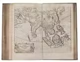
MANDELSLO, Johann Albrecht von. Morgenländische Reyse-Beschreibung.
Hamburg, Christian Guth, printed by Johan Holwein, Schleswig, 1658. Folio. With engraved frontispiece by Christian Rothgiesser, engraved author's portrait, double-page engraved map, and 21 large engravings in text, mostly signed by Rothgiesser. Contemporary pigskin, with boards blind-tooled in a panel design. [32], 248, [36] pp. Full description
€ 11,000
Order Inquire Terms of sale

14th-century tales of travels in Turkey, the Middle East, Near East, India and the East Indies,
illustrated with about 60 woodblocks

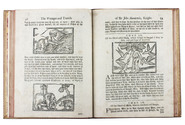
MANDEVILLE, John [= Jehan d'OUTREMEUSE]. The voyages & travels of Sir John Mandevile, Knight, ... to the Holy Land, and to Hierusalem: as also to the lands of the Great Caan, and of Prestor John: to Inde, and divers other countries: ...
London, Richard Chiswell, Benjamin Walford, Matthew Wotton, George Conyers, 1696. 4to. With a woodcut ship on the title-page and about 60 woodcut illustrations in the text (mostly about 5.5 x 8 cm) plus about 10 repeats. Gold-tooled, red goatskin morocco by Robert Riviere in London (ca. 1875/80), one of England's best binders. [4], “139” [= 135], [5] pp. Full description
€ 22,500
Order Inquire Terms of sale

A 19th-century tourist's experiences during his travels to the Philippines

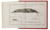
MAN, Jules de. Souvenirs d'un voyage aux Iles Philippines.
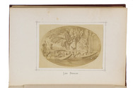
Antwerp, Imprimerie Stockmans & Moerincx, 1875. 8vo (22 x 15 cm). With 8 albumen prints, including 3 reproductions of drawings, representing the local population, mounted within printed frames on separate leaves with printed captions below. Original publisher's gold- and blind stamped red pebble-grained cloth, yellow endpapers. 268 pp. Full description
€ 2,950
Order Inquire Terms of sale

Cartographic manuscript to teach engineer-geographers to "centrer" (bisect?) angles and triangulate,
based on the work of two important French 18th-century cartographers

[MANUSCRIPT - CARTOGRAPHY]. Memoire sur la manière de centrer les angles et de calculer les triangles selon la direction de la méridienne et de la perpendiculaire à l 'usage des ingenieurs-géographes.
[France, ca. 1750/99]. Folio. Manuscript in French on thick paper, written in a neat 18th-century cursive hand. With 5 manuscript plates, showing 14 geometrical figures. Sewn in quires and stored loose in a portfolio covered with grey paper, grey cloth ties, paper label on the front board. [2 blank], [1], [1 blank], 61, [3 blank] pp. Full description
€ 2,750
Order Inquire Terms of sale
693 books found / Show all