
Large wall map of the region showing population and minorities
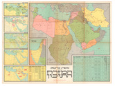
[MIDDLE EAST - WALL MAP].
Mapah carta shel ha-mizrah ha-tikhon. (Carta's Map of the Middle East).
[Jerusalem], Carta, 1973 121 x 92 cm. Colour-printed map (folded). Scale 1:20,000,000. Full description
€ 4,500
[Jerusalem], Carta, 1973 121 x 92 cm. Colour-printed map (folded). Scale 1:20,000,000. Full description