Categories
Shopping cart (0 items € 0)
Advanced search

Cartography & Exploration / Middle East & Islamic World

Early work of one of the greatest French mathematicians

VIÈTE, François. Principes de cosmographie, tirez d'un manuscrit de Viette, & traduits en François. Corrigées et augmentées.
Paris, Jean Behourt, 1647. 12mo. With 2 woodcut illustrations in the text (a geocentric universe and a simple geometric figure). Contemporary limp sheepskin parchment. [8], "72" [=172] pp. Full description
€ 11,500
Order Inquire Terms of sale

"Arabia Petra" explored: account of an expedition (1865) through the Sinai, Petra in Jordan, and surrounding regions, with 48 plates and albumen prints

VISCONTI, Giammartino Arconati. Diario di un viaggio in Arabia Petrea (1865).Including: Atlante per servire al Diario di un viaggio in Arabia Petrea.
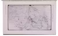
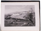
Torino, Vincenzo Bona, 1872. 2 volumes. Royal 4to (31 x 27 cm). With 2 title-pages printed in red and black, each with the author's wood-engraved decorated GAV-monogram and motto; vol. 1 with 2 folding lithographed maps (1 printed in black, brown and blue, with the route coloured by hand in red, of the Sinai Peninsula; the other in black and white, of the city of Petra); 40 mounted albumen prints after paintings by Emile Pierre Metzmacher (mainly 11.5 x 16 cm), individually mounted with letterpress captions on the mount; and 2 engraved plates; vol. 2 with 6 numbered engraved plates of molluscs and insects. The Diario in the original publisher's maroon cloth with the author's crowned monogram gold--blocked on the front board and spine. The Atlante in the original publisher's blue cloth, with the author's crowned monogram and the title gold-blocked on the front board. Both volumes with gilt edges, orange endpapers and with tissue guard leaves tipped in, protecting the albumen prints and engraved plates. 439; 46, [2 blank] pp. (vol. II, pp. 1-2 blank). Full description
€ 25,000
Order Inquire Terms of sale

Hand-coloured map of Africa, with an especially accurate southern coastline

[MAP - AFRICA]. VISSCHER, Nicolaas. Africae accurata tabula.
[Amsterdam], Nicolas Visscher, [ca. 1690?]. Engraved double-page map (image size: 43.5 x 54 cm; leaf size: 51 x 60 cm), coloured by a contemporary hand. With title in a decorated cartouche on the top right flanked by two Africans and two putti and dedication to Gerardus Schaap in a decorated cartouche on the bottom left, with Schaap's coat of arms on top and flanked by mythical figures. Further illustrated with small ships and African animals (including lions, monkeys, rhinoceros and ostriches). In passepartout (56 x 66 cm). Full description
€ 2,500
Order Inquire Terms of sale

First edition of H.A.G. Percy, Lord Warkworth's accounts of his travels through Anatolia

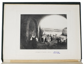
WARKWORTH, Lord (Henry Algernon George PERCY, Earl Percy). Notes from a dairy in Asiatic Turkey.
London, Edward Arnold publisher to the India Office, 1898. Large 8vo (ca. 24 x 18 cm). With one large folding map of Turkey (ca. 55 x 24 cm), printed in black and red, and 32 plates with half-tone reproductions of photographs. Green buckram with gold-blocked decorations on the front board. XVI, 267, [1 blank] pp. Full description
€ 1,250
Order Inquire Terms of sale

With two large maps of Yemen

WERDECKER, Josef. A contribution to the geography and cartography of north-west Yemen (based on the results of the exploration by Eduard Glaser, undertaken in the years 1882-1884).
Cairo, lInstitut Français dArchéologie Orientale du Caire, 1939. 8vo. With a portrait of Eduard Glaser, 8 numbered plates and 2 large folding maps. Later half cloth, with the original front wrapper mounted on the front board. [2], 160 pp. Full description
€ 2,800
Order Inquire Terms of sale

Beautifully illustrated description of Palestine, Sinai and Egypt

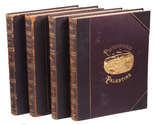
WILSON, Charles. Picturesque Palestine, Sinai and Egypt. Edited by Colonel Wilson, R.E, C.B., F.R.S. formerly engineer to the Palestine Exploration Society. Assisted by the most eminent Palestine explorers etc. With numerous engravings on steel and wood.
London, Virtue and Co., [ca. 1870]. 4 volumes. Large 4to (33 x 25 cm). With 4 title-pages in red and black, each with a different large steel-engraved vignette, 38 steel-engraved plates (including 4 different frontispieces), 2 double-page engraved maps of Egypt and Sinai, printed in brown, and 576 wood-engravings on integral leaves, many full-page. Contemporary half sheepskin. [2], X, 240; [2], VI, 240; [2], IV, 240; [2], IV, 236 pp. Full description
€ 2,500
Order Inquire Terms of sale
147 books found / Show all