Categories
Shopping cart (0 items € 0)
Advanced search

Cartography & Exploration / Middle East & Islamic World

Important work on the natural history of Palastine

HASSELQUIST, Friedrich and Carl LINNAEUS. Reise nach Palästina in den Jahren von 1749 bis 1752. auf Befehl ihro Majestät der Königinn von Schweden herausgegeben vond Carl Linnäus aus em Schwedischen.
Rostock, Johann Christian Koppe, 1762 (colophon: Leipzig, Johann Gottlob Immanuel Breitkopf, 1761). 8vo. With woodcut tailpieces. Contemporary half vellum. [18], 606 pp. Full description
€ 1,800
Order Inquire Terms of sale

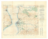
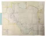
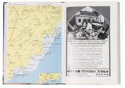
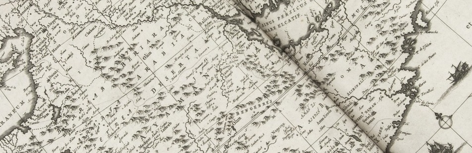
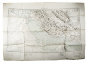
British military terrain map of the Persian Gulf, published in Calcutta

HUNTER, Frederic Fraser (editor); Sir Sidney Gerald BURRARD (director). Southern Asia series - Southern Persia sheet - Persia, Arabia and Turkey in Asia
[Dehradun, Survey of India Office], sold at the Map Record and Issue Office, Calcutta, 1912. 61.5 x 88 cm. Large photozincographed (heliozincographed) folding map on a scale of 1:2,000,000 in black, blue and red, with relief shown by contours, hachures and gradient tints. Folded. Full description
€ 15,000
Order Inquire Terms of sale

First substantial English translation of Ibn Batuta's travels through the Islamic world and beyond

IBN BATUTA and Samuel LEE (editor). The travels of Ibn Batuta; translated from the abridged Arabic manuscript copies, preserved in the public library of Cambridge. With notes, illustrative of the history, geography, botany, antiquities, &c. occurring throughout the work.
London, printed for the Oriental Translation Committee (colophon: by J.L. Cox). Large 4to (32 x 26). With various passages including the original Arabic text. Later half calf. "XVIII" [=XX], [2], 243, [1] pp. Full description
€ 17,500
Order Inquire Terms of sale

The Gallipoli Campaign, depicted in an extremely detailed map drawn in Cairo under the direction of Lawrence of Arabia

[INTELLIGENCE OFFICE - ARAB BUREAU - CAIRO]. Chanak.
Cairo, Survey Department Egypt, 1915 Colour-lithographed map (79 x 62.5 cm), printed in black, brown, red, blue and green. Mounted on contemporary cloth, with the key on the back (printed on or printed and pasted onto). Folded. Full description
€ 3,500
Order Inquire Terms of sale

British colour-printed aerial maps of Iraq for use in the Persian war

[MAPS - IRAQ]. [Reconnaissance maps of Iraq].
[UK Government], Survey Directorate HQ Tenth Army / Indian Field Survey Co., 1942 42 chromolithographed topographic maps of parts of Iraq, made from aerial photographs during World War II, on a scale of 1:100,000 and 1:253,440 (a quarter-inch to a mile). 68 x 50.5 cm & 60 x 47 cm. Full description
€ 6,500
Order Inquire Terms of sale
145 books found / Show all