Categories
Shopping cart (0 items € 0)
Advanced search

Cartography & Exploration / Voyages & Travel

Rare journal of De la Salles last American voyage, exploring the Mississippi River,
including the large folding map, rarely included

JOUTEL, Henri (Monsieur DE MICHEL, ed.). Journal historique du dernier voyage que feu M. De la Sale fit dans le Golfe de Mexique, pour trouver l'embouchure & le cours de la riviere de Missicipi, nommée à présent la rivière de Saint Louis, que traverse la Louisiane. Où on voit l'histoire tragique de sa mort, & plusieurs choses curieuses du nouveau monde.
Paris, Estienne Robinot, 1713. 12mo. With a large folding engraved map. Contemporary calf. XXXIV, 386 pp. Full description
€ 10,000
Order Inquire Terms of sale

One of the most comprehensive accounts of 18th-century South America,
especially valuable for Panama, Peru and Ecuador

JUAN, Jorge and Antonio de ULLOA. A voyage to South America. Describing at large, the Spanish cities, towns, provinces, &c. on that extensive continent.
London, L. Davis and C. Reymers, 1760. 2 volumes. 8vo. With 7 folding engraved plates, including some maps and ground plans. Contemporary calf, gold-tooled spine; rebacked, with the original backstrip laid down. XX, [4], 498 [=488]; [4], 410, 18 pp. Full description
€ 1,800
Order Inquire Terms of sale

Important collection of voyages to America and Africa, together with a standard work on Constantinople

[JUSTEL, Henri]. Recueil de divers voyages faits en Afrique et en l'Amerique.
Paris, Louis Billaine, 1674. With 17 engraved plates: 5 maps (4 folding), 3 folding plans and 9 other illustrations.
With: (2) GRELOT, Guillaume-Joseph. Relation nouvelle d'un voyage de Constantinople.
Paris, Nicolas Belley, 1689 (colophon 1680). With engraved portrait of a saint on title-page, 13 engraved plates, 4 engravings in text and engraved coat of arms. 2 works in 1 volume. 4to. 18th-century tan calf, gold-tooled spine. [16], 262, 35 [1 blank], 23 [1 blank], 49 [1 blank], [2], 81 [1 blank]; [12], 306, 1 [1 blank] pp. Full description
€ 18,000
Order Inquire Terms of sale

The main source of early knowledge of the Pelew or Palau Islands in Micronesia, in Dutch translation

KEATE, George. Beschryving van de Pelew Eilanden ...
Rotterdam, Gerard Abraham Arrenberg, 1789. 4to. With 8 plates: 4 mixed technique (partly stipple-engraved) portraits, 1 large folding engraved map of the Palau Islands and western equatorial Pacific, and 3 folding engraved views. Contemporary boards. XXXII, 365, [1] pp. Full description
€ 2,500
Order Inquire Terms of sale

Eyewitness report of the dramatic shipwreck of the Dutch East Indiaman Arnhem
and the survival of its castaways on Mauritius

KERCKHOVEN, Johannes van [= Simon van den KERKHOVEN]. Wijtloopig breede en waerachtige beschrijvinge van de ongeluckige voyage van t schip Aernhem; van Batavia vertrocken den 23 December 1661 in compagnie van noch ses andere schepen, onder t commando van de heer Aernout de Vlamingh van Outshoorn ...
Amsterdam, Jacobus van der Fuyck, 1664. 4to. With a woodcut vignette on the title page and 2 decorated woodcut initials. Disbound, loosely inserted in 20th-century plain brown paper wrappers. “28” [= 24] pp. Full description
€ 2,500
Order Inquire Terms of sale

Very rare Dutch picaresque novel, with the female protagonist getting caught by pirates
and ending up in the household of an Arabic slave trader

[KERSTEMAN, Petrus Lievens]. De vermakelyke avanturesse, of de dienstmaagd van fortuin. Vervattende hare zonderlinge levensgevallen, ontelbare wederwaardigheden en rampen; zeltzame ontmoetingen, en koddige vryagien; deszelfs driejarige dienst als lakye, gevangenneming op de Moorsche kusten, en hare slavernye in Asia by de Arabieren.
Amsterdam, Steven van Esveldt, 1754. 8vo. With engraved frontispiece. Contemporary mottled half calf, gold-tooled spine, later endpapers. [4], 360 pp Full description
€ 3,500
Order Inquire Terms of sale

Concise handbook for Western travellers visiting the Gulf States

KILNER, Peter and Jonathan WALLACE (editors). A guide for businessmen and visitors. The Gulf handbook 1978.
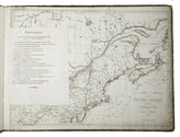
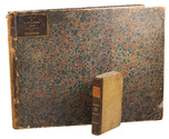
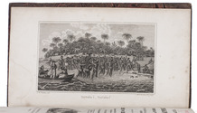
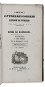
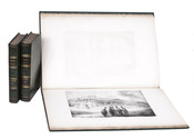
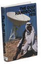
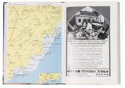
Bath and London, Trade and Travel Publications and MEED, 1978. 17.5 x 12 cm. With 8 sections of a map (2 full-page and 3 double-page) in colour of showing several parts of the Arabian peninsula, 8 full-page black-and-white photographic portraits of the Heads of State of the different Gulf States, 21 black-and-white maps and plans of these states and their largest cities, and numerous advertisements (partially in colour) throughout. Original illustrative printed boards, showing an Arab man with a gun in front of a large satellite dish and an advert for Arab Wings showing a plane in the sky on the back. XII, 576 pp. Full description
€ 350
Order Inquire Terms of sale

Richly illustrated and influential 17th-century book on China

KIRCHER, Athanasius. Tooneel van China.
Amsterdam, Johannes Janssonius van Waesberge and the widow of Elizaeus Weyerstraten, 1668. Folio. With engraved frontispiece, engraved author's portrait, 24 engraved plates (including 2 double-page maps and 1 folding plate) and 60 engraved illustrations in text (plus another copy on a separate leaf, without letterpress text, of the engraving on 2F3v). Including maps of China and Asia, traditional Chinese costumes, illustrations of the Chinese and the Mughal rulers in abundantly decorated rooms, linguistic illustrations, zoological illustrations, etc. Contemporary gold-tooled calf, later endpapers (re-cased). [12], 286, [10] pp. Full description
€ 8,000
Order Inquire Terms of sale

1824 description and atlas of the United States of America, with views of New York and Philadelphia

KLINKOWSTRÖM, Axel. Bref om de Förenta Staterna, författade under en resa till Amerika, ären 1818, 1819, 1820. ... Förra[-Senare] delen.
Stockholm, Ecksteinska Tryckeriet, 1824. 3 volumes, the 2 text volumes bound as 1. 8vo (text) & 1mo (atlas, 42 x 56 cm). Each text volume with the same engraved title-page, and in volume 1 a folding letterpress table. The atlas volume has a lithographed title-page with a view of the White House, 2 large engraved maps of the northern part and the southern part of the United States by John Melish, dated 1816, and 14 maps, plans and views of New York, Philadelphia and Washington, including 8 fine engraved aquatints by Akrell. Bound in the atlas volume are 2 letterpress 4to leaves, one with the numbered list of 19 plates: the 2 engraved title-pages for the text volumes (1-2), lithographed title-page for the atlas (3) and 16 plates for the atlas (4-19: seven are 1mo - full or nearly full sheets - and nine smaller).
With: (2) [KLINKOWSTRÖM, Axel]. Atlas til Friherre Klinckowströms Bref om de Förente Staterne.
[Stockholm, Ecksteinska Tryckeriet, 1824]. Contemporary half sprinkled calf with the volume numbers 1 & 2 in half tanned sheepskin. IX, 242, [2]; VIII, [2], 243-496 pp. Full description
€ 7,000
Order Inquire Terms of sale
363 books found / Show all