Categories
Shopping cart (0 items € 0)
Advanced search

Cartography & Exploration / Voyages & Travel

Travelling in the Hadramaut: the longest journey of Philby through southern Arabia

PHILBY, Harry St John Bridger. The land of Sheba (The Geographical Journal Vol. 92, no. 1).
[United Kingdom, The Royal Geographical Society], July 1938. 8vo. With 1 large folding coloured map, 1 smaller uncoloured folding map, and numerous photographs on 7 plates. Later half black cloth. 21, 107-132 pp. Full description
€ 300
Order Inquire Terms of sale

The land, indigenous peoples and colonists in Nova Scotia, by a French official spying for England

[PICHON, Thomas]. Lettres et memoires pour servir à l'histoire naturelle, civile et politique de Cap Breton, ...
The Hague, Pierre Gosse; London, Jean Nourse [printed in England], 1760. 12mo. Half brown morocco (ca. 1885?), by Frank J. Pfister in New York, gold-tooled spine, round gold stamp of Henry Gurdon Marquand on the front. XVI, 327, [1 blank] pp. Full description
€ 1,250
Order Inquire Terms of sale

One of the earliest sources on the Congo and central Africa, complete with all plates and maps

PIGAFETTA, Filippo and Duarte LOPEZ. Relatione del reame di Congo et delle circonvicine contrade tratta dalli scritti & ragionamenti di Odoardo Lopez.
Rome, Bartolomeo Grassi, [1591]. 4to. With an integral engraved architectural title-page (with the coat of arms of the dedicatee Antonio Migliore, Bishop of San Marco), large folding engraved general map of Africa (64×44 cm), large folding engraved map of the Congo (43.5×51.5 cm) and 8 numbered folding engraved plates of plants, animals and inhabitants of the country, by Natalis Bonifazio. Contemporary limp sheepskin parchment. [8], 82, [1], [1 blank] pp. Full description
€ 60,000
Order Inquire Terms of sale

Exploring New Mexico and Louisiana and searching for the source of the Mississippi,
while unknowingly supporting plans for empire in the Southwest

PIKE, Zebulon Montgomery. Reize naar Nieuw-Mexico en de binnenlanden van Louisiana, voorgegaan door eenen togt naar de bronnen der Mississippi.
Amsterdam, Cornelis Timmer (colophon: printed by A. Breeman & Co.), 1812. 2 volumes. 8vo. With 3 engraved folding maps: the first two showing the interior of Louisiana and the third the Mississippi River. Contemporary half calf, gold-tooled spine. VIII, 327, [1]; [4], 374 pp. Full description
€ 4,950
Order Inquire Terms of sale

Portuguese classic of practical navigation, with 36 maps and nautical charts

PIMENTEL, Manuel. Arte de navegar, em que se ensinão as regras praticas, e os modos de cartear, e de graduar a Balestilha por via de numeros, e muitos problemas uteis aì navegação, e roteiro das viagens, e costas maritimas de Guineì, Angola, Brazil, Indias, e Ilhas Occidentaes, e Orientaes ...
Lisbon, Miguel Manescal da Costa, 1762. Folio (30 x 20.5 cm). With 21 engraved plates (1 folding), 1 nearly full-page engraving of a compass rose and about 10 woodcut diagrams in the text. Contemporary or near contemporary tanned sheepskin, richly gold-tooled spine, new endpapers. [12], 603, [1] pp. Full description
€ 5,000
Order Inquire Terms of sale

The wondrous travels of Pinto according to radical enlightenment philosophy

PINTO, Fernão Mendes and Jan Hendrik GLAZEMAKER (translator). De wonderlyke reizen van Fernando Mendez Pinto; die hij in de tijt van eenëntwintig jaren in Europa, Asia en Afrika... gedaan heeft.
Amsterdam, printed for Jan Rieuwertsz I and Jan Hendricksz Boom, 1653. 4to. With an engraved title-page and 7 engraved plates. Modern vellum. [8], 280 pp. Full description
€ 4,500
Order Inquire Terms of sale

Magnificent engraving of the 1661 mosaic floor map of the world in 2 hemispheres,
incorporating Tasman's discoveries not otherwise published for decades

[PLAN - AMSTERDAM CITY HALL]. [CAMPEN, Jacob van]. Le pavé de la grand' sale des bourgeois.
[Amsterdam, Gerard Valk, 1719]. Very large engraved folding plan comprising 1 1/2 sheets (measuring 46 x 83 cm as assembled), engraved by Danckert Danckertsz. and his father after drawings by Jacob Vennekool, including the two hemispheres of the world map and a celestial map of the constellations of the northern hemisphere (each 10 cm in diameter). Full description
€ 2,500
Order Inquire Terms of sale

Augmented Dutch edition of Pocockes celebrated description of the Near and Middle East,
with 205 engraved plates

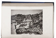
POCOCKE, Richard. Beschryving van het Oosten, en van eenige andere landen, ...
Utrecht, Gijsbert Tieme and Abraham van Paddenburg; Rotterdam, Jacobus Bosch and Reinier Arrenberg; Amsterdam, Martinus de Bruyn, 1776-1786. 3 volumes (in 6 parts) bound as 6. 4to. With 205 engraved folding plates (irregularly numbered I-CIII), including maps, plans, views and other illustrations, depicting temples, antiquities, plants, animals, etc. Contemporary half calf. XXXVI, 219, [1 blank], [11], 224-491, [1 blank]; [12], 262, [2 blank], VIII, [3], 268-376, 397-519, [1 blank]; VIII, 262, [2 blank], VIII, [3], 268-403, [1 blank]; [4], 115, [1], 124 pp. Full description
€ 15,000
Order Inquire Terms of sale

An important source of knowledge of the Near East

POCOCKE, Richard. Beschryving van het Oosten, en van eenige andere landen. Uit het Engelsch overgezet en met aantekeningen voorzien, door Ernst Willem Cramer.
Utrecht, Rotterdam and Amsterdam, G.T. en A. van Paddenburg, J. Bosch, R. Arrenberg, and M. de Bruyn, 1776-1786. 3 volumes (in 6 parts) bound as 6. 4to. With 205 folding engraved maps, plans, views and plates. Contemporary half calf. Full description
€ 12,000
Order Inquire Terms of sale
370 books found / Show all