Categories
Shopping cart (0 items € 0)
Advanced search

Cartography, Exploration & Voyages

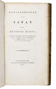
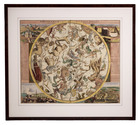
Incunable edition of an influential second century description of the antique world,
including early mentions of China and Arabia

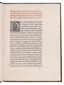
DIONYSIUS Periegetes. 
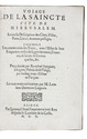
[Incipit :] ... de situ orbis habitabilis ...
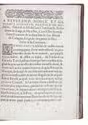
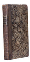
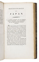
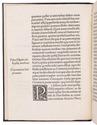
[Colophon:] Venice, Franz Renner, 1478. Small 4to (19 x 14 cm). With the first four lines printed in red and 9 white on black decorated woodcut initials (1 series), plus 1 repeat. Set in roman type, 26 lines to a page, with two words in Greek. Modern blind-tooled calf. [36] ll. Full description
€ 35,000
Order Inquire Terms of sale

Life and customs in the Ottoman Empire, described by a Christian former slave

DJURDJEVIC, Bartol (Bartholomeus GEORGIEVITZ) Voiage de la saincte cite de Hierusalem. Jointe la description des citez, villes, ports, lieux, & autres passages. Ensemble les ceremonies des Turcs ...
Liège, printed by Leonard Streel for Lambert de la Coste, 1600. 2 parts in 1 volume. 4to. 18th-century calf, gold-tooled spine. [32], [32] lvs. Full description
€ 17,500
Order Inquire Terms of sale

Travels in Siberia and China

DOBELL, Peter. Travels in Kamtchatka and Siberia; with a narrative of a residence in China.
London, Henry Colburn and Richard Bentley (back of title-page: J.B. Nichols and son), 1830. 2 volumes. 12mo. With two hand-coloured aquatint frontispieces by J. Clarck. Contemporary boards. IX, [1 blank], 351, [1]; X, 341, [1 blank], [2] pp. Full description
€ 2,250
Order Inquire Terms of sale

Highly decorative celestial chart, coloured by a contemporary hand

DOPPELMAYR, Johann Gabriel. Hemisphaerium coeli boreale in quo fixarum loca secundum eclipticae ductum ad an[n]um 1730 completum exhibentur.
[Nürnberg, Heirs of Homann, 1742]. Engraved celestial chart (50 x 59 cm), wholly coloured by a contemporary hand. With title at the head, circular chart in the centre flanked by positional tables and views of the astronomical observatories of Tycho Brahe at Hven, at Paris, of Hevelius at Danzig and of Eimmart at Nürnberg. Framed (69 x 77 cm). Full description
€ 1,750
Order Inquire Terms of sale

Beautiful hand-coloured wall map of Rijnland

DOU, Jan Jansz. (Johannes Dou I), Steven van BROECKHUYSEN and Melchior BOLSTRA. 'T Hooge Heemraedschap van Rhynland.
[Amsterdam], Isaak Tirion, 1746. Atlas folio (58.5 x 37.3 cm). With 15 double-page engraved plates, all coloured by hand, including 13 maps. The plate size is mostly ca. 44.5 x 55 cm and ca. 41.5 x 55 cm, the map of the Haarlemmermeer has plate size 55 x 63 cm. An illustration of existing and projected sluices for drainage of the polder and another illustration with title, both after drawings by Melchior bolstra. All plates mounted on stubs so that they open flat. Half red sheepskin and intricately marbled paper sides. Full description
€ 6,000
Order Inquire Terms of sale

Imaginary voyage around the world, nicely bound copy from the Huth library

DRALSÉ DE GRANDPIERRE. Relation de divers voyages faits dans l'Afrique, dans l'Amérique, & aux Indes Occidentales. La description du Royaume de Juda, & quelques particularitez touchant la vie du roy reignant. La relation d'une isle nouvellement habitée dans le détroit de Malaca en Asie, & l'histoire de deux princes de Golconde.
Paris, Claude Jombert, 1718. 12mo. With some woodcut head- and tailpieces. Contemporary gold-tooled polished calf, spine richly decorated with floral ornaments in compartments and with dark brown morocco labels lettered in gold, triple filets on boards, gold-tooled turn-ins, gilt edges. [12], 352 pp. Full description
€ 9,500
Order Inquire Terms of sale

Large paper copy of the original edition of the most comprehensive survey of China printed in the 18th century,
from the library of the Earls of Macclesfield

DU HALDE, Jean-Baptiste du. Description géographique historique, chronologique, politique, et physique de l'Empire de la Chine et de la Tartarie Chinoise, enrichie des cartes générales et particulieres de ces pays, de la carte générale & des cartes particulieres du Thibet, & de la Corée.
Paris, P.G. le Mercier, 1735. 4 volumes. Folio (ca. 43 x 28 cm). With 43 engraved maps (folding, double-page and full-page), 21 engraved plates (folding, double-page and full-page), numerous decorated woodcut initials and head- and tailpieces. Contemporary gold- and blind-tooled mottled calf. [4], VIII, LII, IV, 592; [4], IV, 725, [1]; [4], IV, 564, IX-[XII]; [4], II, 520 pp. Full description
€ 40,000
Order Inquire Terms of sale
757 books found / Show all