Categories
Shopping cart (0 items € 0)
Advanced search

Cartography, Exploration & Voyages

Abu Dhabi's Oil industry: the Israeli perspective

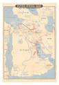
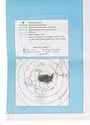
[MAP - ARABIAN PENINSULA OIL RESOURCES]. Neft ba-mizrah ha-tikhon. Zikaynot, shadot, tzinorot, batei zikuk. [= Oil in the Middle East. Concessions, oilfields, pipelines, refineries].
Tel Aviv, Israel Defence Forces, General Staff, [1957]. 56 x 82.5 cm. Chromolithographic map of the Arabian Peninsula, from Turkey in the north to the Indian Ocean in the south, and covering Saudi Arabia, Egypt, Israel, Palestine, Jordan, Syria, Lebanon, Iraq, Iran, Kuwait, Bahrain, Qatar, United Arab Emirates, Oman, North and South Yemen. Scale 1:5,000,000. Scale and key in Hebrew inset to top-right, inset explanatory panels in Hebrew and English, compass rose in Saudi Arabia. Folded. Full description
€ 7,500
Order Inquire Terms of sale

Extremely rare traveller's map of Northwest Europe indicating the main cities
and post stations and the distances between them

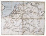
[MAP - FRANCE - GERMANY]. Nouvelle carte itinéraire, qui indique d'une manière très-exacte les routes et stations, ainsi que les distances des principales villes de France et d'Allemagne.
Amsterdam, E. Maaskamp, [ca. 1810]. An engraved map printed on linen (ca. 33.5 x 43 cm.), partly coloured by hand in red and blue ink. Folded. Full description
€ 1,750
Order Inquire Terms of sale

Rare wall map of the Gooi, coloured by a contemporary hand

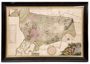
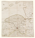
[MAP - HET GOOI]. POST, Hendrik. Nieuwe kaart van Gooilandt word met schuldige eerbiedigheidt aan den wel. ed. gestr. Heere en Mr. Henrick Bicker schepen der stadt Amsterdam, raadt en advt. fiscaal ter Admiraliteit aldaar meestersknaap van Gooilandt, enz, enz. opgedragen door Reinier & Josua Ottens.
Amsterdam, Reinier & Josua Ottens. [ca. 1737]. 52.5 x 82 cm. Framed. Full description
€ 28,000
Order Inquire Terms of sale

Declassified CIA map of the Middle East from the early 1970s

[MAPS - MIDDLE EAST - CIA]. Franklin's CIA maps of the Middle East Kuwait, Bahrain, Qatar, United Arab Emirates the Persian Gulf and Iraq.
King of Prussia, Pennsylvania, USA, Franklin Maps, [after 1986 (and probably before 1991)]. Ca. 87.5 x 114 cm. Three maps printed in colour on one large sheet of paper: one large overview map of the Middle East (also showing parts of the Soviet Union, North Africa, and Turkey) on one side, and the "title page" with two smaller maps - one of Iraq and one of the countries around the Persian Gulf - on the other side. Folded. Full description
€ 1,500
Order Inquire Terms of sale

Collection of 6 maps of the Beemster polder 1644-1979

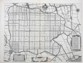
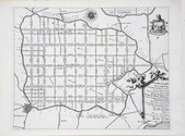
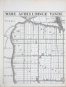
[MAP - NETHERLANDS - BEEMSTER]. FLORISZ. VAN BERCKENRODE, Balthasar and Daniel van BREEN. Beemsterlants caerte... [with a second title at the head:] Ware afbeeldinge vande bedyckte Beemster-landen... M.DC.XLIIII.
Amsterdam, 1644 [reprinted ca. 1769?].
And:
(2) [FLORISZ. VAN BERCKENRODE, Balthasar] and Daniel van BREEN. Beemsterlants caerte…
Amsterdam, 1658. Engraved map (43.5 x 58 cm).
(3) [MAP - NETHERLANDS - BEEMSTER]. Beemster landts kaarte, aenwijsende de hoogte vande ringhdyck. Als mede de diepte vande tocht & wech slooten.
[Amsterdam(?), ca. 1696].
(4-5) DORLAND, C. [2 maps of the Beemster].
Amsterdam, Tresling & Co., March 1908.
(6) [MAP - NETHERLANDS - BEEMSTER]. Waterschap de Beemster.
February 1970, updated to 1979. Large map (64 x 50 cm).
Collection of 6 maps (the first in 6 sheets). Engraved map in 6 sheets (each 56 x 44 cm). With the main title in a large cartouche at right, the statement about its production and a scale of Rijnland rods in a pedestal at the foot, a Latin verse in praise of the Beemster polder by Caspar van Baerle at lower right, a compass rose at upper right, and the arms of Beemster at the head. Bound in modern cloth (57.5 x 47 cm). Full description
€ 3,750
Order Inquire Terms of sale

Rare 18th-century wall map of the Netherlands

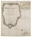
[MAP - NETHERLANDS]. [LE ROUGE, George-Louis]. La Hollande en 12 feuilles.
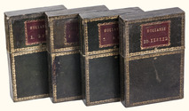
Paris, Jean Dezauche, 1790. Published on 12 sheets, numbered as 48 quarter-sheets. An engraved wall map of the Netherlands (excluding Zeeland), with the main title in a large cartouche at upper left, the Latin title at upper right. Many cities and coastlines, and a few other features, highlighted in colour. Cut, mounted on cloth and folded, in 4 contemporary gold-tooled green morocco boxes. Full description
€ 8,500
Order Inquire Terms of sale
765 books found / Show all