Categories
Shopping cart (0 items € 0)
Advanced search

Cartography, Exploration & Voyages / Americas

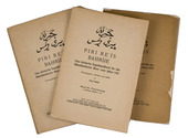
Only published edition of the original 1521 text of the navigation book of the great Ottoman admiral

PIRI REIS (Paul KAHLE, ed.). Bahrije. Das türkische Segelhandbuch für das Mittelländische Meer vom Jahre 1521.
Berlin and Leipzig, Walter de Gruyter & Co., 1926-1927. 3 volumes. Large 8vo (26 x 18 cm). Volume 1 with 137 reproductions of manuscript pages of Ottoman Turkish text and maps and volume 2 with 4 plates. Publisher's original printed wrappers. [1], [1 blank], [2] pp. + 64 ll. + [4], [1 blank], [1] pp.; ll. 65-137; [1], [1 blank], XLVIII, 88 pp. Full description
€ 2,500
Order Inquire Terms of sale

Extensive travel account of Middle and South America

PONS, François Raymond Joseph de. Voyage a la partie orientale de la Terre-Ferme, dans l'Amérique méridionale, fait pendant les années 1801, 1802, 1803 et 1804: contenant la description de la Capitainerie générale de Caracas, composée des Provinces de Venezuela, Maracaïbo, Varinas, la Guiane Espagnole, Cumana et de l'Ile de la Marguerite; ...
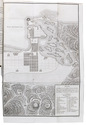
Paris, F. Buisson (back of half-title: Imprimerie de Fain et compagnie), 1806. 3 volumes. 8vo. With 4 folding engraved maps, including a large map of Caracas and surroundings and 3 smaller showing groundplans of Caracas, Puerto Cabello and La Guaira. All engraved by J.B. Tardieu. Contemporary half calf. [4], 358; [4], 469; [4], 362 pp. Full description
€ 1,950
Order Inquire Terms of sale

Important and influential description of Amsterdam,
with accounts of the Dutch East India Company's maritime explorations around the globe

PONTANUS, Johannes Isaac. Rerum et urbis Amstelodamensium historia.
Amsterdam, Jodocus Hondius, 1611. Folio. With an engraved title, 7 engraved maps and plates (5 folding, 2 double-page), and 50 engraved maps and views in the text. Contemporary limp vellum. [8], 292, [6], 38, [3] pp. Full description
€ 9,000
Order Inquire Terms of sale

The first English voyage to Hawaii after Captain James Cook's

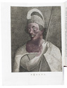
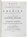
PORTLOCK, Nathaniel. Reis naar de noord-west kust van Amerika. Gedaan in de jaren 1785, 1786, 1787 en 1788.
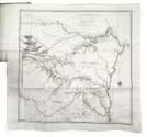
Amsterdam, Matthijs Schalekamp, 1795. 4to. With folding engraved map (34.5 x 46 cm) showing the routes of the ships King George and Queen Charlotte, 1 plate with engraved music and 8 folding engraved plates (last plate partly hand-coloured). Modern red half leather. XII, [4], 265, [1] pp. Full description
€ 2,750
Order Inquire Terms of sale

One of the greatest of English travel books: the first edition of the "Pilgrimes"
together with the fourth and best edition of the "Pilgrimage" - with many extra plates

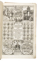
PURCHAS, Samuel. Purchas his pilgrimes. In five bookes. ...
London, printed by William Stansby for Henry Featherstone, 1625.
With:
(2) PURCHAS, Samuel. Purchas his pilgrimage ...
London, printed by William Stansby for Henry Featherstone, 1626.
2 works in 5 volumes, the first in 5 parts, 4 volumes and the second in 4 parts, 1 volume. Folio. Ad 1 with the engraved frontispiece, 5 folding engraved maps, 58 half-page engraved maps by Hondius, 2 full-page engraved plates (including 1 folding), 5 half-page engraved plates, and numerous woodcut illustrations. Further extra illustrated with 94 engravings taken from various late 16th- or early 17th-century travelogues: 1 engraved frontispiece, 1 title-page (with an engraved world map on recto and an engraved portrait of Jacob le Maire on verso), and 92 engraved maps or plates (including 48 half-page and 18 folding). Ad 2 with 1 folding engraved map of China, 1 half-page engraved illustration, and 23 half-page engraved maps by Hondius in the text. Uniform 19th-century black tooled brown morocco (by Hatton, Manchester), spines lettered in gold, gold-tooled turn-ins, marbled endpapers, gilt edges. Full description
€ 110,000
Order Inquire Terms of sale

Dutch edition of the voyage of Walter Raleigh and Laurence Keymis to Guiana,
describing the city El Dorado

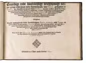
RALEIGH, Walter and Lawrence KEYMIS. Grondige ende waerachtige beschryvinge van het groot end gout-rijck koninckrijck van Guiana, geleghen in America, by- noorden de groote rivier Orelliana, vanden vyfden graet by Zuyden totten vyfden graet by- noorden de middel-linie; in welcke beschrijvinge de rechte gelegentheyt vande groote ende rijcke hooft-stadt Manca, Macureguarai ende andere steden derselvigen koninckrijcks ende van het groot Souten Meyr Parime (zynde omtrent 200 Spaensche mijlen lang) verclaert wort: insgelijcks wat voor rijcke waaren daer te lande ende daer omtrent vallen.
Mitsgaders vande omlegghende rijcke landschappen Emeria, Arromaja ende Topago: in welck laetste krijgs-vrouwen (Amzones genoemt) hare wooninge hebben: as oock van 53 groote rivieren onder welcken Oronoque de voornaemste is, welcke spruyt omtrent 500 Duystche mijlen landwaerts in, niet verre van Quitio een vermaerde hooft-stadt in Peru. Alles ontdeckt beschreven in de jaren 1595-1596.
[Amsterdam, Johannes Janssonius], 1644. Oblong 4to. With a vignette built up from typographical ornaments on the title page, and a decorated woodcut initial. Later half mottled calf. [49] ll. Full description
€ 7,500
Order Inquire Terms of sale

Important 17th-century illustrated description of the Antilles

[ROCHEFORT, Charles de]. Histoire naturelle et morale des Iles Antilles de l'Amérique ...
Rotterdam, Arnout Leers, 1658. 2 parts in 1 volume. 4to. With an engraved title-page, a woodcut printer's device on the typographical title-page, a full-page portrait of Amproux, 43 engraved plates in the text of all kinds of plants, trees, animals and costumes from the Antilles. Further with a divisional title-page for the second part, and woodcut decorated initials, head- and tailpieces throughout. Contemporary gold-tooled marbled calf, with a red morocco title-label lettered in gold, gold-tooled board edges, marbled edges, marbled endpapers, and a bright pink reading ribbon. [1], [1 blank], [12], 527, [12], [1 blank] pp. Full description
€ 8,500
Order Inquire Terms of sale

22 excellent watercolour views of rocky sea-coasts in New Caledonia & Peru

ROMIEUX, Osmond. [Watercolour views of sea-coasts in New Caledonia and Peru].
[New Caledonia & Peru], [1855/60?]. Album: full-sheet leaves (oblong 1mo) (39.5 × 52.5); drawings: oblong folio and oblong 4to. An album with 21 watercolour drawings on paper with views of sea coasts from the shore (24 × 31 cm to 29.5 × 46.5 cm), one with a 22nd watercolour drawing on the back with a similar view, and one with about 15 human figure drawings in graphite pencil on the back. All bear the artists stamp on the front (Lugt 3703) and 4 are signed or initialled by the artist. Richly gold- and blind-tooled green goatskin morocco, white watered silk endleaves. 21 album ll. with 1 drawing mounted on each recto. Full description
€ 18,000
Order Inquire Terms of sale

Rare Dutch adaptation of the account of the second voyage of captain John Ross, with 6 plates

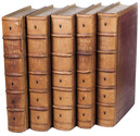
ROSS, John. De reizen en lotgevallen van kapitein John Ross, op zijne ontdekkings togten naar de Noordpools gewesten. Voor jonge lieden ... Uit het Hoogduitsch vertaald.
Amsterdam, Ten Brink & De Vries, 1837. 8vo. With the title-page, 6 plates (including frontispiece) and folding map of the Arctic region all lithographed. Slightly later half cloth. VIII, 247, [1 blank], pp. Full description
€ 400
Order Inquire Terms of sale

The great Lisbon earthquake of 1755 and the city of Augsburg: a splendid publication with more than 100 engraved maps, plans and views, in an Augsburg gold-brocade paper wrapper

ROTH, Johann Michaël. Augsburgische Sammlung derer wegen des höchstbetrübten Untergangs der Stadt Lissabon, ... anbey hat man die Stadt Augsburg in Grundriß mit 48. Prospecten der schönsten Gebäude denselben mit beygefüget ...
Augsburg, Johann Michael Roth, [ca. 1756].
Including:
(2) [MAP - GERMANY - AUGSBURG]. KRAUS, Johann Thomas. Accurata recens delineate ichnographia ... metropolis Augustae Vindelicorum ... = Neu verfertigt accurater Grund Riß der ... Statt Augspurg, ...
Augsburg, Matthäus Seutter, [ca. 1750]. Large engraved map on a folding sheet (50 x 61 cm) at a scale of about 1:4000.
(3) WEYERMANN, Jakob Christoph. Prospectus praecipuorum aedificorum et locorum intra et extra urbem Augustam Vindelicorum ...
Augsburg, Matthäus Seutter, 1742. 4 large uncut folding sheets (each 40 x 70 cm) containing the engraved title-page in an elaborately decorated cartouche and 47 engraved views of buildings in and around Augsburg (each 16 x 13.5 cm), numbered [I], II-XLIII.
1mo (50 x 38.5 cm). With an engraved title-page, the title in the arched doorway of an architectural ruin with a female figure with the Portuguese coat of arms in mourning on the steps, flanked by 2 putti; an engraved report on the earthquake and resulting tsunami on 1 November 1755; and in the first part 60 engraved views, maps and plans printed from 25 copperplates on 13 leaves (4 large folding, including 1 constructed from 2 sheets, the rest on both sides of 9 leaves, except the last, which is blank on the reverse). Gold on black gold brocade paper wrapper, probably from the publisher, sewn without supports at 3 stations, each wrapper made from a whole sheet of the decorated paper, with as centrepiece a statue in a domed gazebo, the dome carried by 4 visible (probably of 6) caryatids. The sheet is further filled with scrollwork decoration with oval portraits in the upper corners, winged angels in the lower corners, 4 more angels plus 2 faces in the scrollwork. Pasted in the centre of the front wrapper is an engraving of the Augsburg pine cone flanked by Neptune with his trident and a river God with an oar, above a city view with cornucopias (10 x 6.5 cm), with a manuscript label below it, "1755 et 1756." The whole is kept is a finely produced modern tanned sheepskin box with the form of a book, the spine with 7 raised bands and a red morocco label, a single brass fastening, and the interior and what would be the edges of the paper lined with marbled paper combining Stormont, zebra and Spanish patterns. [20] engraved ll., some printed on both sides. Full description
€ 47,000
Order Inquire Terms of sale
137 books found / Show all