Categories
Shopping cart (0 items € 0)
Advanced search

Cartography, Exploration & Voyages / Americas

Only Dutch translation of the 1824-1825 farewell tour of general Lafayette, the hero of the American Revolution

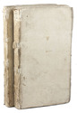
LEVASSEUR, Auguste. Reis door de Vereenigde Staten van Noord-Amerika in de jaren 1824 en 1825 door den generaal Lafayette.
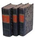
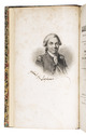
Zutphen, W.J. Thieme, 1831. 2 volumes. 8vo. With lithographed portrait of Lafayette for frontispiece to volume 1. Contemporary boards with pasted title-label on spine, uncut. 8, 254, [1, 1 blank]; [1, 1 blank], 223, [1 blank] pp. Full description
€ 1,500
Order Inquire Terms of sale

The most important work in American western exploration, with the original folding map

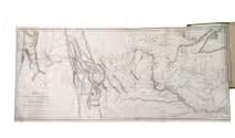
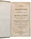
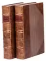
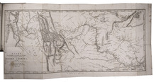
LEWIS, Merriwether and William CLARK. History of the expedition under the command of Captains Lewis and Clark, to the Sources of the Missouri Thence across the Rocky Mountains and Down the River Columbia to the Pacific Ocean, Performed During the Years 1804-5-6 [with map:] Map of Lewis and Clark's Track, Across the Western Portion of North America from the Mississippi to the Pacific Ocean
Philadelphia, 1814. 2 volumes. 8vo. With a large folding engraved map, and 5 full-page engraved charts. Modern gold-tooled half calf over cloth-covered boards, faux raised bands to spine, with a red morocco title-label lettered in gold on either spine, further with the volume numbers and place and date of publication lettered in gold on the spine. XXVIII, 470, [2 blank]; IX, [1], 522 pp. Full description
€ 70,000
Order Inquire Terms of sale

Rare first Dutch edition of the famous Lewis and Clarke expedition

LEWIS, Meriwether, William CLARKE and Nicolaas Godfried van KAMPEN (translator). Reize naar de bronnen van den Missouri, en door het vaste land van America naar de Zuidzee. Gedaan op last van de regering der Vereenigde Staten van America, in de jaren 1804, 1805 en 1806.
Dordrecht, A. Blussé and son, 1816-1818. 3 volumes. 8vo. With a large folding engraved map of the Missouri River (34.5 x 71 cm) by Cornelis van Baarsel and son, after the map in the first British edition. Modern half calf. XXXII, 398; VIII, 390; "XII" (lacking I-II), 335, [1 blank] pp. Full description
€ 8,500
Order Inquire Terms of sale

Influential guide to the East and West Indies, featuring 42 double-page and folding plates,
including 6 detailed maps.

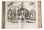
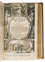
LINSCHOTEN, Jan Huygen van. Histoire de la navigation... aux Indes Orientales. Contenant diverses descriptions des lieux jusques à present descouverts par les Portugais: observations de coustumes & singularitez de delà, & autres declarations. Deuxiesme edition augmentee.
Including: LINSCHOTEN, Jan Huyghen van. Le grand routier de mer, ...
[LINSCHOTEN, Jan Huygen van]. Description de lAmerique & des parties dicelle ...
Amsterdam, Evert Cloppenburg, 1619. 3 works in 1 volume, the first in 2 parts. Folio (31 x 21 cm) With an engraved title page for each work, 42 engraved plates (31 double-page and 11 folding), including 6 maps, and a full-page portrait of the author within collation. Near-contemporary gold-tooled calf. [1], [1 blank], [6], "205" [= 206]; [1], [1 blank], [2], 181, [1 blank]; [1], [1 blank], "86" [= 80]. Full description
€ 40,000
Order Inquire Terms of sale

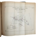
Ground-breaking work on Brazilian ports

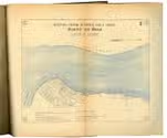
LISBOA, Alfredo (editor). Portos do Brasil 1822-1922. Texto e atlas.
Rio de Janeiro, Norte (vol. 1) and Castro, Mendonça & Cia. (vol. 2), 1922 & 1923. 2 volumes in 1. 4to. With 30 folding maps, 24 of which are coloured in blue and partly in red. Original publisher's dark green leather over paperboards, rebacked in black cloth. [1], [1 blank], IX, [1], “338” [= 336], [6]; [1], [1 blank] pp. Full description
€ 2,500
Order Inquire Terms of sale

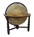
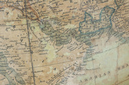
Extremely rare example of the largest globe engraved by Malby (45.5 cm diameter), with lines of magnetic variation, London 1848, showing “Debai” (Dubai)

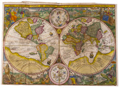
[GLOBE - TERRESTRIAL]. MALBY & CO. Malby's terrestrial globe.
[London], Malby & Co. (engraved by Chas. Malby), 1 January 1848. Diameter: 45.5 cm (18 inch), height in stand: 64.5 cm. An engraved terrestrial globe with 12 gores and 2 polar caps over a plaster-covered core, and the engraved horizon ring on the wooden stand, all coloured by a contemporary hand. In a contemporary wooden stand with 3 turned legs supporting the horizon ring, and 3 turned stretchers with a cylindrical centrepiece with a knob on the underside. Further with a contemporary brass hour circle and a slightly later iron meridian ring (and probably the axis pivots). Full description
€ 35,000
Order Inquire Terms of sale

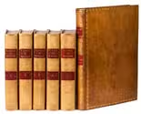
A notable narrative with detailed information on Northwest America, in splendid bindings

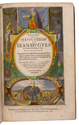
MARCHAND, Étienne and Charles Pierre Claret de FLEURIEU. Voyage autour du monde, pendant les anneés 1790, 1791 et 1792, par Étienne Marchand, précédé d'une introduction historique; auquel on a joint des recerches sur les terres Australes de Drake, et un examen critique du voyage de Roggeween.
Paris, De l'imprimerie de la République, [1798-1800]. 6 volumes: 5 text volumes and 1 atlas. Large 8vo (23 x 15 cm) and 4to atlas. With 3 folding tables with vocabulary in 3rd volume and 15 engraved maps and 1 engraved plate in atlas volume. Contemporary light brown calf, gold-tooled spine gilt with star and flower pattern and 2 red morocco title labels, gold-tooled ornamental borders on the boards, gold-tooled board edges and turn-ins, gilt edges (COURTEVAL). [4], VIII, CCI, [3], 294, [2]; VII, [1], 529, [1]; [2], VIII, 474, [2]; VIII, 494, [2]; XII, 559, [5]; [2], VIII, 158, [2] pp. Full description
€ 27,500
Order Inquire Terms of sale

Italian edition of Martens's important account of a whaling voyage

MARTENS, Friedrich. Viaggio di Spizberga o' Gronlanda fatto da Federico Martens Amburghese l' anno 1671...
Bologna, Giacomo Monti, 1680. 12mo. With 2 folding engraved plates and 3 woodcut illustrations. Contemporary limp parchment. 264 pp. Full description
€ 6,500
Order Inquire Terms of sale

Research voyage into inner Surinam, encountering native tribes

MARTIN, Johann Karl Ludwig. Westindische Skizzen. Reise-erinnerungen.
Leiden, E.J. Brill, 1887. 4to. 22 plates, of which 14 chromolithographs and 8 collotypes, and 1 folding lithographed map of the Surinam River by W.L. Loth. Original publisher's printed paper wrappers. VII, [1], 186 pp. Full description
€ 375
Order Inquire Terms of sale

Research voyage into inner Surinam, encountering native tribes

MARTIN, Johann Karl Ludwig. Westindische Skizzen. Reise-erinnerungen.
Leiden, E.J. Brill, 1887. 4to. 22 plates, of which 14 chromolithographs and 8 collotypes, and 1 folding lithographed map of the Surinam River by W.L. Loth. Original publisher's printed paper wrappers. VII, [1], 186 pp. Full description
€ 375
Order Inquire Terms of sale
137 books found / Show all