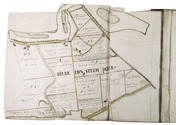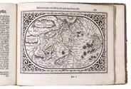

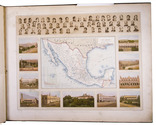
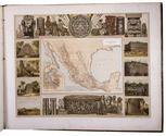
Mexico in the 1880s, with atlas volume including 13 chromolithographed maps and 1 general map of Mexico
GARCIA CUBAS, Antonio.
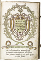
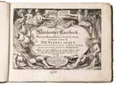
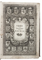
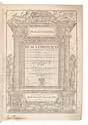
Cuadro geográfico, estadístico, descriptivo é histórico de los estados unidos Mexicanos. Obra que sirve de texto al Atlas pintoresco.
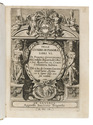
Including: Atlas Pintoresco e Historico de los Estados Unidos Mexicanos.
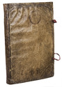
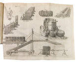
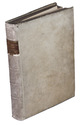
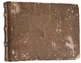
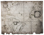
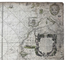
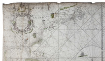
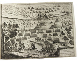
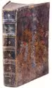
México, Fomento & Debray, 1885. 2 volumes. 8vo and oblong large folio (64.5 x 82 cm). With 2 folding tables and 2 full-page plates in the text volume and in the atlas 13 chromolithographed maps (52 x 69 cm), and a full-page chromolithographed map of Mexico at the end. Contemporary black cloth with gold lettering on front board (text); contemporary red half morocco, title and ornaments in gold on spine (atlas). IV, 474, [3] pp. text. Full description
€ 11,000
Including: Atlas Pintoresco e Historico de los Estados Unidos Mexicanos.
México, Fomento & Debray, 1885. 2 volumes. 8vo and oblong large folio (64.5 x 82 cm). With 2 folding tables and 2 full-page plates in the text volume and in the atlas 13 chromolithographed maps (52 x 69 cm), and a full-page chromolithographed map of Mexico at the end. Contemporary black cloth with gold lettering on front board (text); contemporary red half morocco, title and ornaments in gold on spine (atlas). IV, 474, [3] pp. text. Full description