
Famous series of Dutch city views and costumes plates
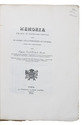
MAASKAMP, Evert, and others.
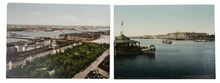
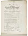
Tableau des principales vues des palais et edifices; representations et des coutumes et usages, dans les Provinces Septentrionales du Royaume des Pays-Bas.
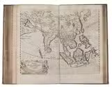
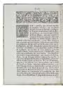
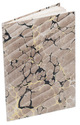
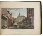
Amsterdam, Evert Maaskamp, [ca. 1825]. Oblong folio. With 68 hand-coloured engraved plates and aquatints by different artist, some of them in proof-state with manuscript captions, depicting Dutch city views and Dutch costumes. Contemporary boards covered with dark-brown paper with a gilt border along the edges and a gilt-stamped title on the front board; preserved in a grey modern cloth box. 69 ll. Full description
€ 25,000
Amsterdam, Evert Maaskamp, [ca. 1825]. Oblong folio. With 68 hand-coloured engraved plates and aquatints by different artist, some of them in proof-state with manuscript captions, depicting Dutch city views and Dutch costumes. Contemporary boards covered with dark-brown paper with a gilt border along the edges and a gilt-stamped title on the front board; preserved in a grey modern cloth box. 69 ll. Full description