Categories
Shopping cart (0 items € 0)
Advanced search

Europe / Central & Eastern Europe

Drilling the Austrian Imperial infantry, with 49 manuscript formation plans in colour

LEEUWEN, Engelhard August Baron van. Plans des neu herrauss gegebene Exercittii nach den dermahligen Kayserl: Königl: kriegs Fuss Volck eingerichtet. Herausgegeben im Jahr 1765. Zugehörig Titl. Herrn Obrist Wacht M[ei]st[er] Baron v[on]: Engelhard.
Austria, 1769[?]. Oblong 4to (18.5 x 23 cm). With title and the explanation of the key letters used in the plans written in red, the key to the colour coding in the troop formations in 8 colours, and 49 (of 55) numbered colour-coded plans of infantry exercises. Each text leaf and each plan (except no. 26) in a frame of rules, nos. 2-35 in red, the rest in black. Plans 1, 24, 32, 33, 42, and 46 have been torn out, in 2 cases leaving a small piece of the drawing. Contemporary mottled tanned sheepskin, gold-tooled spine. [3], 16 ll. plus 49 (of 55) numbered plans. Full description
€ 5,000
Order Inquire Terms of sale

96 letters from Dutch diplomats throughout Europe, 1715-1729
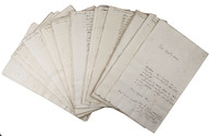
[LETTERS - DIPLOMATIC]. [Official contemporary copies of incoming diplomatic correspondence to the Dutch government in The Hague from Dutch ambassadors, envoys, diplomatic residents and others in Vienna, Graz, Schaffhausen, Turin, Madrid, Paris, Stockholm, Copenhagen, Moscow, Cologne, Frankfurt, Dresden, Regensburg, Warsaw, Grodno, Maastricht, The Hague, Brussels and Ostend].
[The Hague], letters dated 26 January-17 December 1715 and 7 November 1725-22 November 1729. Folio (32.5 x 20.5 cm). 96 letters clearly written in dark brown ink on paper, 84 in Dutch and 12 in French, mostly in a Latin hand (the Dutch ones from 1715 in a semi-gothic hand). Loose leaves in a modern portfolio. [96] letters ([138] written pp. on [97] ll.). Full description
€ 8,500
Order Inquire Terms of sale

Very rare pocket atlas of the Rhineland, owned by the commander of the Buffs
during the Battle of Fontenoy and containing the original entry in his ledger

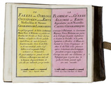
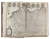
L'ISLE (DELISLE), Guillaume, and others. Le flambeau de la guerre allumee au Rhin; representee en 36 nouvelles cartes geographiques, ... = De fakkel des oorlogs ontstoken aan den Rhyn; verbeeld in 36 nieuwe geographische landkaarten, ...
Amsterdam, Petrus Schenk II, 1735. 8vo. With a double-page engraved title, two double-page engraved pages of text in Dutch and French, a folding engraved map and 36 double-page engraved maps; all coloured by hand. Original publisher's red sheepskin with a flap and wrapping band. Full description
€ 7,500
Order Inquire Terms of sale

The second voyage of Paul Lucas through the Levant

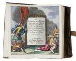
LUCAS, Paul. Voyage du sieur Paul Lucas fait par ordre du Roi dans la Grèce, L'Asie Mineure, La Macedoine et L'Afrique. Contenant la description de la Natolie, de la Caramanie, & de la Macedoine.
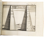
Amsterdam, aux dépens de la Compagnie, 1714. 2 parts in 1 volume. 12mo. With an engraved frontispiece and a title-page printed in red and black for each part, 9 folding engraved plates with pyramids, archeological findings, the Holy Grave, and inscriptions, 2 folding engraved maps of the Levant (engraved by B. Ruyter), and of Fioum, the Nile and surroundings in Egypt, and 8 full-page engraved plates. Contemporary half calf. [1], [1 blank], [28], 323, [1 blank]; [1], [1 blank], [8], 328 pp. Full description
€ 3,500
Order Inquire Terms of sale

Congratulations to Ferdinand II, king of Two Sicilies,
and the Archduchess Maria Therese of Austria on the birth of their eldest son

[AUTOGRAPH]. LUIGIOS, Maria [= MARIA KAROLINE LUISE CHRISTINE OF AUSTRIA?]. [Signed letter to Ferdinand II, king of Two Sicilies].
Innsbruck, 13th August 1838. 25 x 20 cm. Signed manuscript letter in brown ink on paper in Italian, with signature 'Maria Luigios'. [1], [3 blank] pp. Full description
€ 500
Order Inquire Terms of sale

Engraved map of central Europe, coloured in outline in a contemporary hand

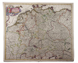
[MAP - CENTRAL EUROPE]. DANCKERTS, Justus. Accuratissima Germaniae tabula.
Amsterdam, Justus Dankerts, [before 1701]. Engraved map (48.5 x 57.5 cm) on a sheet of laid paper (51.5 x 61 cm), coloured in outline in a contemporary hand, with the title in an illustrated cartouche at the upper left, and a scale at the lower right (ca. 1:2,400,000). Full description
€ 450
Order Inquire Terms of sale

First and only edition of the horrible story of the murder of the Polish Kings representative in Copenhagen,
told by the representatives sister-in-law

[MEIBOM, Anna]. Relation veritable de l'horrible et detestable assassinat commis en la personne de Mr. De Schade, conseiller et resident du Roi de Pologne a la cour de Dannemarc; avec les cruelles persecutions & les injustices criantes, qui lui ont été faites pendant son sejour a Copenhague, & qu'on a continué d'exerces après sa mort contre sa veuve.
Utrecht, widow of Ernestus Voskuyl, 1713. 8vo. With a woodcut vase of leafy flowers on the title-page, a woodcut decorated initial, Contemporary tanned half sheepskin. [2], 212 pp. Full description
€ 1,250
Order Inquire Terms of sale

A famous topography of Switzerland enlarged with 68 extra engravings

MERIAN, Matthäus. Topographia Helvetiae Rhaetiae et Valesiae. Das ist, Beschreibung und eigentliche Abbildung der vornembsten Stätte und Plätz, in der hochlöblichen Eydgnoßschafft, Grawbündten, Walliß, und etlicher zugewanten Orten.
[Frankfurt am Main], Matthäus Merian, 1642. Folio. With richly engraved title-page, 74 (of 76) engraved maps, plans and views on 54 (of 56) plates normally included the 1642 first edition (nearly all double-page) plus 1 large folding plate from the 1653 Anhang, and 67 additional engravings from the 17th and 18th century, including at least 16 by or after Merian. Altogether there are 3 general maps (1 of Germany and surroundings and 2 of Switzerland), 4 detail maps, and numerous city plans and views. Lacking the bird's eye view of Herisau and the second of two views of Neuchâtel. Tanned sheepskin (ca. 1700?), gold-tooled spine. 72, [8] pp. plus engraved plates. Full description
€ 29,500
Order Inquire Terms of sale

Original watercolours of military men and related people 1757-1852 in the realms
of what was to become the Austro-Hungarian Empire

[MILITARY UNIFORMS]. [Military and quasi-military uniforms, portraits and scenes of battles, uprisings etc.].
[Austria or Saxony?, ca. 1870?]. Large folio album (39 x 30.5 cm). With 84 large watercolour drawings (28 x 16 cm to 25.5 x 36 cm) on wove paper, with captions in German and/or French, mounted on the (ca. 1962) album leaves, and with the coat of arms of Von Lindeman(n) of Sachsen-Anhalt (in coloured gouaches plus gold) mounted on the first page. Early 20th-century(?) half tanned sheepskin. [44] album ll. Full description
€ 35,000
Order Inquire Terms of sale
80 books found / Show all