Categories
Shopping cart (0 items € 0)
Advanced search

Maritime History / Navigation

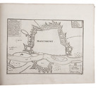
Europe fortified: the fortifications of Marolois, Stevin and Vauban, beautifully mapped,
together with an atlas of the coasts of France, also with fortifications
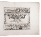
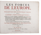
FER, Nicolas de. Les forces de l' Europe, ou description des principales villes; avec leurs fortifications. . . .
Paris, "chez l'auteur" [=Nicolas de Fer, a false imprint], 1695-1696 [printed in Amsterdam, for Pieter Mortier, 1695-ca. 1702]. 10 parts in 1 volume. With 234 beautifully engraved plates (a few folding) with 366 maps and views of fortified cities.
With: (2) FER, Nicolas de. Costes de France, sur l' ocean & sur la Mer Mediterranée &c. avec leurs fortifications. . . .
Paris, "Nicolas de Fer" [a false imprint], 1695. [printed in Amsterdam, for Pieter Mortier]. With engraved title-page and 40 engraved plates (including 2 folding). 2 works in 12 parts or volumes, bound as 1 volume. Oblong 1mo (30×37 cm). Contemporary tanned sheepskin, gold-tooled spine. Full description
€ 17,500
Order Inquire Terms of sale

A standard navigational directory for the Indian Archipelago

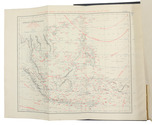
FINDLAY, Alexander George. A directory for the navigation of the Indian archipelago and the coast of China, from the Straits of Malacca and Sunda, and the passages east of Java, to Canton, Shanghai, the Yellow Sea, and Korea. With the descriptions of the winds, monsoons, and currents, and general instructions for the various channels, harbours, etc. Third edition.
London, Richard Holmes Laurie, 1889. Royal 8vo. With 11 folding maps and charts. Original publishers blindstamped cloth, lettered in gold. XLVIII, IV, 1478; [2], 8 pp. Full description
€ 2,500
Order Inquire Terms of sale

Testing chronometers by Harrison's leading French rival

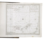
FLEURIEU, Charles Pierre Claret, Count d'Eveux de. Voyage fait par ordre du Roi en 1768 et 1769, à différentes parties du monde, pour éprouver en mer les horloges marines inventées par M. Ferdinand Berthoud. Première[-seconde] partie, ...
Paris, Imprimerie Royale, 1773. 2 volumes. Large 4to (27 x 20.5 cm). With 5 numbered folding engraved plates in volume 1 (4 maps of the Atlantic Ocean, the Canaries, the Azores, etc., and 1 plate with topographic diagrams), 1 folding engraved plate with geometrical figures illustrating the determination of latitude[!], and 5 folding letterpress tables in volume 2. Contemporary gold-tooled mottled calf. [2], LXXIX, [1 blank], 803, [1 blank]; [2], 622, XL, [2 blank] pp. Full description
€ 9,500
Order Inquire Terms of sale

Rare Swedish scientific dissertation on the making of nautical charts and their use

FRIBERG, Olavus and Olavus HERWECH. Q.B.V. Dissertatio academica, de constructione et usu mapparum hydrographicarum, quam consentiente ampliss. senatu philosoph. in regia academia Upsaliensi, publico eruditorum examini modeste submittunt auctor Olavus Friberg et respondens Olavus Herwech. ad. fil. Vermelandi, In auditorio Carolino Marjori die III. Maji Anno MDCCXLIV.
Uppsala, 1744. 4to. With 4 woodcut geometrical illustrations in the text, a large woodcut headpiece (with the words "constantia coronatur" in it) and one large woodcut decorated initial. Modern stiff (marbled?) paper boards with the title in gold on the spine. 16 pp. Full description
€ 750
Order Inquire Terms of sale

Spanish pioneer of the use of the chronometer in navigation and mapping

GALIANO, Dionisio Alcalá. Memoria sobre las observaciones de latitud y longitud en el mar.
[Madrid], widow of Joaquin Ibarra, 1796. Narrow 4to (20.5 x 14 cm). With a woodcut crowned cypher monogram (of a Spanish Duke?) on the title-page and 7 folding leaves containing 13 numbered letterpress tables. Early 19th-century gold-tooled tree calf. [2], 87, [1] pp. Full description
€ 3,950
Order Inquire Terms of sale

Well-illustrated encyclopaedia of astronomical and surveying instruments from the time of Galileo,
with a world map in two hemispheres, and 3 volvelles

GALLUCCI, Giovanni Paolo. Della fabrica et uso di diversi stromenti di astronomia, et cosmografia, ove si vede la somma della teorica, et pratica di queste due nobilissime scienze.
Venice, Roberto Meietti, 1598. 4to (22 x 16.5 cm). With engraved title-page, folding woodcut plate, 3 woodcut volvelles with moving parts, and numerous woodcut illustrations in text. Including a world map in two hemispheres (incl. America and a scattering of islands at the location of Australia) on two facing pages, they reappear with volvelle attachments on both sides of leaf 149 and leaf 153. Contemporary limp sheepskin parchment. [8], 228 ll. Full description
€ 35,000
Order Inquire Terms of sale

The art of navigation for aspiring VOC helmsmen

GIETERMAKER, Klaas Hendriksz. 't Vergulde licht der zee-vaard, ofte konst der stuurlieden.
Amsterdam, Johannes II van Keulen [frontispiece: Gerard van Keulen], [not before 1742, ca. 1747?].
With:
(2) [VOOGHT, Claas Jansz.]. De taeffelen der sinuum, tangentium en secantium, ofte der hoekmaaten, raecklijnen en snijlijnen.
Amsterdam, Johannes II van Keulen, [late 17th, early 18th century].
(3) [Drop-title:] De tafel des aardryks breeten en langten, der voornaamste zee-plaatsen des bekenden aardbols.
Amsterdam, Johannes II van Keulen, [late 17th or early 18th century].
3 works in 1 volume, the first in 4 parts. 4to. Contemporary gold-tooled mottled brown calf. [12], 106, [2]; 152, 8; 120; [2], 70, [66]; 16, [2 blank] pp. Full description
€ 6,500
Order Inquire Terms of sale

Convolute with rare Dutch works on the art of navigation, richly illustrated with many mathematical
and geometrical figures and two circle figures with moving volvelles

GIETERMAKER, Klaas Hendriksz. 't Vergulde licht der zee-vaard, ofte konst der stuurlieden. Zynde een volkomen en klare onderwyzinge der navigatie, bestaande in 't geen een stuurman hoognodig behoorde te weten.
Amsterdam, Joannes van Keulen & sons, [not before 1774]. With an engraved frontispiece, 2 engraved circle figures with moving volvelles, 1 engraved mathematical and geometrical folding plate, many tables (some folding) and many mathematical and geometrical woodcut illustrations and figures in the text.
With:
(2) DOUWES, Bernardus Joannes. Tafelen, bevattende 1°. De sinussen, tangenten en secanten, van minuut tot minuut voor ieder boog van het quadrant, in hunne natuurlyke getallen, op een radius van 10.000.000. 2°. Derzelver logarithmen. 3°. De logarithmen der gewoone getallen, in hunne natuurlyke orde van opvolging, van 1 tot 10.000. 4°. De vergrootende breedten, in tiende-deelen van minuuten. 5°. De streektafelen, naar het plat en het rond, voor ieder geheele compasstreek van een vierde-rond. Nieuwe, naauwkeurige en veel verbeterde uitgaave.
Amsterdam, Gerard Hulst van Keulen, 1779. Completely filled with mathematical tables.
(3) [drop title:] Tafel van de lengte en breedte der meest bekende zee-plaatzen.
[Amsterdam?, Gerard Hulst van Keulen?, ca. 1779?].
3 works in 1 volume, the first in 4 parts. 4to. Contemporary blind-tooled vellum. Ad 1: [8], 106; 152, 8; 97; 98-120 pp. Ad 2: [233], [1 blank] pp. Ad 3: 39, [1 blank] pp. Full description
€ 6,500
Order Inquire Terms of sale

Goos's West-Indische paskaert in its very rare first state: a monumental nautical chart of the Atlantic Ocean
on vellum in Mercator projection, used by the Dutch West Indian Company (WIC)

GOOS, Pieter. West-Indische Paskaert waer in de graden der breedde over wederzijden van de middellijn wassende so vergrooten dat die geproportioneert sijn tegen hunne nevenstaende graden de lengde. Vertonende behalve[n] Europaes zuydelijcste alle de zeekusten van Africa en America begrepen in 't Octroy bij de H.M.H. Staten Generael der vereenichde Nederl. verleent aende Generale West Indische Compagnie. Mitsgaders die van Peru en Chili inde groote Zuyd-Zee.
Amsterdam, Pieter Goos, [ca. 1660]. Printed on vellum (ca. 80 x 98 cm) from one large copperplate engraving, partly coloured by a contemporary hand. Full description
€ 185,000
Order Inquire Terms of sale

A rare, very important work on the scientific side of nautical navigation, by a leading 17th-century Dutch mathematician

GRAAF, Abraham de. De seven boecken van de groote zeevaert, zijnde een volkomen klare, en konstige beschrijvinghe der navigatie.
Amsterdam, Pieter Goos, 1658. 7 parts in 1 volume. Folio. With a half-page engraving on the half-title, a woodcut vignette on the title-page, 6 folding engraved tables and numerous woodcut mathematical diagrams, figures, tables and other illustrations in the text. With woodcut tailpieces and woodcut decorated initials. Contemporary vellum with a manuscript title on the spine. [1], [1 blank], [8], 39, [1 blank]; [2], 4, [45], [1 blank], [90], 5-91, [1 blank]; 96; 86, [2 blank]; 39, [1 blank]; 60, 18, [2 blank]; 96, [7], [1 blank] pp. Full description
€ 8,500
Order Inquire Terms of sale
80 books found / Show all