Categories
Shopping cart (0 items € 0)
Advanced search

Maritime History / Navigation

An important surveying voyage to the Pacific

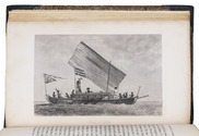
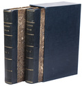
BELCHER, Edward. Narrative of a voyage round the world, performed in Her Majesty's ship Sulphur, during the years 1836-1842, including details of the naval operations in China, from Dec. 1840 to Nov. 1841.
London, Henry Colburn, 1843. 2 volumes. 8vo. With a folding map of the Canton river, folding map with the routes of the H.M.S. Sulphur, large world chart also showing the route of the Sulphur, 19 steel-engraved views and several illustrations in text. Gold-tooled blue sheepskin, shell-marbled sides. Rebacked. In modern slipcase. XXII, 387; VI, 474 pp. Full description
€ 2,950
Order Inquire Terms of sale

Wonderful and very rare nautical atlas for the Mediterranean

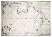
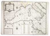
BERTHELOT, François. [Nautical atlas of the Mediterranean Sea].
Marseille, "se vend chez Benoît", 1720-1730. Large folio (40 x 55 cm). With 4 double-page engraved maps, with the first half of the first map as the front paste-down and the second half of the last map as the back paste-down. Contemporary vellum-backed boards, reinforced with light brown leather at the head and foot of the spine. 4 nautical maps on [8] pp. Full description
€ 8,500
Order Inquire Terms of sale

Winds and the weather in the coast of India and the Arabian and Persian Gulf:
first edition of a rare meteorological work

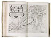
CAPPER, James. Observations on the winds and monsoons; illustrated with a chart and accompanied with notes, geographical and meteorological.
London, Charles Whittingham, 1801 4to. With 1 folding engraved map of the world depicting all the world-wide seas and waters and several tables printed within the text. Later half calf. XXVIII, 29-234 pp. Full description
€ 2,950
Order Inquire Terms of sale

Navigation and astronomical research in present-day Canada

CHABERT, Joseph Bernard. Voyage fait par ordre du Roi en 1750 et 1751, dans l'Amérique septentrionale, pour rectifier les cartes des côtes de l'Acadie, de l'Isle Royale & de l'Isle de Terre-Neuve; et pour en fixer les principaux points par des observations astronomiques.
Paris, Imprimerie Royale, 1753. 4to. With an engraved printer's vignette on the title-page, an engraved headpiece at the beginning of the first chapter, 6 folding engraved maps, a folding engraved plate showing geometrical figures, and a large folding table with calculations for the position of the sun and the moon. Contemporary gold-tooled red morocco. [2], VIII, 288, [10] pp. Full description
€ 12,500
Order Inquire Terms of sale

Ocean waves, flooding & hydraulic engineering, well-illustrated

EMY, Amand Rose. Ueber die Bewegung der Wellen und über den Bau am Meere und im Meere. ... Mit 10 Kupfertafeln [sic].
Vienna, Ludwig Förster's artistischer Anstalt (on reverse of title-page: printed by J.P. Sollinger), 1839. 8vo. With 10 folding lithographic plates (23 x 39 to 54 cm) with 75 figures showing diagrams of wave forms and motions, and plans and cross-sections of coasts, man-made barriers, buildings, hydraulic devices, etc. 19-century blue cloth. [2], XIV, 242, [2] pp. Full description
€ 350
Order Inquire Terms of sale

Monograph on rivers, torrents and inland navigation

FABRE, Jean Antoine. Essai sur la théorie des torrens et des rivières, contenant les moyens les plus simples d'en empêcher les ravages, d'en rétrécir le lit & d'en faciliter la navigation, le hallage & la flottaison. Accompagné d'une discussion sur la navigation intérieure de la France; et terminé par le projet de rendre Paris, port maritime en faisant remonter à la voile, par la Seine, les navires qui s'arrêtent à Rouen.
Paris, Bidault, 1797. 4to (29 x 21.5 cm). With 8 folding engraved plates, showing how to determine the drop of a river, the contents of water, how to change currents, how to create different effects with different dyke constructions, etc. Contemporary mottled calf, gold-tooled spine, in the style of Bradel & Derôme. [4], XXXII, 284 pp. Full description
€ 750
Order Inquire Terms of sale

Classic of surveying & instrument-making

FABRI, Ottavio. L'uso della squadra mobile, con la quale per teorica, e pratica si misura geometricamente ogni distanza, altezza, e profondità; ... accresciuta in questa terza edizione di parecchie istruzioni, ..., ec. da Giovanni Vettori.
Trent, Stamparia Vescovile Paroniana [= Giambattista Parone, printer to the Diocese of Trent], 1753. 4to. With engraved architectural title-page, 1 unnumbered folding and 3 numbered illustration plates, 25 engraved illustrations in the text, engraved arms of the dedicatee, 1 engraved pictorial initial letter. Richly gold-tooled contemporary tanned sheepskin, silk ties, gilt edges. XII, 9-144 pp. Full description
€ 3,500
Order Inquire Terms of sale
80 books found / Show all