Categories
Shopping cart (0 items € 0)
Advanced search

Book History, Education, Learning & Printing

The greatest map of Paris, 240 x 316 cm, here with the 20 sheets and key map bound as an atlas
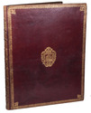
in contemporary gold-tooled morocco with the Paris city arms
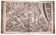
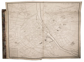
BRETEZ, Louis. Plan de Paris commencé l'année 1734. Dessiné et gravé, sous les ordres de Messire Michel Etienne Turgot, Marquis de Sousmons ... Achevé de graver en 1739.
[Paris, 1739]. Grand-Aigle folio (56 x 45.5 cm). An enormous engraved map of Paris in 20 numbered sheets plus a key map, at a scale of about 1:2000, each segment measuring 55 x 84 cm (plate size 51.5 x 80.5 cm; image 48 x 79 cm) which would give an assembled map with image size about 240 x 316 cm! The key map is slightly larger than the segments and folds out at the head. Bound as an atlas (but with segments 18 and 19, containing the cartouche, assembled to make a long fold-out) in contemporary gold-tooled red morocco, each board with as centrepiece the Paris coat of arms (a ship with chief a field of fleurs-de-lis). Full description
€ 15,000
Order Inquire Terms of sale

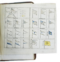
An extensive information source for British colonialists in Madras (India)

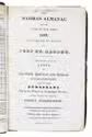
[BRITISH-INDIA - MADRAS ALMANAC]. The Madras almanac for the year of our lord 1829, calculated for the meridian of Port St. George. To which are added: lists of the civil, judicial and medical establishments, and of the Europeans not in the King's or Company's service. With other matters of useful information.
Madras, Asylum Press, [1828?]. 8vo. With 1 engraved hand-coloured folding plate showing different kinds of ships flags. Lacking 2 leaves.Contemporary red sheepskin, sprinkled edges. Rebacked in calf, red sheepskin spine label, blue paper pasted over the sides. [1 blank], [2], [1 blank], VI, 1-146, [2], 147-361, [1] blank, XXX, VIII pp. (lacking pp. 19-22). Full description
€ 1,750
Order Inquire Terms of sale

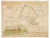
Hand coloured battle plan for the 1816 attack on Algiers

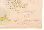
[BRITISH NAVY - BATTLE PLAN - ALGIERS]. Plan of the Bay and City of Algiers.
[London?, 1816]. 35 x 44. With an illustration of the plan of attack and a view of the fortifications on the Mole at Algiers. Full description
€ 1,750
Order Inquire Terms of sale

Beautiful early 19th-century announcement of a circus show with fireworks

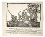
[BROADSIDE - CIRCUS]. Mit hoher Bewilligung wird heute die hier angekommene Gymnastische- und Athleten-Gesellschaft unter der Direction des Hrn. Bartholomäus Ramini die Ehre haben sich zu produciren......
[Austria, ca. 1827]. Oblong folio (ca. 40 x 46 cm). With a large woodcut illustration (ca. 27 x 38 cm). The text is set in a Gothic type. [1] l. Full description
€ 2,500
Order Inquire Terms of sale

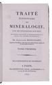
Textbook for mineralogy students, with 16 engraved plates

BRONGNIART, Alexandre. Traité élémentaire de minéralogie, avec des applications aux arts; ouvrage destiné a l'einseignement dans les lycées nationaux.
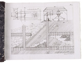
Paris, Crapelet; Deterville, 1807. 2 volumes. 8vo. With 16 folding engraved plates. Contemporary half calf, gold-tooled spines. XII, 564; [4], 443, [1] pp. Full description
€ 350
Order Inquire Terms of sale

Very popular manual for colouring books, prints and maps

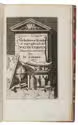
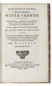
BRUGGE, Geerard ter, and Willem GOEREE. Verligterie-kunde, of, regt gebruik der water-verwen. In welke desselfs kennis, en gebruik tot de schilderkunde, en de illuminatie of verligterie noodig zijnde, kortelijk geleerd word. Eertijds uytgegeven door den voortreflijken verligter Mr. Geerard ter Brugge. Ende nu tot nut der liefhebbers, doorgaans met noodige aanmerkingen vermeerderd, om neffens het illumineeren of afzetten, insonderheid het schilderen met water-verwen te oeffenen, ... Den derden druk.
Amsterdam, Daniel van den Dalen, 1697. 8vo. With an engraved title. Modern half sheepskin parchment, marbled paper sides. 92 pp. Full description
€ 1,250
Order Inquire Terms of sale
758 books found / Show all