Categories
Shopping cart (0 items € 0)
Advanced search

Cartography & Exploration

A general in the Spanish army on the battles and sieges in Flanders 1601-1609,
during the Dutch war for independence, with 29 folding maps and plans

GIUSTINIANO, Pompeo. Delle guerre di Flandra libri VI. ... Posti in luce da Gioseppe Gamurini ...
Antwerp, J. Trognesio, 1609. 4to. With engraved architectural title-page and 29 folding engraved maps and plans of sieges and fortifications. White sheepskin (ca. 1700 or possibly later). [4], 329, [1 blank], [15], [3 blank] pp. Full description
€ 2,950
Order Inquire Terms of sale

Rare collection of travel accounts in the form of letters,
including a Swedish translation of a biography of Captain Cook

GJÖRWELL, Carl Christoffer (ed.). Almänna rese-beskrifwaren eller sammandrag af de nyaste och bästa rese-beskrifningar, hälst de som nyligast utkommit; til uplysning af andra länders geographie, natural-historia, stats-förfatning, hushålning, lärdom, bruk och seder: uti bref författat.
Stockholm, printed by Johan Arvid Carlbohm [and A.J. Nordstrom], 1780 [-1782]. 2 volumes. 8vo. With an engraved portrait of "Jacob" (James) Cook as a frontispiece in vol. 1, with some head and tail pieces throughout the 2 vols. Contemporary half goatskin. [4], 360; [2], 134, [2], 135-194, [2], 195-“168” [= 268] pp. Full description
€ 2,250
Order Inquire Terms of sale

A pair of striking Victorian library globes by map-maker George Frederick Cruchley

[GLOBES - TERRESTRIAL & CELESTIAL]. CRUCHLEY, George Frederick. Cruchley's new terrestrial globe from the most recent and best authorities, exhibiting the discoveries in equatorial Africa, North Pole, and the new settlements and divisions in Australia, New Zealand, California, Texas &c.
London, George Frederick Cruchley, [ca. 1850].
With: CRUCHLEY, George Frederick. Cruchleys new celestial globe on which is accurately laid down the whole of the stars and nebule contained in the astronomical catalogue of the Reverend Mr. Wollaston F.R.S. Also from the authorities Flamstead, De la Caille, Hevellus, Bradley, Herschel, Maskelyne, &c. and the limits of each constellation determined by a boundary line.
London, George Frederick Cruchley, [ca. 1850].
A matching pair of terrestrial and celestial globes (53 cm diameter) each made a hollow paper-marché core (2 hemispheres, joined at the equator), covered with a layer of plaster and 12 hand-coloured, engraved gores, showing the terrestrial geography and celestial bodies in great detail. Each globe mounted in a mahogany tripod stand on small wheels. With a compass (diameter: 25 cm) at the base of each stand; graduated brass meridian ring and engraved graduated horizontal rings (paper pasted on the mahogany frame) showing the months of the year, the zodiac signs and wind directions. Full description
€ 97,500
Order Inquire Terms of sale

A pair of extremely rare Valk table globes

[GLOBES - TERRESTRIAL & CELESTIAL]. VALK, Gerard and Leonard. [Terrestrial globe:] Cosmotheore, caelesti nostro globo, par, et plane novus, hic terrestris ut existeret, certo scias, errore veterum sublato, non tantum utriusque orbis, longitudines ac latitudines, par reiterates neotericorum observationes, hicce esse restitutas, sed et nullum typis emendatiorem prodiisse, hoc igitur novissimô tam diu fruere, donec sub majori forma, meô aere alios excudam Gerardus Valk calcographus, Amsterdami, A[nn]o 17[50] cum privilegio.
Amsterdam, [Maria Schenk, widow of Leonard Valk], 17[50].
And: [Celestial globe:] Uranographia, caelum omne hie complectens, illa pro ut aucta, et ad annum 1700 competum, magno ab hevelio, correcta est, ita, ejus ex prototypis, sua noviter haec ectypa, veris astronomiae cultoribus, exhibit et consecrate, Ger. et Leon. Valk, Amstelaedamenses.
Amsterdam, Gerard and Leonard Valk, [ca. 1711]. Full description
€ 275,000
Order Inquire Terms of sale

The deterioration and restoration of Russo-Japanese relations 1811-1813
GOLOVNIN, Vasilii Mikhailovich. Memoirs of a captivity in Japan, during the years 1811, 1812, and 1813; with observations on the country and the people ... second edition.
Including:
-RIKORD, Petr Ivanovich. Account of voyages to the coasts of Japan; and of negotiations with the Japanese, for the release of Captain Golownin and his companions.
-Account of the voyages of Messrs. Chwostoff & Dawidoff.
London, Henry Colburn & Co., 1824. 3 volumes. 8vo. With an additional facsimile map, copied from the French edition of 1818, inserted in volume 2. Modern red cloth. IV, 315, [1 blank]; [2], 356, [2]; VIII, LXXXIX, [1 blank], 302 pp. Full description
€ 1,500
Order Inquire Terms of sale

Very rare Dutch edition of "one of the most influential early books on China"

GONZÁLEZ DE MENDOZA, Juan. De historie ofte beschijvinghe van het groote rijck van China.
Amsterdam, Cornelis Claesz. [printed by Jacob Cornelisz Vennecool, Delft], "1595" [= 1596/99]. 8vo. Modern polished tan calf, gold-tooled spine. 197, [1 blank] pp. Full description
€ 12,500
Order Inquire Terms of sale

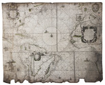
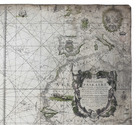
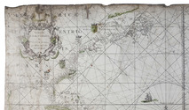
Goos' West-Indische paskaert in its very rare first state: a monumental nautical chart of the Atlantic Ocean in Mercator projection on vellum, used by the Dutch West Indian Company (WIC)

GOOS, Pieter. West-Indische Paskaert waer in de graden der breedde over wederzijden van de middellijn wassende so vergrooten dat die geproportioneert sijn tegen hunne nevenstaende graden de lengde. Vertonende behalve[n] Europaes zuydelijcste alle de zeekusten van Africa en America begrepen in 't Octroy bij de H.M.H. Staten Generael der vereenichde Nederl. verleent aende Generale West Indische Compagnie. Mitsgaders die van Peru en Chili inde groote Zuyd-Zee.
Amsterdam, Pieter Goos, [ca. 1660]. Printed on vellum (ca. 80 x 98 cm) from one large copperplate engraving, partly coloured by a contemporary hand. Full description
€ 185,000
Order Inquire Terms of sale

Illustrated travel account of the "sights" and sacred places in the Holy Land

GOUJON, Jacques. Histoire et voyage de la Terre-Sainte, où tout ce qu'il y a de plus remarquable dans les saints lieux, est tres exactement descrit.
Lyon, Pierre Compagnon & Robert Taillandier, 1671. 4to. With a woodcut vignette on the title-page and 17 folding engraved plates showing maps, views, and plans of regions, mountains and buildings in the Holy Land, further with woodcut decorated initials, and woodcut head- and tailpieces. Contemporary calf. [1], [1 blank], [10], 358, [9], [1 blank] pp. Full description
€ 11,500
Order Inquire Terms of sale
693 books found / Show all