Categories
Shopping cart (0 items € 0)
Advanced search

Cartography & Exploration

Very interesting large folding map of Galicia (southeastern Poland) as part of the Habsburg Empire
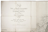
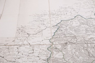
REYMANN, Daniel Gottlob. Karte eines Theils von Neu oder West Gallicien welcher die Woywodschaften Sendomier und Krakau enthält nebst einem Theil von Alt Gallicien in XII Blatt, entworffen von Daniel Gottlob Reymann Königl: Preuss: Plan Kammer Inspector und Ingénieu Géographe.
[Berlin, S. Schropp & Comp.,] 1797. Engraved map in 12 sheets, cut into 49 (7 x 7) sections (each ca. 22 x 21 cm) with a total size of 154 x 154 cm. Scale ca. 1:180,000. Partly hand-coloured in outline. Mounted on linen. Full description
€ 2,500
Order Inquire Terms of sale

The state of religion in the Dutch East Indies

RHIJN, Leonard Johannes van. Reis door den Indischen Archipel, in het belang der evangelische zending.
Rotterdam, M. Wijt & zonen, 1851. 8vo. With 1 chromolithographed and 4 lithographed folding maps and 8 tinted lithographed illustrations. Rebacked in modern half cloth and the original gold-tooled green sheepskin backstrip laid down. XX, IV, “655” [= 651], 28 pp. Full description
€ 1,500
Order Inquire Terms of sale

First French edition of the most important work on China of the 17th century

RICCI, Matteo and Nicolas TRIGAULT. Histoire de l'expedition Chrestienne au royaume de la Chine, entreprinse par les PP. de la compagnie de Iesus.
Lyons, for Horace Cardon, 1616. 8vo. With engraved title-page and full-page engraved portrait of prince Philippe Guillaume of Orange, and large folding plan (42.5 x 15 cm). Contemporary overlapping vellum. [40], 1096 pp. Full description
€ 25,000
Order Inquire Terms of sale

Important account of Cook's final voyage

[RICKMAN, John]. Troisieme voyage de Cook, ou Journal d'une expédition faite dans la Mer Pacifique du Sud & du Nord en 1776, 1777, 1778, 1779, & 1780 ... Seconde edition.
Paris, Belin, 1783. 8vo. With folding engraved plate, illustrating the death of Captain James Cook, and folding engraved chart, depicting the route of Cook's expedition. Modern half calf. [4], "376" [= 378] pp. Full description
€ 3,500
Order Inquire Terms of sale

Surprising respect for Australian Aboriginal languages, with 4 botanical wood engravings and colour-printed decorations

RIDLEY, William. Kamilaroi, Dippel, and Turrubul: languages spoken by Australian Aborigines.
Sydney, Thomas Richards (New South Wales government printer), 1866. 4to. With an armorial vignette printed in several colours and gold (the unofficial "Advance Australia" Australian coat of arms), 4 fine full-page wood engravings of plants and flowers. Original publisher's maroon textured cloth. VI, 88, [2] pp. Full description
€ 1,950
Order Inquire Terms of sale

Travelogue of Arabia by a distinguished Lebanese Arab-American writer, with 32 plates

RIHANI, Ameen. Around the coasts of Arabia.
London, Constable & Co., 1930. 8vo. With a pictorial map as frontispiece, 31 photographic half-tone plates and a full-page map on an integral leaf. Original publishers black cloth, with title in gold on spine. X, [2], 364 pp. Full description
€ 1,500
Order Inquire Terms of sale

Fantastic (partly true?) adventures in Ottoman Africa, by an English merchant captured by Barbary pirates in 1648

ROBERTS, A. The adventures of (Mr T. S.) an English merchant, taken prisoner by the Turks of Argiers, and carried into the inland countries of Africa.
London, Moses Pitt [printed by William Wilson?], 1670. Small 8vo. Blind- and gold-tooled calf (ca. 1800). [8], "252" [= 254], [2] pp. Full description
€ 9,500
Order Inquire Terms of sale

Stunning double-tinted views of the Middle East, after drawings made in 1838 and 1839,
with 250 plates

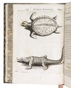
ROBERTS, David, George CROLY and William BROCKEDON. The Holy Land, Syria, Idumea, Arabia, Egypt & Nubia.
London, Day & son (vol. 3: New York, D. Appleton & Co.), 1855-1856. 6 volumes bound as 3. Imperial 8vo (30 x 22 cm). With 250 numbered plates (including 6 tinted lithographed title-pages, 2 stone-engraved maps and 239 tinted and double-tinted lithographed and 2 chromolithographed views). Contemporary, richly gold-tooled reddish-brown morocco, gold-tooled turn-ins, marbled endpapers, gilt and gauffered edges. With thin paper guard leaves facing each plate. Full description
€ 18,000
Order Inquire Terms of sale

Mexico, Peru and indigenous American culture

ROBERTSON, William. L'histoire de l'Amérique ... Traduite de l'anglais.
Paris, Panckoucke, 1778. 4 volumes. 12mo. With 4 title-pages, each with a different woodcut vignette, 4 folding engraved maps depicting the Gulf of Mexico (33 x 49 cm), South America (46 x 33 cm), Mexico (30 x 39 cm), and the northwestern part of South America (39 x 25 cm) and 1 folding engraved plate illustrating the chronology of Mexicans (27 x 24.5 cm). Contemporary French calf, gold-tooled spines with red morocco labels, marbled endpapers and edges. Full description
€ 975
Order Inquire Terms of sale

Important 17th-century illustrated description of the Antilles

[ROCHEFORT, Charles de]. Histoire naturelle et morale des Iles Antilles de l'Amérique ...
Rotterdam, Arnout Leers, 1658. 2 parts in 1 volume. 4to. With an engraved title-page, a woodcut printer's device on the typographical title-page, a full-page portrait of Amproux, 43 engraved plates in the text of all kinds of plants, trees, animals and costumes from the Antilles. Further with a divisional title-page for the second part, and woodcut decorated initials, head- and tailpieces throughout. Contemporary gold-tooled marbled calf, with a red morocco title-label lettered in gold, gold-tooled board edges, marbled edges, marbled endpapers, and a bright pink reading ribbon. [1], [1 blank], [12], 527, [12], [1 blank] pp. Full description
€ 8,500
Order Inquire Terms of sale
693 books found / Show all