Categories
Shopping cart (0 items € 0)
Advanced search

Cartography & Exploration

"Pioneer Portuguese Jesuit missionary to Japan"

RODRIGUES GIRÃO, João. Litterae Iaponicae annorum M.DC.IX et X. ad R. admodum piae mem. p. Claudium Aquavivam generalem praepositum Societatis Iesu A.R.P. Provinciali eiusdem in Iapone Societ. Missae.
Antwerp, Petrus and Johannes Bellerus, 1615. 8vo. With woodcut printer's device on title-page. Modern limp parchment, gilt edges. [24], 111, [1 blank] pp. Full description
€ 4,750
Order Inquire Terms of sale

The complete scientific reports from the private German expedition to the Arctic Ocean in 1898

RÖMER, Fritz & Fritz SCHAUDINN (editors). FAUNA ARCTICA. Eine Zusammenstellung der arktischen Tierformen, mit besonderer Berücksichtigung des Spitzbergen-Gebietes auf Grund der Ergebnisse der Deutschen Expedition in das Nördliche Eismeer im Jahre 1898. Herausgegeben von F. Römer und F. Schaudinn..
Jena, G. Fischer, 1902-1933. 6 volumes. Large-4to (360 x 280mm). With 2 photogravure portraits (of both editors), 8 lithographed maps, 49 (a few chromo-) lithographed plates and 609 figures in the text. Contemporary half cloth (volumes II-IV & VI) & wrappers (remainder). Full description
€ 1,350
Order Inquire Terms of sale

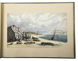
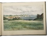
22 excellent watercolour views of rocky sea-coasts in New Caledonia & Peru

ROMIEUX, Osmond. [Watercolour views of sea-coasts in New Caledonia and Peru].
[New Caledonia & Peru], [1855/60?]. Album: full-sheet leaves (oblong 1mo) (39.5 × 52.5); drawings: oblong folio and oblong 4to. An album with 21 watercolour drawings on paper with views of sea coasts from the shore (24 × 31 cm to 29.5 × 46.5 cm), one with a 22nd watercolour drawing on the back with a similar view, and one with about 15 human figure drawings in graphite pencil on the back. All bear the artists stamp on the front (Lugt 3703) and 4 are signed or initialled by the artist. Richly gold- and blind-tooled green goatskin morocco, white watered silk endleaves. 21 album ll. with 1 drawing mounted on each recto. Full description
€ 18,000
Order Inquire Terms of sale

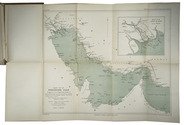
First and only publication of the original text of the primary logbook of the first Dutch expedition
to the Arabian Gulf by Cornelis Cornelisz Roobacker

[ROOBACKER, Cornelis Cornelisz.] A. HOTZ (publ.). Cornelis Cornelisz Roobacker's scheepsjournaal Gamron-Basra (1645); de eerste reis der Nederlanders door de Perzische Golf. Uitgegeven, met inleiding en noten, door A. Hotz.
In: BEEKMAN, A.A. etc. (eds.), Tijdschrift van het Koninklijk Nederlandsch Aardrijkskundig Genootschap gevestigd te Amsterdam. Tweede serie Deel XXIV. No. 3 (15 Mei).
Leiden, Brill, 1907. 8vo. One folding table and 3 folding maps (1 belonging to another article in the journal). Brown paper wrappers, with title information of the journal on the front and spine, and the contents on the back wrapper. 289-405 [=117] pp. Full description
€ 750
Order Inquire Terms of sale

One of the first scientific descriptions of Gorontalo

ROSENBERG, Carl Benjamin Hermann von. Reistogten in de afdeeling Gorontalo, gedaan op last der Nederlandsch Indische regering.
Amsterdam, Frederik Muller, 1865. 8vo. With 4 folding lithographed maps (3 chromo, 1 tinted), 9 full-page lithographed plates (4 chromo, 5 tinted (of which 2 folding)). 20th-century cloth. VIII [i.e. VI], 162 [1, 1 blank] pp. Full description
€ 450
Order Inquire Terms of sale

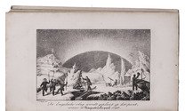
Rare Dutch adaptation of the account of the second voyage of captain John Ross, with 6 plates

ROSS, John. De reizen en lotgevallen van kapitein John Ross, op zijne ontdekkings togten naar de Noordpools gewesten. Voor jonge lieden ... Uit het Hoogduitsch vertaald.
Amsterdam, Ten Brink & De Vries, 1837. 8vo. With the title-page, 6 plates (including frontispiece) and folding map of the Arctic region all lithographed. Slightly later half cloth. VIII, 247, [1 blank], pp. Full description
€ 400
Order Inquire Terms of sale

Celestial atlas containing an introduction on astronomy,
with 38 contemporary hand-coloured plates showing celestial maps, spheres, constellations etc.

MEIJLAN, Johann Leonard. Atlas portatilis coelestis. Oder Compendiöse Vorstellung des gantzen Welt-Gebäudes in den Anfangs-Gründen des wahren Astronomie...; sondern auch zugleich daraus, sich einen bessern Begriff von dem wahren Fundament sowol der Geographie als Schiffahrt zueignen kan.
Nürnberg, Johann Christoph Weigel, printed by Johann Ernst Adelbulner, 1723. Large 8vo. With a double-page title-page printed in red and black and XXVIII (38) engraved plates (1 double-page) with celestial maps, globes, armillary spheres and astronomical diagrams and constellations, coloured by a contemporary hand and tipped onto the fore-edge, folding out so that they can be viewed while reading the book. Contemporary calf. [16], 362, [22] pp. Full description
€ 3,500
Order Inquire Terms of sale

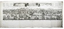
The great Lisbon earthquake of 1755 and the city of Augsburg: a splendid publication with more than 100 engraved maps, plans and views, in an Augsburg gold-brocade paper wrapper

ROTH, Johann Michaël. Augsburgische Sammlung derer wegen des höchstbetrübten Untergangs der Stadt Lissabon, ... anbey hat man die Stadt Augsburg in Grundriß mit 48. Prospecten der schönsten Gebäude denselben mit beygefüget ...
Augsburg, Johann Michael Roth, [ca. 1756].
Including:
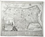
(2) [MAP - GERMANY - AUGSBURG]. KRAUS, Johann Thomas. Accurata recens delineate ichnographia ... metropolis Augustae Vindelicorum ... = Neu verfertigt accurater Grund Riß der ... Statt Augspurg, ...
Augsburg, Matthäus Seutter, [ca. 1750]. Large engraved map on a folding sheet (50 x 61 cm) at a scale of about 1:4000.
(3) WEYERMANN, Jakob Christoph. Prospectus praecipuorum aedificorum et locorum intra et extra urbem Augustam Vindelicorum ...
Augsburg, Matthäus Seutter, 1742. 4 large uncut folding sheets (each 40 x 70 cm) containing the engraved title-page in an elaborately decorated cartouche and 47 engraved views of buildings in and around Augsburg (each 16 x 13.5 cm), numbered [I], II-XLIII.
1mo (50 x 38.5 cm). With an engraved title-page, the title in the arched doorway of an architectural ruin with a female figure with the Portuguese coat of arms in mourning on the steps, flanked by 2 putti; an engraved report on the earthquake and resulting tsunami on 1 November 1755; and in the first part 60 engraved views, maps and plans printed from 25 copperplates on 13 leaves (4 large folding, including 1 constructed from 2 sheets, the rest on both sides of 9 leaves, except the last, which is blank on the reverse). Gold on black gold brocade paper wrapper, probably from the publisher, sewn without supports at 3 stations, each wrapper made from a whole sheet of the decorated paper, with as centrepiece a statue in a domed gazebo, the dome carried by 4 visible (probably of 6) caryatids. The sheet is further filled with scrollwork decoration with oval portraits in the upper corners, winged angels in the lower corners, 4 more angels plus 2 faces in the scrollwork. Pasted in the centre of the front wrapper is an engraving of the Augsburg pine cone flanked by Neptune with his trident and a river God with an oar, above a city view with cornucopias (10 x 6.5 cm), with a manuscript label below it, "1755 et 1756." The whole is kept is a finely produced modern tanned sheepskin box with the form of a book, the spine with 7 raised bands and a red morocco label, a single brass fastening, and the interior and what would be the edges of the paper lined with marbled paper combining Stormont, zebra and Spanish patterns. [20] engraved ll., some printed on both sides. Full description
€ 47,000
Order Inquire Terms of sale

Navigational guide covering the coast and coastal waters of Brazil, by the French Imprimerie Royale

ROUSSIN, Albin-Reine. Le pilote du Brésil, ou description des côtes de l'Amérique Méridionale comprises entre l'ile Santa-Catharina et celle de Maranaõ, avec les instructions nécessaires pour atterrir et naviguer sur ces côtes; ...
Paris, Imprimerie Royale, 1827. 8vo. Modern half calf, marbled sides. [3], [1 blank], 241, [1 blank] pp. Full description
€ 1,950
Order Inquire Terms of sale
693 books found / Show all