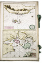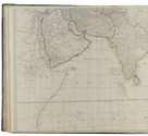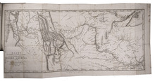

Rare journal of De la Salles last American voyage, exploring the Mississippi River,
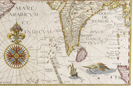
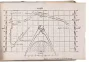
including the large folding map, rarely included
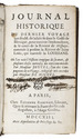
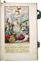
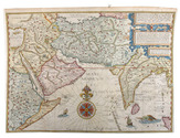
JOUTEL, Henri (Monsieur DE MICHEL, ed.).
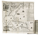
Journal historique du dernier voyage que feu M. De la Sale fit dans le Golfe de Mexique, pour trouver l'embouchure & le cours de la riviere de Missicipi, nommée à présent la rivière de Saint Louis, que traverse la Louisiane. Où on voit l'histoire tragique de sa mort, & plusieurs choses curieuses du nouveau monde.
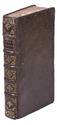
Paris, Estienne Robinot, 1713. 12mo. With a large folding engraved map. Contemporary calf. XXXIV, 386 pp. Full description
€ 10,000
Paris, Estienne Robinot, 1713. 12mo. With a large folding engraved map. Contemporary calf. XXXIV, 386 pp. Full description