Categories
Shopping cart (0 items € 0)
Advanced search

Cartography, Exploration & Voyages

Dutch translation of Parry's account of his first Arctic expedition
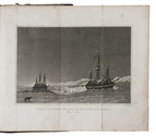
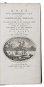
PARRY, William Edward. Reis ter ontdekking van eene noordwestelijke doorvaart, uit de Atlantische in de Stille Zee, gedaan in de jaren 1819 en 1820 door de schepen The Hecla en The Griper...
Amsterdam, Johannes van der Hey, 1822. 8vo. With engraved title-page, 1 large folding map and 3 plates (2 folding). Contemporary half calf. XII, 333, [2], [1 blank] pp. Full description
€ 1,250
Order Inquire Terms of sale

A travel guide to Ancient Greece

PAUSANIAS. Pausaniou tes hellados periegesis [= in Greek]. Hoc est, pausaniae accurata Graeciae descriptio, qua lector ceu manu per eam regionem circumducitur ...
Frankfurt am Main, Heirs of Andreas Wechel [Claude de Marne, Johann Aubry], 1583. 2 parts in 1 volume. Folio. With a woodcut printer's device on the divisional title page of each part and the final leaf, 30 decorated woodcut initials, 7 woodcut headpieces, and 3 woodcut tailpieces. With: PAUSANIAS and Romolo AMASEO (translator). Pausaniae de veteris graeciae regionibus commentarii luculentissimi.
Frankfurt am Main, heirs of Andreas Wechel [Claude de Marne, Johann Aubry], 1583.
17th-century overlapping vellum over recycled blind tooled calf panels (from an older binding, unclear if original binding of present work or just general recycling), sewn on 5 vellum tapes previously laced through the joints, the manuscript author on the spine, remnants of closing ties. [12], 357, [1 blank] pp., 359-374 cols., 375-377 pp., 378-507 cols., [1 (=p. 508)], [1 blank], [76]; [12], 302, pp., 303-352 cols., [1] pp. Full description
€ 3,500
Order Inquire Terms of sale

Travel account with descriptions of the Roman monuments in Dalmatia and Montenegro

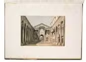
PELERIN, Charles. Excursion artistique en Dalmatie et au Monténégro.
Paris, printed by Dubuisson & Co., 1860. Folio. With 12 full-page tinted lithographed views. Contemporary red half morocco with the title and author lettered in gold on the spine, fleurons on the spine, chemical marbled sides, brown sprinkled edges, marbled endpapers. 30, [2 blank] pp. Full description
€ 3,250
Order Inquire Terms of sale

Rivals at Encounter Bay: the Baudin–Freycinet expedition and the first printed map of Australia

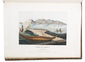
PÉRON, François Auguste and Louis Claude de Saulses de FREYCINET. Voyage de découvertes aux Terres Australes, fait par ordre du gouvernement, sur les corvettes le Géographe, le Naturaliste et la goëlette le Casuarina, pendant les années 1800, 1801, 1802, 1803 et 1804 ...
Paris, l'imprimerie imperial, 1807-16.
With:
(2) PÉRON, François Auguste and Louis Claude de Saulses de FREYCINET. Voyage de découertes aux Terres Australes navigation et geographe.
Paris, de l'Imprimerie royale, 1815. 4 volumes. Large 4to and folio. With the plate volume, the first part contains 40 plates, including a map, 5 coloured coastal profiles, 14 ethnographic plates, of which 8 are coloured, 8 other views, one of which is coloured and 2 folding, including Lesueur's view of Sydney, 11 natural history plates, 9 coloured, 1 technical plate, and 1 engraved vignette on the title page. The second part contains 14 maps, 2 of which are double-page folding. There is also 1 text volume with a portrait of F. Péron and 2 folding tables. Uniformly bound by Bayntun in 19th-century three-quarter brown morocco, marbled boards, with the title, year, and volume number lettered in gold on the spine. [3], [1 blank], XV, [1 blank], 496, [2]; [2]; XXXI, [1 blank], 471, [1 blank] pp.; plate volume: [60] ll.; ad 2: "VXI" [= XVI], 576 pp. Full description
€ 20,000
Order Inquire Terms of sale

Second and improved edition of one the finest items of Australiana

PÉRON, François Auguste and Louis Claude de Saulses de FREYCINET. Voyage de découvertes aux Terres Australes, fait par ordre du gouvernement, sur les corvettes le Géographe, le Naturaliste et la goëlette le Casuarina, pendant les années 1800, 1801, 1802, 1803 et 1804; historique.
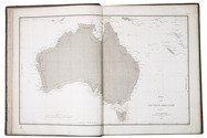
Paris, (printed by Lebel for) Arthus Bertrand, 1824. 4 text volumes (8vo) and 1 atlas volume (folio). With lithographed portrait of François Péron; the atlas with engraved title-page and 68 (27 hand-coloured) lithographed plates, maps and charts, including a double-page map of Australia. Contemporary gold-tooled red half sheepskin. XXIV, 400; 532; 432; 353, [4] pp.; Atlas vol. [10] pp. text (Index of plates). Full description
€ 35,000
Order Inquire Terms of sale

Physical and human geography for early readers

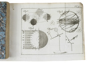
PERPONCHER SEDLNITZKY, Willem Emmery Baron de. Nieuwe aardryks-beschryving voor de Nederlandsche jeugd, tot gebruik zyner kinderen, opgesteld.
Utrecht, widow of Johannes van Schoonhoven, 1784-1786. 3 volumes. 12mo. With 4 folding engraved plates illustrating the planets, the solar system and the stellar constellations. Contemporary marbled stiff paper wrappers. XL, 532; X, 432, [1]; VI, 592, [4] pp. Full description
€ 1,750
Order Inquire Terms of sale

Very scarce, "secret" publication containing information regarding numerous influential Iranian people
by the British authorities

[PERSIA - BRITISH AUTHORITIES - NOTABLE PERSIAN TRIBES & PEOPLE]. Tribes and personalities of Western Persia.
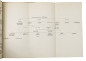
Baghdad, printed at the Government Press, 1918. 8vo. With 2 folding genealogical charts, respectively showing the family trees of the royal Qajar house and the chiefs of the Qaraguzlu tribe, and a printed ornament on the front wrapper. Restored red printed paper wrappers, with a clear plastic protective wrapper. [1], [1 blank], 134, [2 blank] pp. Full description
€ 8,500
Order Inquire Terms of sale

Traversing Qajar Persia with a manuscript guide

[PERSIA - TRAVEL GUIDE]. [Manuscript travel guide].
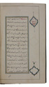
[Qajar Iran, ca. 1850s]. 8vo (12.5 x 22 cm). Persian manuscript on polished paper. Black nasta'liq script in 15 lines per page, ruled in green and blue, with rubricated chapter headings and marginal medallions. Contemporary limp leather and woven floral-patterned cloth. 26 ll. Full description
€ 8,500
Order Inquire Terms of sale
765 books found / Show all