Categories
Shopping cart (0 items € 0)
Advanced search

Maritime History

Only published edition of the original 1521 text of the navigation book of the great Ottoman admiral

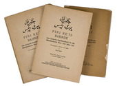
PIRI REIS (Paul KAHLE, ed.). Bahrije. Das türkische Segelhandbuch für das Mittelländische Meer vom Jahre 1521.
Berlin and Leipzig, Walter de Gruyter & Co., 1926-1927. 3 volumes. Large 8vo (26 x 18 cm). Volume 1 with 137 reproductions of manuscript pages of Ottoman Turkish text and maps and volume 2 with 4 plates. Publisher's original printed wrappers. [1], [1 blank], [2] pp. + 64 ll. + [4], [1 blank], [1] pp.; ll. 65-137; [1], [1 blank], XLVIII, 88 pp. Full description
€ 2,500
Order Inquire Terms of sale

Magnificent engraving of the 1661 mosaic floor map of the world in 2 hemispheres,
incorporating Tasman's discoveries not otherwise published for decades

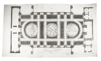
[PLAN - AMSTERDAM CITY HALL]. [CAMPEN, Jacob van]. Le pavé de la grand' sale des bourgeois.
[Amsterdam, Gerard Valk, 1719]. Very large engraved folding plan comprising 1 1/2 sheets (measuring 46 x 83 cm as assembled), engraved by Danckert Danckertsz. and his father after drawings by Jacob Vennekool, including the two hemispheres of the world map and a celestial map of the constellations of the northern hemisphere (each 10 cm in diameter). Full description
€ 2,500
Order Inquire Terms of sale

2 signed autograph letters from a French privateer

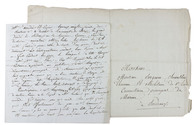
[AUTOGRAPH - MARITIME - PIRACY]. PLEUC or PLEVE?, Jacques René. [Two autograph letters, signed, attempting to secure promised payments for the booty of the captured English frigate HMS Liverpool by the French privateer Le Grand Décidé, one addressed to Auguste-Anne de Bergevin, Commissaire principal de Marine in Bordeaux, and the other to the brothers Amédée & Eugene Larrieu in Bordeaux, who sold the booty].
Bordeaux, 30 June & 18 November 1820. Folio (32.5 x 21 cm) & 4to (19.5 x 20.5 cm). In dark brown ink on paper. [2], [2 blank]; [2], [2 blank] pp. Full description
€ 1,750
Order Inquire Terms of sale

Watercolour coastal profiles in the East Indies and elsewhere, by the maritime painter to King George III

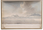
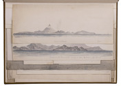
POCOCK, Nicholas. East India views islands headlands &c.
[London, ca. 1790?- ca. 1805]. Ten watercolour coastal profiles in grey and blue, of widely varying sizes (30 to 119 cm long), with contemporary captions and other notes in pencil or black ink. 20th-century brown cloth with the artist's original laid-paper wrappers bound at the end. [10] drawings. Full description
€ 28,000
Order Inquire Terms of sale

First Dutch editions of 8 accounts of the Middle & Far East, from Marco Polos voyages
to the capture of Formosa by the pirate Zheng Chenggong

POLO, Marco. Reisen, en beschryving der Oostersche lantschappen; ...
Including:
-HETOUM of Corycus. Historie der Oostersche lantschappen; ...
-[BRACCIOLINI, Poggio, and Girolamo di SANTO STEFANO]. Reysen naar Indien, en d'oostersche landen; gedaan by Nicolaus Venetus, en Jeronymus van St. Steven.
-[Anonymous VOC officer in Formosa]. Verhaal van de verövering van 't eylant Formosa door de Sinesen.
Amsterdam, Abraham Wolfgang, 1664. With 4 engraved plates.
With:
(2) BOURGES, Jacques de. Naaukeurig verhaal van de reis des Bisschops van Beryte uit Frankryk te lant en ter zee naar China.
Amsterdam, Abraham Wolfgang, 1669. With 8 half-page engraved illustrations in text.
(3) Verhaal van drie voorname reizen naar Oostindien, te weten van Johan Jacobsz Saar, Volkert Evertsz, en Albrecht Herport.
Comprising:
-SAAR, Johann Jacob. De reisbeschryving ... naar Oostindien, sedert ... 1644. tot ... 1659. ...
-OLEARIUS, Adam. De beschryving der reizen van Volkert Evertsz. [= Volquard Iversen] naar Oostindien. ... uitgevaren in ... 1655. en in ... 1668 ... gekeert.
-HERPORT, Albrecht. De beschryving der Oostindische reizen ... sedert ... 1659. tot ... 1668. ...
Amsterdam, Jan Rieuwertsz & Pieter Arentsz, 1671 (works 2 and 3 dated 1670 on their title-pages). With 8 engraved plates, the last 4 sometimes attributed to Romeyn de Hooghe or his school.
3 editions (the 1st containing 4 works and the 3rd containing 3 works) in 1 volume. 4to.Contemporary vellum. [12], 99, [8], [1 blank], 70, [2], 25, [1 blank], 12; [2], 126; [6], 198 pp. Full description
€ 28,000
Order Inquire Terms of sale

A scientific study of the natural history of Norway, including its sea monsters

PONTOPPIDAN, Erich. The natural history of Norway ...
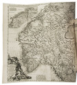
London, printed for A. Linde, 1755. 2 parts in 1 volume. Folio. With a large folding engraved map of Norway by Johann Baptist Homann, and 28 engraved plates depicting minerals, shells, fishes, birds, mammals, plants, and the inhabitants of Norway. Contemporary gold- and blind-tooled calf, with gold-tooled corner edges of the boards, gold-tooled turn-ins and marbled edges. XXIV, 206; VIII, 291, [12] pp. Full description
€ 5,850
Order Inquire Terms of sale

Pamphlet satirising Portuguese notables associated with the Persian wars

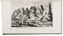
[PORTUGAL - PAMPHLET]. Noticia breve das novidades da Azia mandadas de Ali-Xarife da cidade de Babilonia; para Soliman morador na Corte de Constantinopla, e desta para a cidade de Sevilha a hum contratador de vidros.
(Colophon: Madrid, heirs of Juan Garcia Infanzon, 1742). 4to (20 x 14.5 cm). Disbound. 7, [1 blank] pp. Full description
€ 3,500
Order Inquire Terms of sale

Voyage to the Cape, India and Java

PRIOR, James. Beschrijving eener reis naar de Indiesche zee met het fregat de Nisus en naar de Kaap De Goede Hoop, de eilanden Bourbon, Mauritius en andere; naar Madras, de eilanden Java, Sint Paul en Amsterdam gedurende de jaren 1810 en 1811.
Amsterdam, J.C. van Kesteren, 1820. With a view of Mauritius on the engraved title-page. Contemporary half calf, black morocco spine label, marbled sides. [II], IV, 242 pp. Full description
€ 1,950
Order Inquire Terms of sale

Extremely rare work on the sailing routes in the Caribbean

PURDY, John. The new sailing directory for the Caribbee or West-India Islands, from Porto-Rico to Trinidad, inclusive: with the coasts of Guyana, from the Maranon to the Orinoco, the Colombian or Leeward Isles, from Margarita to Curazao, and the coast of Venezuela, from the Gulf of Paria to La Guayra. Including descriptions of the navigation described in the work, and equally adapted to the particular plans of all the principal harbours, by which the general chart is accompanied.
London, printed [by J. Rider] for R.H. Laurie, chart-seller of the Admiralty, 1839. 8vo. With 12 steel-engraved coastal profiles. Contemporary half black cloth, marbled sides. [6], 184 pp. Full description
€ 1,950
Order Inquire Terms of sale
304 books found / Show all