Categories
Shopping cart (0 items € 0)
Advanced search

Cartography & Exploration

A French view on the Arabs in a Dutch translation

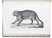
ARVIEUX, Laurent d'. Reis naar de legerplaats van den Grooten Emir, en beschrijving van de zeeden en gewoonten der woestijn-bewoonende Arabieren ... Tweede druk.
Dordrecht, A. Blussé & Zoon, 1802. 8vo. With 3 full-page engraved plates and 1 engraved illustration in text. Contemporary gold-tooled half calf, shell-marbled sides. [4], XL, 384, [16] pp. Full description
€ 1,350
Order Inquire Terms of sale

Asia and the Middle East in 1952, with many borders on the Arabian Peninsula still undefined

[MAP – ASIA – MIDDLE EAST]. NATIONAL GEOGRAPHIC SOCIETY. Southwest Asia, India, Pakistan, and Northeast Africa.
Washington, DC, National Geographic Society, 1952. Colour printed map, 68.5 x 95 cm. Scale 1:7,5000,000. With an inset map of "the Moslem World; percentage of Moslems in total population". Full description
€ 850
Order Inquire Terms of sale

Rare study describing a 622 AH (1225/26 CE) celestial globe with Cufic lettering, with 3 folding plates

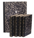
ASSEMANI, Simone. Globus caelestis Cufico-Arabicus Veliterni Musei Borgiani ... illustratus. Praemissa ejusdem De Arabum astronomia dissertatione et adjectis duabus epistolis Cl. Josephi Toaldi.
Padua, Seminary printing office, 1790. Small folio (21.5 x 29.5 cm). With 3 large folding engraved plates. Contemporary green half calf, gold-tooled spine, marbled sides. [16], CCXIX, [9] pp. Full description
€ 28,000
Order Inquire Terms of sale

A wonderfully illustrated rare Dutch compilation of Apian

[ASTRONOMY - APIAN and others]. S.D.V.B (compiler). Een nieu constich boeck inde geometrie en de astronomiae, voor desen noyt in druck gheweest, ende is in ses stucken afghedeylt ...
(Colophon:) Rees, Abraham Wijlicx, 1608. Folio (30 x 19.5 cm). With a half-page woodcut illustration and some decorations built up from typographic ornaments on the title-page, 74 woodcuts of various sizes in text, many (near) full- and half-page, with some woodcut decorated initials (various series), a headpiece built up from typographic ornaments and an ornamental woodcut tailpiece. Contemporary vellum, sewn on four supports laced through the joints. 111, [1] pp. Full description
€ 15,000
Order Inquire Terms of sale

Graphically stunning 3-volume historical manuscript atlas

[ATLAS - HISTORICAL]. Atlas historique. - Souvenirs historiques. - Tableaux et cartes.
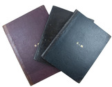
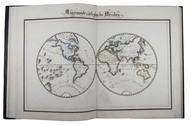
[Montpellier?], [date on spine of vol. 1:] 1851. 3 volumes. Folio (vol. 1) and large 4to (vols. 2-3). Neatly written manuscripts on paper with 23 graphically vibrant maps, coloured in outline with subtly shaded washes in grey (for the coasts) and numerous bright colours (for political boundaries), and with calligraphic headings. Contemporary bindings: vol. 1 red half goatskin; vol. 2 black half goatskin; vol. 3 black sheepskin. [1], [26 double]; [1], [22 double]; [1], 30 double, [1] ll. Full description
€ 1,750
Order Inquire Terms of sale

2nd known copy of the only Antwerp edition (1652) of Colom’s 1635 atlas of the Low Countries

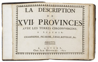
[ATLAS - LOW COUNTRIES]. [COLOM, Jacob Aertsz.]. La description de XVII. Provinces, avec les Terres Circonvoicins, a Scavoir Champagnie, Picardie, Liege, Retelle, &c.
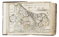
Antwerp, Jan Huyssens, 1652. 4to (18 x 14.5 cm). With a double-page letterpress title-page, with a frame built up from typographic ornaments, and 39 unnumbered double-page engraved maps of the northern and southern Low Countries by Jacob Aertsz. Colom, each map coloured in outline. Interleaved with 38 blank leaves and with a manuscript table of contents ([3], [3 blank] pp.) at the end. Later 17th-century mottled calf. Double-page title-page and 39 double-page maps. Full description
€ 4,950
Order Inquire Terms of sale

Presentation copy by the author

AVEZAC-MACAYA, Armand D'. Considérations géographiques sur l'histoire du Brésil. Examen critique d'une nouvelle histoire générale du Brésil recemment publiée en portugais a Madrid par M. François-Adolphe de Varnhagen chargé d'affaires du Brésil en Espagne. Rapport fait à la société de géographie de Paris dans ses séances des 1er Mai et 5 Juin 1857.
Paris, L. Marinet, 1857. 8vo. With 2 folding maps. Modern gold-tooled red half morocco, marbled boards, preserving the printed wrappers. [4], 271, [1] pp. Full description
€ 600
Order Inquire Terms of sale

“to this day a major source of information about the land and peoples of Paraguay and Río de la Plata”

AZARA, Félix Manuel de. Voyages dans l'Amérique Méridionale, ... depuis 1781 jusqu'en 1801; contenant la description géographique, politique et civile du Paraguay et de la rivière de La Plata; ...
Paris, Dentu, 1809. 8vo (4 text volumes) and folio (1 atlas volume). With 3 folding tables and 25 engraved maps, plans, views and plates of animals and birds. Modern black half calf, gold-tooled spine. LX, 389; [4], 388-562; [4], II, 479; [4], 380 pp. Full description
€ 12,500
Order Inquire Terms of sale

California absolutely unfit for habitation

[BAEGERT, Jakob]. Nachrichten von der Amerikanische Halbinsel Californien: mit einem zweyfachen Anhang falscher Nachrichten. Geschrieben von einem Priester der Gesellschaft Jesu, welcher lang darinn diese letztere Jahr gelebt hat.
Mannheim, Churfürstliche Hof und Academie Buchdruckerey, 1772. 8vo. With an engraved folding map and two full-page plates engraved by E. Verelst, some woodcut pictorial frames for letters, and several nice woodcut head- and tailpieces. Contemporary half calf. [16], 358 pp.; [1] errata l. Full description
€ 9,500
Order Inquire Terms of sale

Four months on a windjammer to India: how to shorten a tiresome voyage in 1835

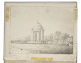
[AUTOGRAPH]. BALDWIN, John Timins. [Manuscript diary and drawing of his voyage to India].
[Onboard the ship from Portsmouth to Madras, India, 1835]. 4to. With a half-page pen drawing on p. 168 and a loosely inserted full-page drawing (16.5 x 22 cm) by Baldwin of a mausoleum in India. 20th-century grey paper over boards. [4] ll.; 189 pp. Full description
€ 6,500
Order Inquire Terms of sale
693 books found / Show all